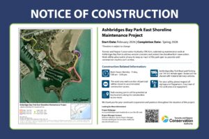
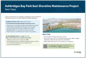
Toronto and Region Conservation Authority (TRCA), in partnership with the City of Toronto, is undertaking shoreline maintenance works on three existing shoreline erosion control structures along Lake Ontario within Ashbridges Bay Park in order to protect against the hazards of shoreline erosion and address public safety concerns.
STAY INFORMED
Implementation commenced in February 2026 with mobilization of TRCA construction crews. Regular progress updates will be provided in the Construction Progress Updates section. Please reach out to the project team if you have any questions.
Project Location
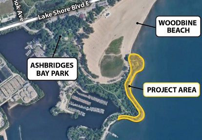
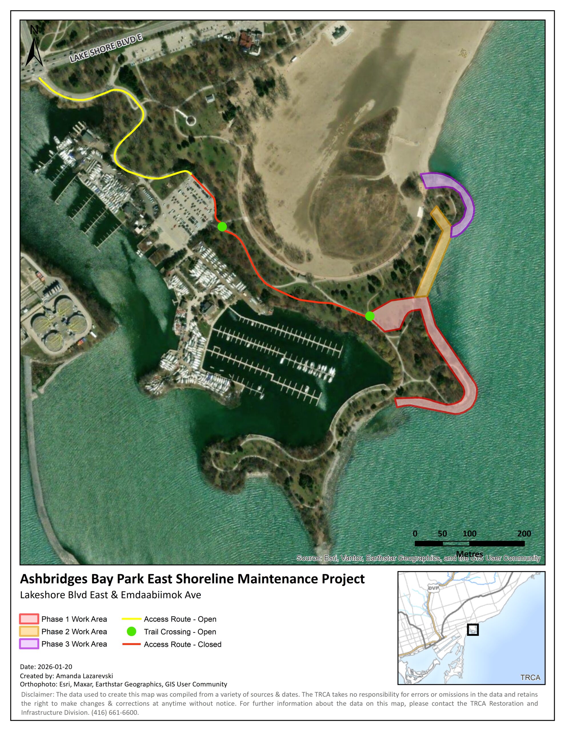
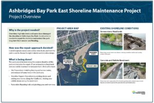
The Project Area is located within Ashbridges Bay Park, in the City of Toronto. The closest major intersection is Emdaabiimok Avenue and Lake Shore Boulevard East.
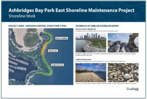
The area of concern includes three existing shoreline erosion control structures (two headlands and a rubble revetment), located at the eastern limit of the park, south of Woodbine Beach.
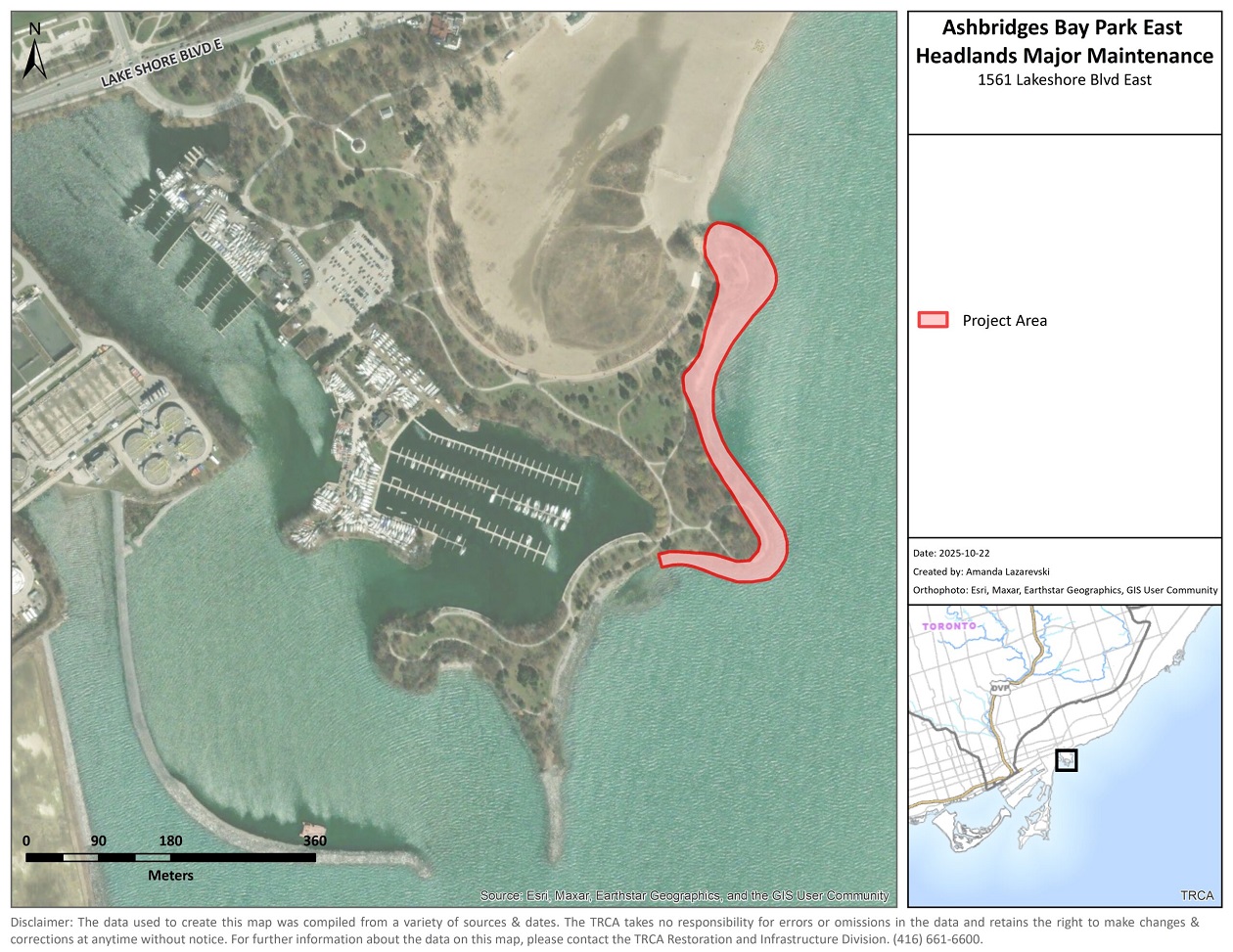
Map of the project area within Ashbridges Bay Park. Source: TRCA, 2022.
Learn More About the Project


Project Background

Ashbridges Bay Park is a unique artificial landform that was created as part of a lakefill project to expand lands east of Coatsworth Cut, following the development of the Ashbridges Bay Wastewater Treatment Plant.
After development, the park was opened to the public in 1977. Today, the park is used for its many amenities including an intricate trail system, marina, fishing boardwalks and picnic areas.
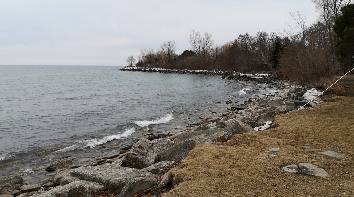
Erosion control structures along the shoreline of Ashbridges Bay Park have been subjected to constant wave action, ice effects and flooding since its construction.
The structures within the Project Area include two headlands and a rubble revetment. These structures and the other nearby erosion control structures have been monitored annually since 2006 as part of TRCA’s Erosion Risk Management Program (ERMP).
In the spring of 2017, Lake Ontario experienced record high water levels, which exacerbated erosion issues along the entire Toronto shoreline. On April 14-15, 2018, a severe ice storm caused high wave conditions resulting in heavy damage to many shoreline erosion control structures.
The structures within the Project Area experienced damage during both severe weather events and were inspected under the ERMP in 2019.
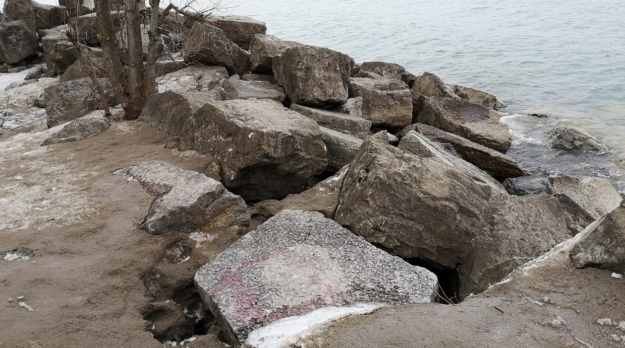
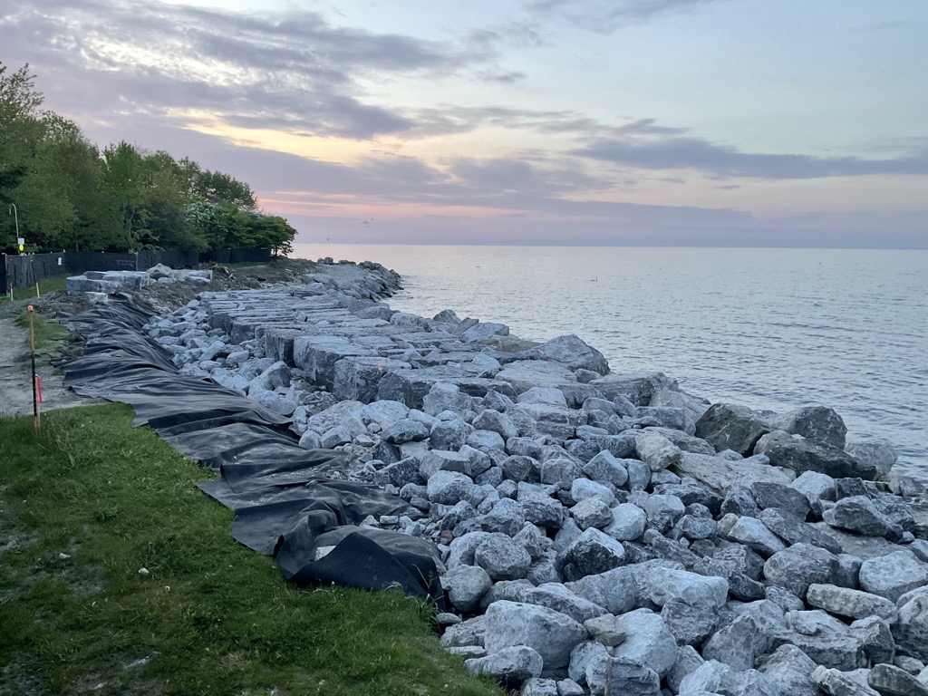
The rubble revetment was identified to be in a failing condition with displacement of rip rap material and scouring evident throughout the structure. This structure was listed as the highest priority for major maintenance works due to proximity of backshore erosion to the park trail.
Both headlands were identified as at-risk with displacement of armourstone material evident along both structures.
Due to the continuing instability of the area and deficiencies observed along the erosion control structures, shoreline maintenance works must be undertaken in the Project Area in order to mitigate the risk to public safety.
In 2022, TRCA retained Shoreplan, a coastal engineering consulting firm, to develop detailed designs for maintenance of the two headlands and rubble revetment within the Project Area to address the ongoing shoreline erosion and public safety hazards. Detailed designs are currently being developed.
Scope of Work
The goal of the project is to restore and enhance the erosion control capabilities of the headlands and rubble revetment by repairing the existing structures.
The general scope/sequence of work for this project includes the following:
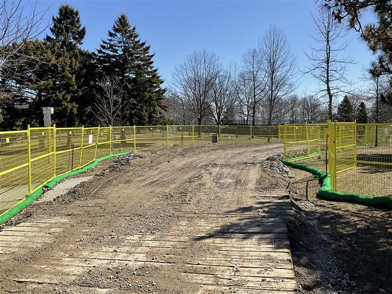
- Undertake site setup and establish staging/stockpile areas, including tree removals, installation of Erosion and Sediment Control (ESC) measures and construction fencing and tree protection
- Prepare existing structures for maintenance including excavation where required
- Reinforce the armourstone headlands and rubble revetment
- Install of habitat stones to promote aquatic habitat development
- Complete site restoration and demobilization
Construction Information
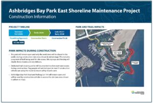
Work is scheduled to commence in February 2026.
The work area and a section of park trail will be closed to accommodate construction access. Trail crossing points will be provided at key locations along the construction access route. Work will be advanced in phases to keep as much of the park open as possible until construction reaches each section.
Construction Progress Updates
June 8, 2026
Work along the shoreline has progressed well.
May 6, 2026
Site set-up activities are complete and work along the shoreline is beginning.
April 2, 2026
Site set-up activities continue. The fencing as well as erosion and sediment control measures has been installed. The access road is being constructed.
February 2, 2026
Construction crews have mobilized and they are starting site set-up activities.
Public Notices and Events
Notice of Construction
Notice of Construction signage will be placed in Ashbridges Bay Park prior to construction.
Public Information Session:
November 5, 2025
View the project panels:
Frequently Asked Questions
Why is this work being done?
Over time, high lake levels and storm events have damaged the shoreline. Construction is needed to repair the shoreline, reduce erosion and flooding risks, and protect park infrastructure for the long term.
How long will construction take?
Construction is expected to begin in early 2026 and will take approximately two years to complete.
Will the park be open during construction?
Yes, the park will remain open during construction. Only the work zone will be closed to the public for safety reasons. This includes a segment of trail that will be used for site access.
Dedicated crossing points will be provided along the trail to maintain east–west access. Flag people may ask trail users to wait briefly while construction vehicles pass these crossing points.
Ashbridges Bay Park Road and Parking Lot 194 will also remain open, but construction vehicles will use them to access the site.
What work exactly is being done?
The work will repair two armourstone headlands and the concrete/rubble shoreline located between them. Activities include:
- Site set-up, including installing access routes, fencing, and some tree removals
- Repositioning existing armourstone and adding a new layer of stone along the headlands
- Resurfacing the concrete/rubble shoreline with new cobblestone material and removing large pieces of concrete and rebar
- Installing aquatic habitat enhancement features in the water
- Repairing trails and planting new grass and trees
What is the extent of changes to the park?
The work being done at the park is routine maintenance and is limited to the repair of damaged shoreline erosion control structures. This is to ensure that the park has long-term protection against erosion to maintain a safe and enjoyable public space. The shoreline will be reinforced using armourstone and cobble material.
How was the repair approach decided?
Coastal engineers assessed wave action, water levels, and how the park is used to choose the most effective shoreline design and materials.
How is this work being funded?
This project is funded by the City of Toronto and also received federal grant funding from Infrastructure Canada’s Disaster Mitigation Adaptation Fund.
What is TRCA doing to protect wildlife?
Wildlife protection is a priority and TRCA is taking the following measures to limit construction impacts by:
- Regularly inspecting the construction access route to prevent vehicles from hitting wildlife
- Monitoring the site for nesting and other wildlife activities
- Avoiding tree and vegetation removals during nesting periods
- Minimizing tree and vegetation removals to only what is necessary to facilitate the construction
- Restoring the site with only native vegetation
- Including aquatic habitat enhancement features underwater to improve fish habitat after construction
Contact Us
For more information regarding this project, please contact the Project Team:
abp-shoreline@trca.ca