The mission of Toronto and Region Conservation Authority (TRCA) is to protect, conserve and restore natural resources, and develop resilient communities through education, the application of science, community engagement, service excellence, and collaboration with its partners.
To that end, a principal mandate of TRCA is to reduce the risk to life and damage to property caused by flooding.
TRCA does this by providing local agencies and the public with notice, information, and advice so they can respond during severe rainfall events (with the potential for flooding) and during flood-related emergencies.
What Is a Flood?
A flood is an overflow or inundation that comes from a river or other body of water and causes or threatens damage. Within a riverine system floods are a natural process that occurs as the result of relatively high flow of water overtopping the channel within a valley system.
TRCA’s Flood Risk Management portfolio continues to evolve and respond to its changing environment, the increasing needs of its municipal partners and the health and well-being of the living city.
Protecting people and property from flood damage is a shared responsibility that requires ongoing coordination of activities among multiple municipal divisions and agencies, conservation authorities, and provincial ministries.

Are You at Risk of Flooding?
The best way to protect yourself and your family in case of a flood is by KNOWING YOUR RISKS, BEING PREPARED, and STAYING INFORMED.


KNOW YOUR RISKS
Understanding your flood risk is the first step in safeguarding your home or business.
When faced with a flood, it’s crucial to have the right information to understand the risks, their causes, and how to respond in a flood situation.
To learn about flood messages, visit TRCA’s Flood Forecasting and Warning Centre.

What Types of Flooding Can Affect You?
Did you know there are several types of flooding? Different levels of government are responsible for the different types.
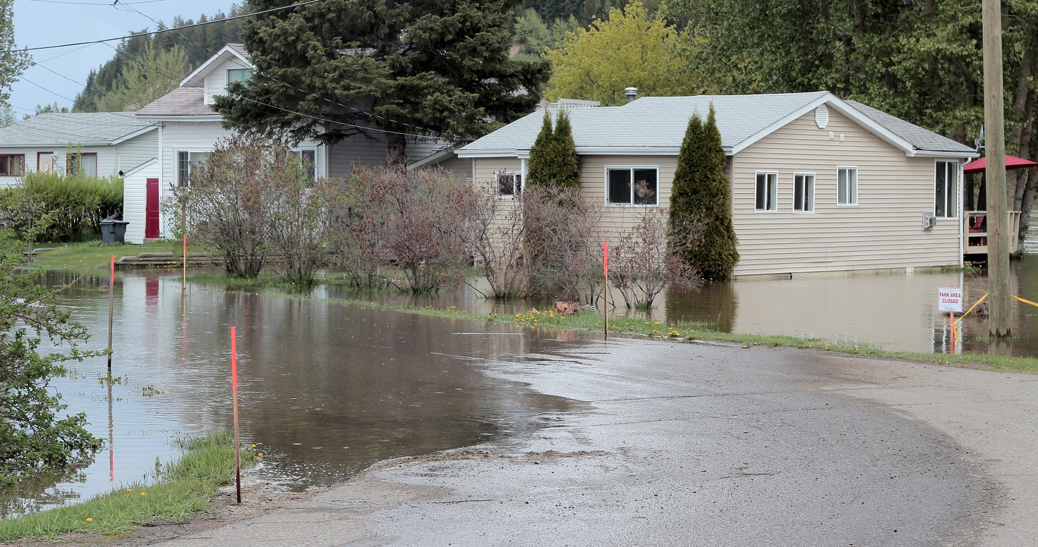
- RIVERINE FLOODING occurs when the water levels of rivers rise, overflowing their banks. Reducing riverine flood risk is the responsibility of conservation authorities like TRCA.
- SHORELINE FLOODING occurs when critical high-water levels and waves result in shoreline flooding and/or erosion, and is monitored by conservation authorities.
- URBAN OR PLUVIAL FLOODING consists of street flooding, basement flooding, and flooding of other low-lying areas due to the overflow of local drainage systems. Municipalities are responsible for managing this type of flooding.
Learn more about the roles and responsibilities for flooding.
FIND OUT WHO TO CONTACT DURING A FLOOD
UNDERSTAND WHY AND HOW FLOODS HAPPEN


Above: Riverine flooding (left); shoreline flooding (right).
Do You Live in an Area at Risk of
Riverine Flooding?
Flood plain management is a fundamental practice of TRCA. LEARN MORE ABOUT THE FLOOD PLAIN.
We achieve this through our flood plain mapping program, which identifies the flood hazard, and through land use planning policies that restrict development within the flood plain.
If you’re not sure whether your home is in a flood plain, use TRCA’s Flood Plain Map Viewer to find out.
Click on the image below to go to the Flood Plain Map Viewer.
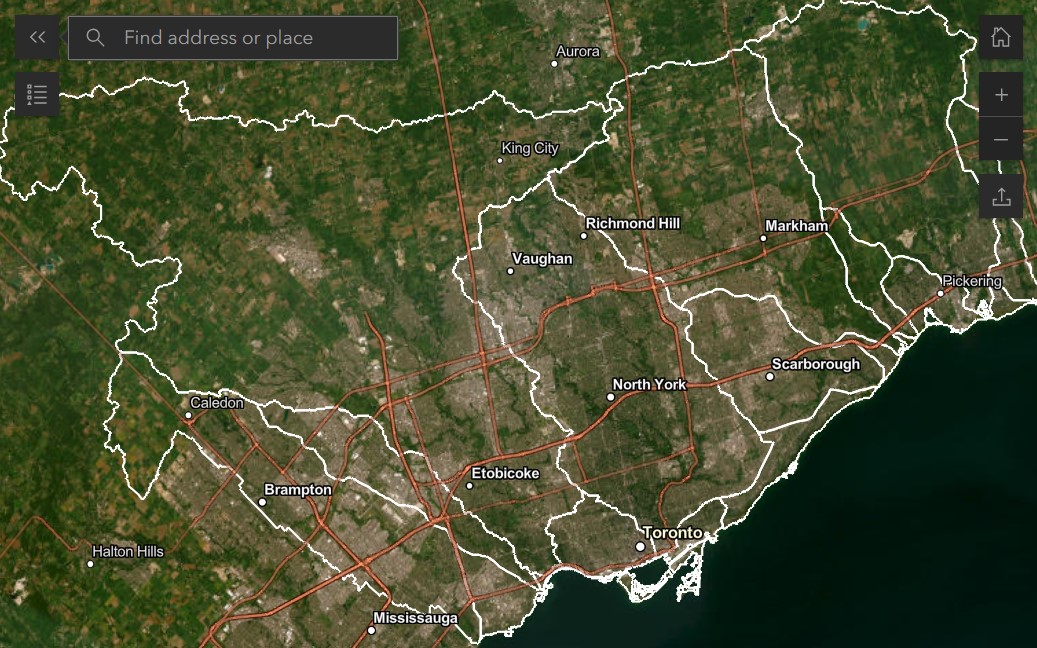
To use the map viewer, just enter your address in the search bar. If your home lies within the blue shaded areas, you could be at risk of flooding.
Living in a Flood Vulnerable Neighbourhood
Within the flood plain, there are higher risk areas known as Flood Vulnerable Clusters (FVC).
A Flood Vulnerable Cluster is an area within the flood plain where there is a higher concentration of roads and structures at risk of flooding.
TRCA has developed digital handbooks with information and resources for residents living in Flood Vulnerable Clusters within our jurisdiction.
Not in a Flood Vulnerable Area?
If don’t live in one of the Flood Vulnerable Clusters, but are still within the flood plain, it’s important to be ready for flooding. Use our resources to get prepared.
Even if you’re outside the flood plain, you may still be in an area regulated by TRCA. Visit TRCA’s Planning and Permits section to learn more about land use policies and regulations regarding development within regulated areas.
GO DEEPER


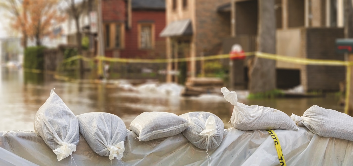
BE PREPARED
Floods are the most frequent natural hazard in Canada*. They can happen anywhere and at any time of the year. The best way to protect yourself and your family in case of a flood is to be prepared.
DOWNLOAD TRCA’S FLOOD PREPAREDNESS FACT SHEET
Signing up for Toronto and Region Conservation Authority (TRCA) flood messages, monitoring the weather, and reviewing emergency preparedness recommendations are all steps you can take to become better prepared.
Learn more at getprepared.gc.ca.
*Source: Government of Canada, Get Prepared, modified: Oct 30, 2019

TRCA Flood Messages
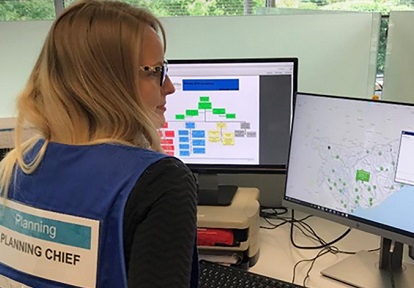
TRCA operates a Flood Forecasting and Warning Program. If flooding is possible or about to occur, TRCA issues flood messages to designated individuals within municipalities, local agencies, school boards, the media, and members of the public who self-subscribe.
How will I know if there’s an active flood message in my area?
- Flood messages will be posted on the TRCA homepage, on our Flood Forecasting and Warning Center webpage, and at TRCAgauging.ca.
- You can also receive flood messages directly from TRCA in two ways:
What should I do if a flood message is issued for my area?
- Read the entire flood message when issued.
- Follow the safety recommendations in the action section of the flood message.
- Be prepared to follow the instructions of emergency response officials.
LEARN ABOUT TRCA FLOOD FORECASTING & WARNING
Real-time Flood Monitoring in
Your Neighbourhood
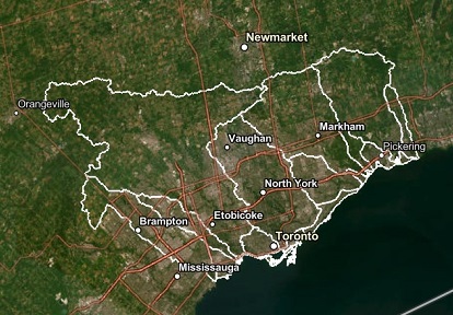
As part of the Flood Forecasting and Warning Program, TRCA operates a flood monitoring gauge network spanning the GTA, which continually monitors in-stream water levels at TRCA dams and river stations as well as collecting rainfall amounts.
The measurements are displayed on TRCA’s flood monitoring website.
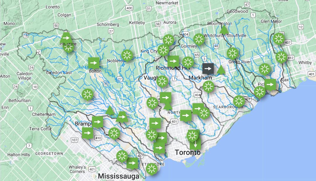
The station map uses shapes, colours and symbols to allow for a quick assessment of the conditions in TRCA’s watersheds.
While the website is designed as a portal for Flood Duty Officers and our municipal partners, limited access to data is available to the public.
How to Use the Gauging Website
TRCA has created a series of videos designed as a user manual for the flood monitoring website. Each video includes step-by-step instructions on using different features of the site.
Safety Around Dams
TRCA owns and operates 12 dams, six dikes, and nine flood control channels within its jurisdiction. Water level and flow around these structures can change rapidly.
Dam operators may change how much water passes through a dam at any time — without warning — making the area downstream hazardous.

HOW TO STAY SAFE
Stay off dam structures unless an area is clearly marked for public travel. These structures were created for specific purpose and only qualified personnel are allowed on the structures.
You should also be alert to changes in water levels.
Throughout TRCA’s jurisdiction there are also dozens of low head dams and weirs located in rivers and creeks. These structures can be extremely dangerous at any water level. It is important to stay away from them.
GET MORE TIPS ON SAFETY AROUND DAMS
Who Should You Contact During a Flood?
If you are in danger, call 911 immediately.

 |
Private Drainage and Surface Water |
| Contact your insurance representative for any property related damage due to flooding. Consider adding other types of flooding coverage to your policy, as necessary. | |
 |
Residents and Businesses Near Watercourses |
| To report incidents and flood risk issues, contact your local conservation authority. | |
 |
Sanitary Sewer Back-up Services |
| If you have a sewer backup in your home, call your regional municipality. | |
 |
Urban Flooding |
| For hydro or natural gas related questions, including safety tips for flooding, contact your local utility provider or the Electrical Safety Authority. | If you have a problem with the storm sewer in your neighbourhood, call your local municipality. |
Emergency Management and Public Safety
When it comes to flood preparedness, everyone has a role to play.
Although conservation authorities and all levels of government work to reduce the impact of floods, individuals also have a responsibility to protect their homes and their families.
Visit getprepared.ca for more information.
You can lessen the impact of a flood by following these rules:
- Know what to do before, during, and after a flood.
- Make an emergency plan, so that everyone knows what to do, and where to go in case of an emergency.
- Prepare an emergency kit for your family and/or business (plan to be self-sufficient for at least 72 hours during a flood or any emergency).
Get Emergency Management & Safety Resources
Flood Insurance
Questions about flood insurance? Contact your insurance representative or visit Insurance Bureau of Canada for more information.
STAY INFORMED
How much do you know about flooding in the Greater Toronto Area? Use these resources we’ve compiled to stay abreast of the latest flood-related news and developments.
Use These Sources to Stay Informed During a Flood
- Check Environment Canada’s public weather alerts.
- Sign up to receive TRCA flood messages or follow @TRCA_flood on X.
- Visit TRCAgauging.ca to check water levels in your local river or stream.
- Check your local municipal and public transit communications channels for any updates or changes due to weather.

Projects to Help Reduce Flood Risk
TRCA is involved in many projects and initiatives for reducing and mitigating the risk of floods from river systems. Learn more about these projects and public education and outreach resources below:
Factsheets & Educational Resources
- 72-Hour Preparedness Flyer
- Ice Jam Factsheet
- Seasonal Flooding Factsheet
- TRCA’s Real-Time Gauging Flood Monitoring Network
- TRCA’s Flood Monitoring Website User Guide
Social Media Channels
TRCA Flood Risk Management: @TRCA_Flood
Region of Peel
City of Toronto
York Region
Region of Durham
Local Traffic and News
Check Out Our Frequently Asked Questions
Quick Links