Preserving and enhancing habitat connectivity — that is, enabling wildlife species to move easily between habitats — is one of the keys to maintaining biodiversity.

The Issue: Habitat Loss and Connectivity
Many native wildlife species, including salamanders and turtles, need to move between habitats (such as forests and wetlands) throughout the year to breed, forage, or hibernate.
However, roads and railways in Toronto and the surrounding regions not only reduce habitat size but also act as barriers, making it difficult for wildlife to travel between natural greenspaces.
This habitat fragmentation limits their access to essential resources and can isolate populations.
Between May and September, an estimated 1.2 million wildlife-vehicle collisions occur within TRCA’s jurisdiction.
Nearly 90% of these involve amphibians and reptiles, which are especially vulnerable due to their slow movement. For example, salamanders travel at an average speed of just 35 cm per minute, making it nearly impossible for them to avoid fast-moving traffic.
Understanding these challenges is key to developing solutions that help wildlife move safely across the landscape while reducing road mortality.
LEARN MORE ABOUT HABITAT CONNECTIVITY
Key Areas of Focus in Our Road Ecology Work
TRCA’s research focuses on improving habitat connectivity and finding solutions to help wildlife cross roads safely.
Key areas of our work include:
1. Strategic Risk Assessments
TRCA maps and models habitat connectivity to understand how different wildlife species move across the region. These assessments help identify critical corridors and high-risk areas, guiding efforts to reduce road-related impacts on wildlife.
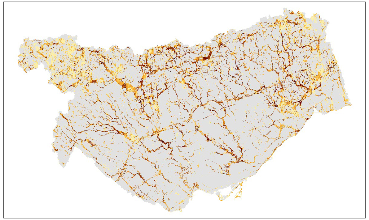
| Wildlife movement corridors across the TRCA jurisdiction and the likelihood of travel (darker colour indicates higher probability of use). |
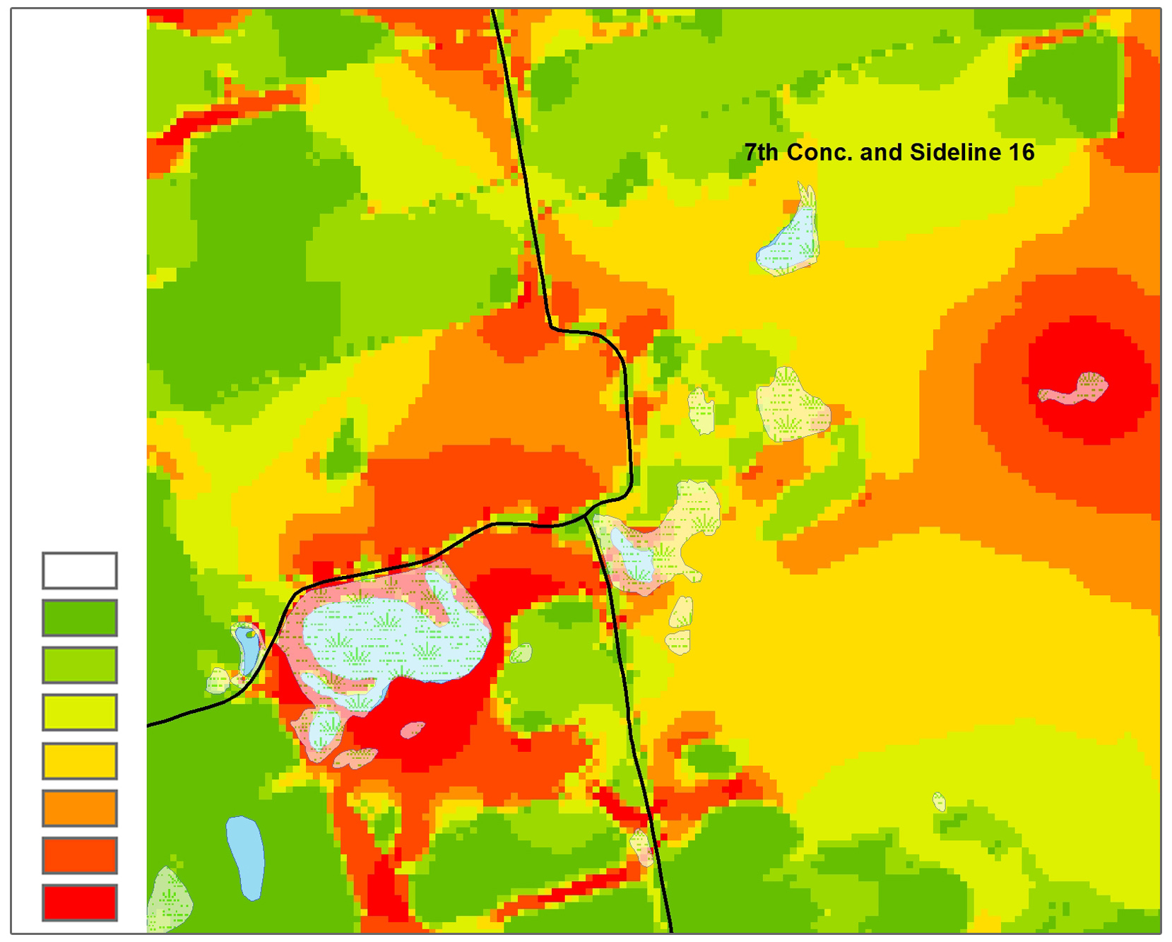
| This model illustrates where an amphibian group is predicted to travel based on different habitat types. Red areas show habitats where this group of amphibians are most likely to travel, while green areas show the least movement. Road ecology data has been used to validate the model. |
2. Site Evaluations and Monitoring
TRCA conducts field surveys to track wildlife movement and identify high-risk road crossings in priority areas, including:
- Heart Lake Road, Brampton
- Stouffville Road, Richmond Hill
- Happy Valley, King Township
- High Park, Toronto
3. Wildlife Crossing Solutions
TRCA recommends practical solutions to help wildlife safely cross roads, including:
- Fencing to prevent wildlife from entering roadways
- Wildlife tunnels (ecopassages) for safe passage
- Creating breeding or nesting habitats in safer areas
- Seasonal road closures to protect vulnerable species

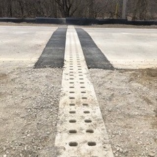
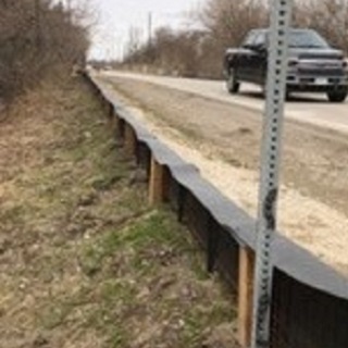
| Above, left to right: Example of a wildlife tunnel (ecopassage) under the road; Example of an ecopassage above the road; Wildlife exclusion fencing installed along Heart Lake Road in Brampton to help guide wildlife towards the ecopassages. |
4. Monitoring and Effectiveness Studies
Once mitigation measures are in place, we assess their success. Using tools like specialized camera traps, we monitor wildlife activity in newly installed ecopassages to determine which species are using them and how frequently.
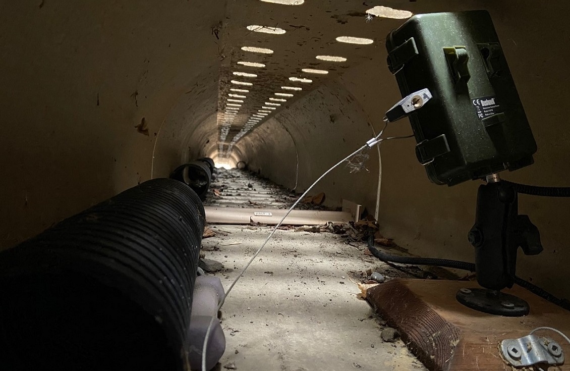
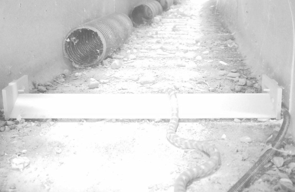
| Monitoring ecopassages installed at Heart Lake Road using camera traps to assess how well they work to mitigate wildlife road mortality. |
5. Road Ecology Strategies and Guidelines
Drawing from our research and field experience, TRCA develops tailored strategies to reduce road mortality and improve wildlife movement. These guidelines are designed for partners and usually target busy municipal roads or park trails and can be adapted for different species – from small amphibians and reptiles to larger mammals.
By combining research, monitoring, and practical solutions, the strategies and guidelines can be a guiding document to create safer landscapes for both wildlife and people.
DOWNLOAD & VIEW THE GUIDELINES
Engaging Partners in our Work
- Consultation with Municipal Partners and Private Sector: Collaborate on the development of TRCA crossing guidelines to ensure effective wildlife movement solutions.
- Engagement with Academic Researchers: Partner with researchers to assess the environmental and economic impacts of crossings in TRCA watersheds.
- Support for Municipalities: Assist partner municipalities with the placement, design, and implementation of mitigation strategies to improve wildlife connectivity. This also includes the evaluation and long-term maintenance related to the impacts of transportation infrastructure on wildlife movement outside of valley and stream corridors.
We are open to discussions with partners on any wildlife connectivity issues or opportunities for research and mitigation implementation in areas of concern across the jurisdiction.
Resource Library
Past Reports
- Final Report: High Park Wildlife and Road Mortality Monitoring Assessing Cycling and Roadway Impacts (2025)
- Urban Planning for Wildlife Connectivity: A Multispecies Assessment of Urban Sprawl and SLOSS Renaturalization Strategies (2025)
- Mitigating Herpetological Road Mortality: A Case Study of How Citizen Science Motivated Municipal Cooperation (2024)
- TRCA Updated Target Natural Heritage System: A Summary Report (2022)
- Wildlife-Vehicle Collision Summaries for Major Roads in Peel and York Region: Hot Spots and Seasonal Movements (2021)
- Best Management Practices for Mitigating the Effects of Roads on Amphibian and Reptile Species at Risk in Ontario (2016)
- TRCA Crossings Guideline for Valley and Stream Corridors (2015)
- Region of Peel Road Ecology Case Study: Gore Road (Patterson Side Road to Hwy 9) Baseline Monitoring Results (2014)
Contact
TRCA Watershed Planning and Ecosystem Science: wpes@trca.ca