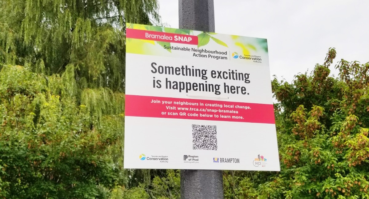
Toronto and Region Conservation Authority (TRCA), City of Brampton, Region of Peel, and Healthy Communities Initiative (HCI) are working closely with community leaders, residents, and businesses to implement a Sustainable Neighbourhood Action Plan (SNAP) for Bramalea.


About Bramalea SNAP
Retrofits to the natural and built environment demonstrate implementation of Brampton’s Grow Green Master Plan, Community Energy and Emissions Reduction Plan, and Vision 2040, as well as TRCA’s Etobicoke and Mimico Creeks Watersheds Plan, the Healthy Communities Initiative, and Region of Peel Public Health priorities.
They also support the Region of Peel’s Climate Change and Water Efficiency priorities.
About the Bramalea Community
The SNAP Action Plan will focus on the K, E, and F sections of Bramalea. First developed in the 1960s, this area was planned as Canada’s first “satellite city”* and has a unique history and identity in Brampton.
Select the images below to view full-sized maps.


*Learn more about Bramalea’s history HERE.
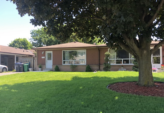
The area is home to more than 13,600 people living in detached and semi-detached homes, town homes, and apartment and condo towers.

There are numerous parks, schools and places of worship, as well as a recreation centre. Western portions of the neighbourhood drain to the Spring Creek, which is part of the Etobicoke Creek Watershed.
Eastern portions form the headwaters of the main branch of the Mimico Creek, within the Mimico Creek Watershed.

The Bramalea SNAP Action Plan
The Bramalea SNAP Action Plan for neighbourhood revitalization integrates local community interests and sustainability objectives under the overarching theme of working together for a green, healthy, and welcoming Bramalea SNAP neighbourhood.
The Action Plan was co-designed with community and stakeholders to reflect local top-of-mind issues, motivating interests, and shared objectives.
Engagement also aimed to build relationships and a foundation for long term local action.
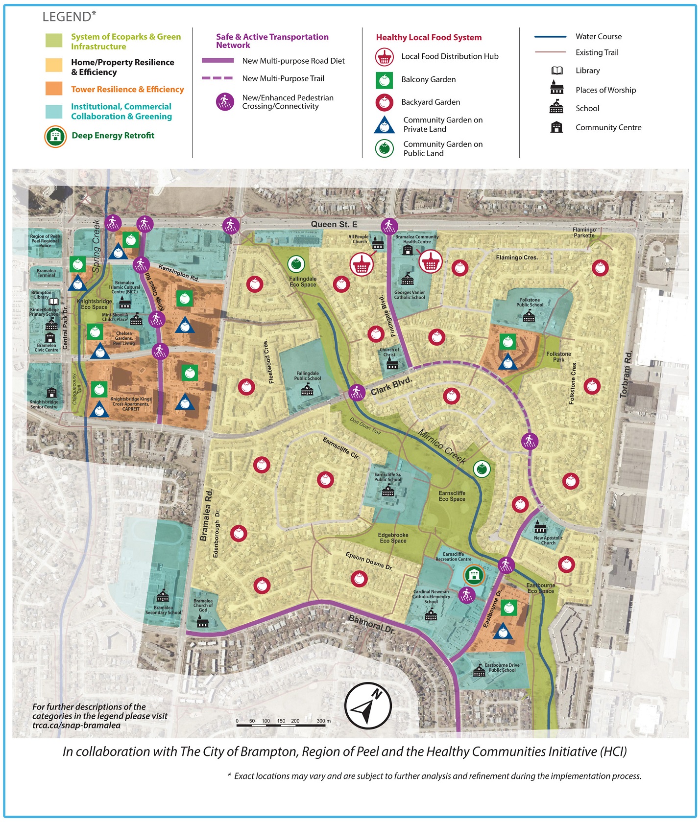
Themes and Action Areas
The Action Plan is made up of six themes, each with their own integrated initiatives:
1. System of Eco Spaces & Green Infrastructure
Re-shaping older parks into Eco Spaces, supporting a healthy green infrastructure system extending into backyards, tower properties, and streets.
- Eastbourne, Earnscliffe, Fallingdale, Edgebrooke, Folkstone, and Knightsbridge Parks as Eco Spaces
2. Safe & Active Transportation Network
Enhancements to the existing pedestrian and cycling routes, including safe pedestrian crossings and multi-objective road diets improvements in key areas.
- Multi-objective Road Diets and Pedestrian Realm Improvements
3. Healthy Local Food System
A series of interconnected urban agriculture initiatives on private and public land to support local growing, sharing, distribution, and skills building.
4. Home/Building Efficiency & Resilience
Integrated initiatives and targeted programming to reduce GHGs and increase overall climate change resilience in residential homes and buildings.
- Tower Resilience and Efficiency Initiative
- Home and Property Resilience and Efficiency Initiative
5. Institutional/Commercial Collaboration & Greening
Targeted engagement of institutional and commercial properties to collaborate on community-based SNAP projects and encourage greening initiatives on their own properties.
6. Community Resilience
Facilitating community events and programming to help support neighbourhood connections, capacity-building, emergency preparedness, education, arts and culture.
Action Plan Map
Select image below to view the full-sized Action Plan Concept Map.
Action Plan Report
Read the full Bramalea SNAP Action Plan report approved by Committee of Council, City of Brampton on February 17, 2021.
Select image below to download the report.

Next Steps
TRCA, City of Brampton, and Region of Peel are working closely with the local community and partners to implement the action plan recommendations, which vary from short to long term.
Each recommended project involves further community involvement, so be sure to contact us to get involved or sign up for project updates.
Bramalea SNAP Projects


Have You Recently Planted a Tree? Add it to Brampton’s Tree Planting Tracker!
The City of Brampton has launched an online tree planting tracker tool to help monitor and report progress toward achieving the City’s One Million new trees goal. If you’ve recently planted a tree, record it on the tree planting tracker.
Stay Connected
UPCOMING EVENTS
Find out what’s been going on with Bramalea SNAP by checking out back issues of the newsletter:
Contact Information
Do you live or work in this neighbourhood? Get involved!
Help make decisions about Bramalea and have your say!
Questions? Please contact:
Justyna Braithwaite
Project Manager, SNAP Projects
justyna.braithwaite@trca.ca
(437)-880-2409
In Collaboration With: