Toronto and Region Conservation Authority (TRCA) reminds residents to be aware of river flooding risk due to thunderstorms.
Thunderstorms can develop suddenly during the warmer months and are often accompanied by strong winds, hail, lightning, and heavy rain.
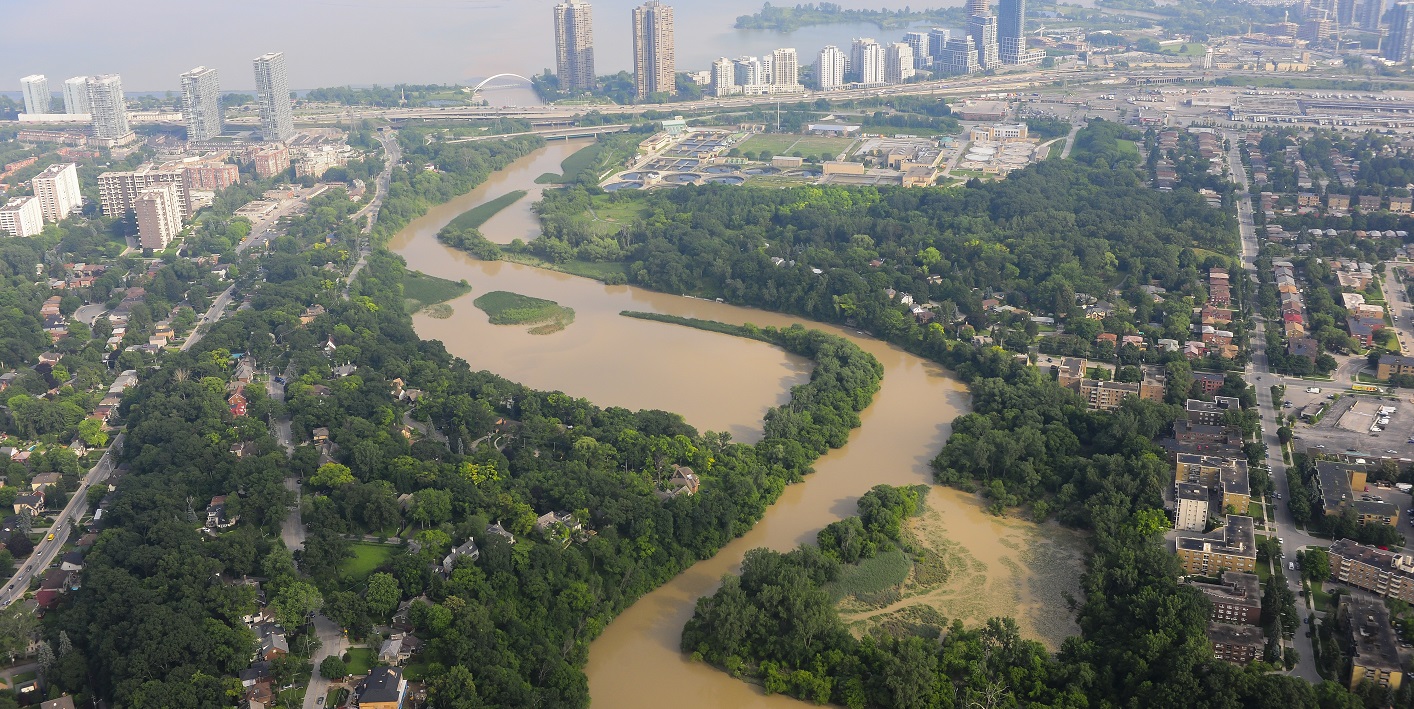
River flooding occurs when rivers and streams rise over their banks and spill into the surrounding land.
The rivers in TRCA’s jurisdiction are considered “flashy” due to urbanization, which means that large amounts of precipitation over a short period of time, often associated with thunderstorms, can cause water levels in river systems to rise with little warning — even in as little as a few minutes.
Residents should be aware that flooding can occur very quickly with passing thunderstorms.
Summer Safety Tips – River Flooding
- Stay away from riverbanks and avoid recreational activities in watercourses during storm events, especially thunderstorms.
- Do not drive through, stand, or walk in any moving water. Avoid low-lying areas such as road underpasses and walkways.
- Stay informed on storm events such as thunderstorms through local radio, television, mobile, or other public alerting systems.
- If you are instructed by emergency officials to evacuate due to flooding, do so immediately.
- If you are in danger, call 911 immediately.
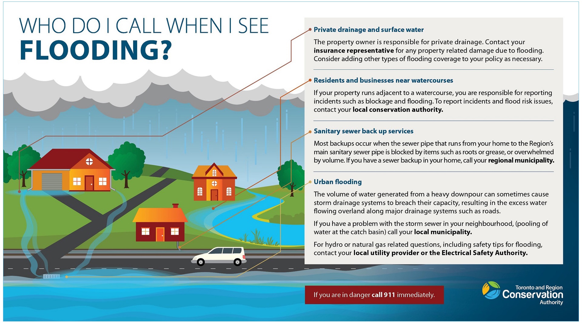
To find out who to call when you see flooding, please refer to the graphic below.
Select the image to download a PDF copy.
Additional Facts: TRCA’s Role in Flood Monitoring
- If a storm event is forecasted for TRCA’s jurisdiction, a storm event risk assessment is completed by an on-call Flood Duty Officer (FDO), as part of the Flood Forecasting and Warning Program.
- TRCA may issue a flood message when there is certainly that a storm event with heavy rainfall could cause river flooding. TRCA issues flood messages to designated stakeholders, and members of the public who self-subscribe.
- During severe storm events, FDOs will monitor the real-time weather and watershed conditions in TRCA’s jurisdiction, using tools such as radar and weather forecast models as well as TRCA’s Flood Monitoring Real-time Gauging Network.
- TRCA continuously monitors the watersheds in its jurisdiction for potential flooding, through the Flood Forecasting and Warning Program, and will continue to monitor for storm events throughout the thunderstorm season.
SUBSCRIBE FOR TRCA FLOOD MESSAGES
Thunderstorms and Flooding in the GTA
There have been a number of recent instances in which TRCA’s watersheds have experienced thunderstorms that resulted in significant flooding:
- July 8, 2020: A sudden downpour associated with thunderstorm activity caused flooding in several parts of the City of Toronto. Within a half-hour, approximately 65 millimetres of rainfall poured over the city’s west end, causing flooding in low-lying areas along Black Creek and the Humber River.
- July 8, 2013: Parts of the Greater Toronto Area were hit by an extreme rainfall event that caused widespread power outages and disrupted evening traffic, stranding many commuters and flooding a GO Train near the Don River. The maximum total rainfall recorded for this event was 138 mm, near Toronto Pearson International Airport. Many areas along Etobicoke Creek, Mimico Creek, and the Humber River and Don rivers were impacted by flooding due to the storm.
- August 19, 2005: A thunderstorm caused extensive flooding when Toronto and surrounding areas received as much as 150mm of rain over a few hours. In the Black Creek sub-watershed, where the creek flows under Finch Avenue West, the flood washed out a culvert, collapsing the road.

Learn More
Learn more about weather hazards and summer safety from the Government of Canada HERE.
For more information about regional water levels and seasonal changes, contact your local Conservation Authority:
- Toronto and Region Conservation Authority: (416) 661-6514
- Lake Simcoe Region Conservation Authority: (905) 895-1281
- Conservation Halton: (905) 336-1158
- Credit Valley Conservation: (905) 670-1615
- Central Lake Ontario Conservation Authority: (905) 579-0411
- Ganaraska Region Conservation Authority: (905) 885-8173
- Nottawasaga Valley Conservation Authority: (705) 424-1479
- Kawartha Conservation: (705) 328-2271