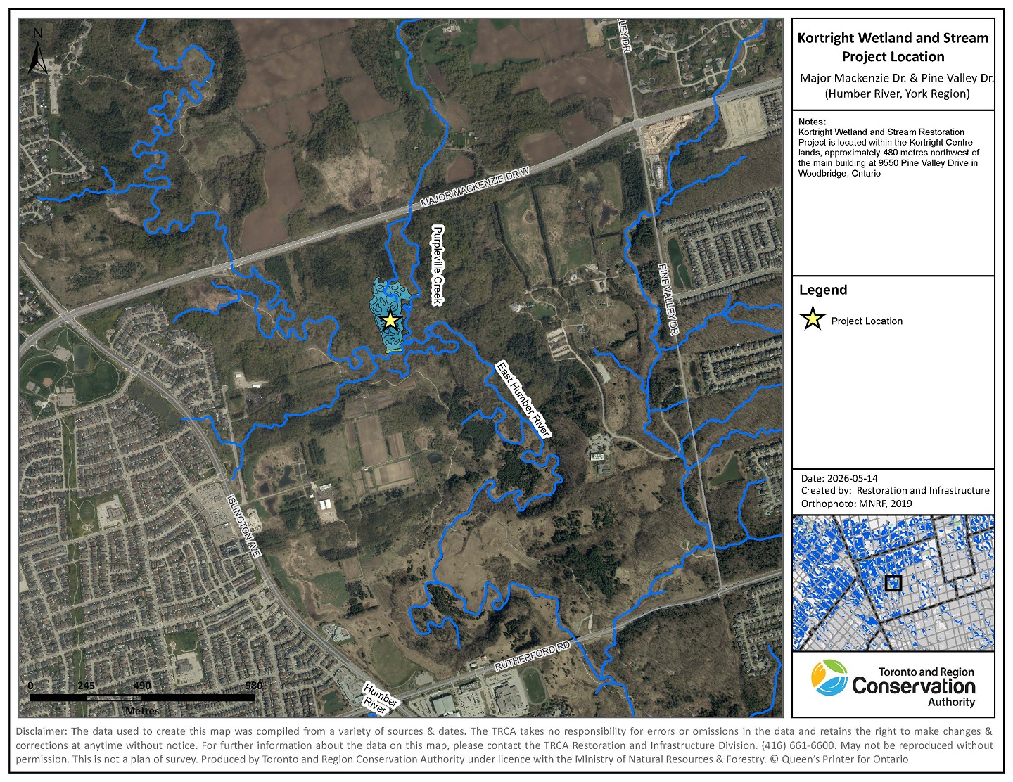
Toronto and Region Conservation Authority (TRCA) is planning the Kortright Wetland and Stream Restoration Project within the Kortright Centre for Conservation lands. The project area is situated in the Humber River Watershed at the confluence of Purpleville Creek and the East Humber River.

Project Location
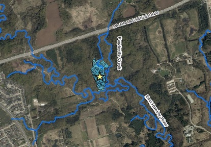
The project site is located approximately 480 metres northwest of the Kortright main building at 9550 Pine Valley Drive in Woodbridge (Figure 1).
Select the image below to view full-sized.
Project Background
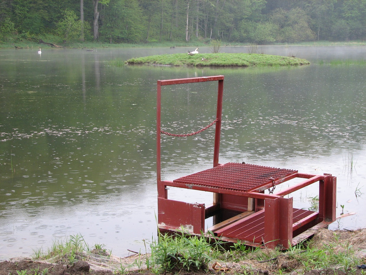
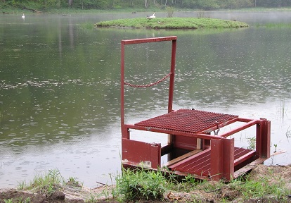
First photo/left: The view from the water control structure in Kortright Wetland, looking northwest, 2010.
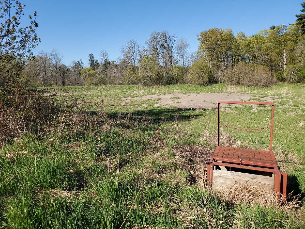
Second photo/right: The same location, looking southwest, in 2021.
This wetland and stream restoration project will restore an existing wetland (constructed in 1978) and stabilize sections of Purpleville Creek, which are currently eroding toward the wetland berm.
Since the original wetland construction, upstream drainage patterns have changed, affecting the wetland’s hydroperiod and contributing to seasonal drying in recent years. Ongoing erosion and increased water inputs have contributed to erosion on Purpleville Creek, which contains sensitive habitat.
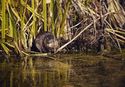
This project will restore a connection between Purpleville Creek and the floodplain, resulting in improved bank stability, restored wetland hydrology, and enhanced habitat conditions for native wildlife.
This site is part of the Humber River watershed and the East Humber River Wetland Complex, and is classified as an Area of Natural and Scientific Interest (ANSI), making it a high priority for ecological restoration.
Project Timeline
| Planning and Permitting | Summer 2025-Spring 2026 |
| Wetland and Stream Construction | July 15 to October 1, 2026 |
| Planting | Fall 2026 to Spring 2027 |
| Project Completion | Fall 2027 |
Project Overview
This project will focus on improving wetland connectivity and function, while also restoring the banks of Purpleville Creek in highly eroded areas.
The wetland floodplain connectivity will be improved through targeted removals of wetland berm. These openings will allow water into the floodplain during high flow events and improve year-round water retention.
The wetland will be enhanced through the addition of deep and shallow dug pockets and raised soil mounds. These pockets create suitable habitat for breeding and overwintering amphibians and reptiles.
Habitat features including repurposed logs and brush piles will be installed to provide basking, perching, and refuge habitat for wildlife.
Stream restoration will involve minor bank regrading and planting shrubs to stabilize eroding banks, along with debris removal to remove refuse within the creek and root wad installation to provide in-stream fish habitat.
Following construction activities, native trees, shrubs, and wetland seed will be planted to increase habitat diversity and provide cover and foraging opportunities for wildlife.
Key Goals:
- Stabilize the banks of Purpleville Creek through minor regrading works and planting of native shrubs
- Restore the floodplain wetland by removing sections of berm and recontouring pockets to increase water retention and improve ecological function
- Plant native tree and shrub species to increase cover within the wetland
- Restore habitat for sensitive species, including fish, amphibians, and birds
Scope of Work
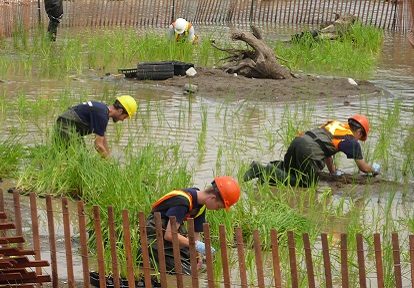
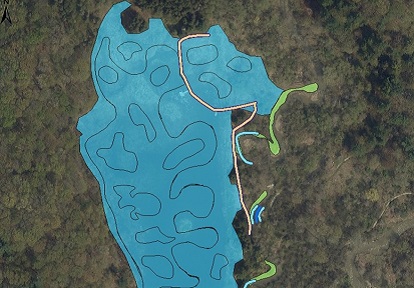
1. Purpleville Creek Restoration:
Stabilize and revegetate three erosion sites (Figure 2) along Purpleville Creek.
Select the image below to view full-sized.
2. Wetland Enhancement:
Reconnect existing wetland to the floodplain and create deeper wetland pockets and planting mounds to diversify topography and habitat.
3. Habitat Structures:
Placement of habitat features throughout the wetland including perching poles, log tangles, and woody debris to provide perching and resting habitat for frogs, turtles, and birds.
4. Vegetation:
Plant native trees and shrubs, broadcast native riparian and wetland seed.
5. Debris Removal:
Remove old gabion baskets and debris jams to restore natural river form.
Completed Steps:
- Archaeological assessment complete
- Detailed topographic survey complete
- Design design complete
- Invasive species treated and removed
- Permitting complete
Next Steps:
- Float equipment to the site
- Implement erosion and sediment control plan
- Complete in-stream minor grading works
- Remove berm, excavate pockets, and install habitat features
- Spread cover crop and native seed on disturbed areas
- Plant native tree and shrub species
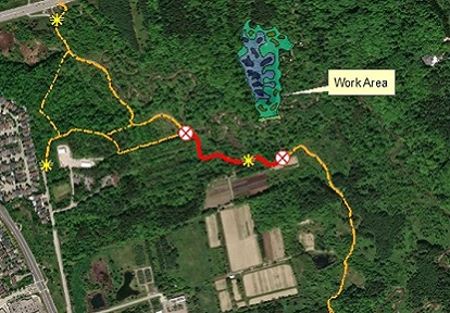
Public Access
To ensure public safety during construction, a temporary trail closure will be in place on a portion of the William Granger Greenway Humber trail system near the active work zone (Figure 3).
Select the image below to view full-sized.
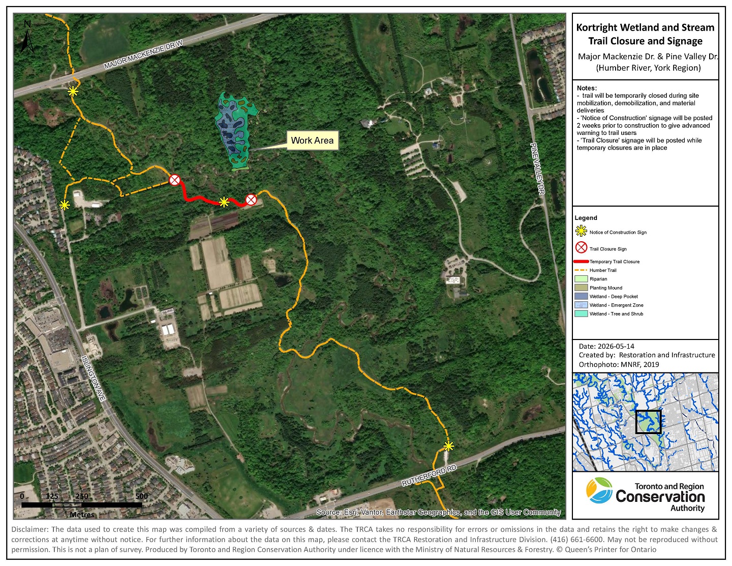
- The trail will be closed for a short duration of time (1-2 hours) during the movement of equipment and materials to and from site.
- Temporary trail closures will occur periodically throughout the project implementation timeline (July to October).
- Trail closures will be clearly marked with on-site signage and flag personnel.
- Please respect all posted signs and construction barriers.
- Project updates will be updated on this page when available.
Project Updates
Coming soon.
Contact Us
For more information regarding this project, please contact:
Jessie Spasov, Project Manager
Restoration Resource Management
Restoration & Infrastructure
jessie.spasov@trca.ca