Notice of Public Consultations
NOTICE is hereby given that in accordance with Section 21(4) of the Conservation Authorities Act, Toronto and Region Conservation Authority (TRCA) is undertaking public consultation regarding the following potential dispositions:
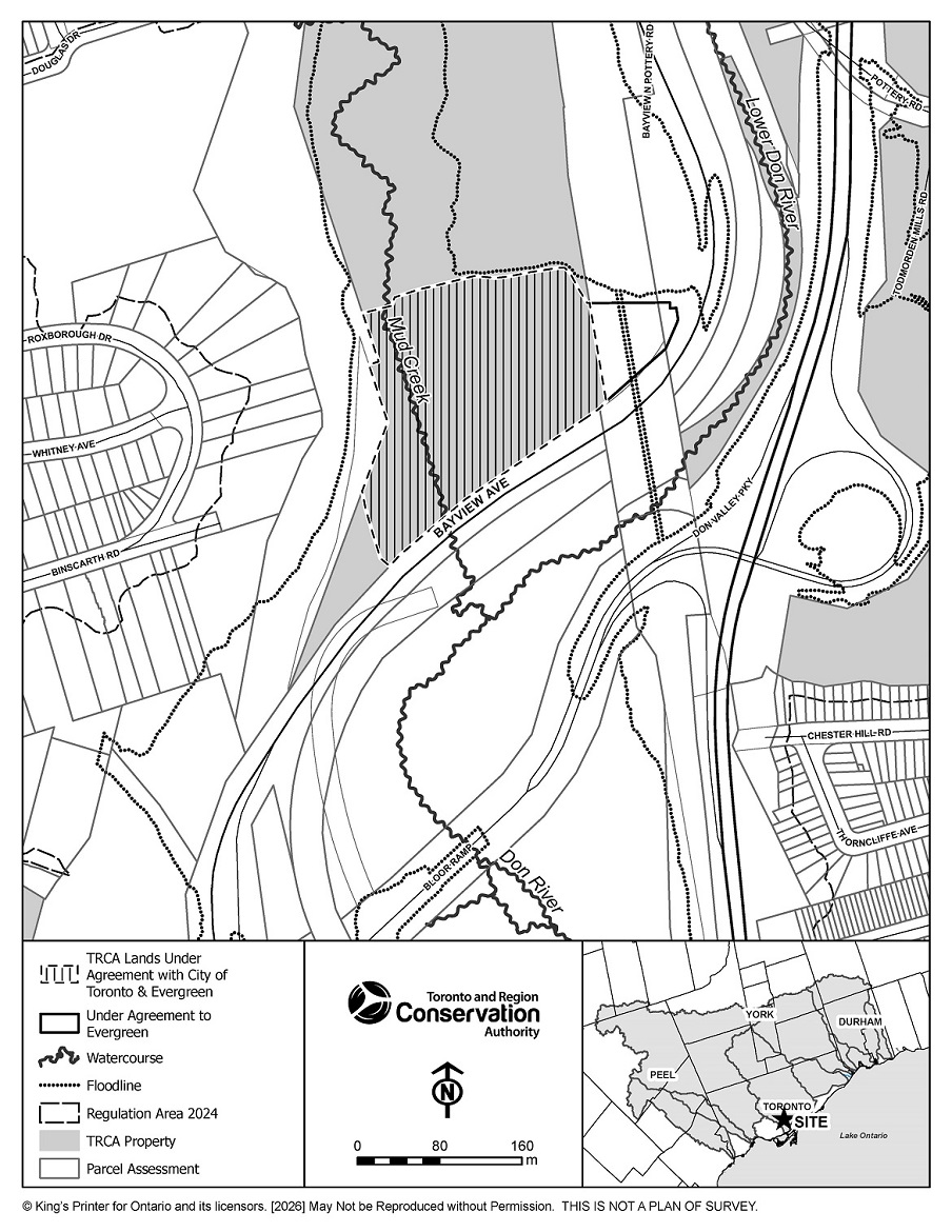
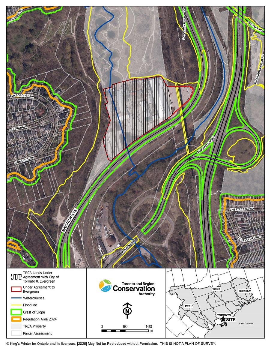
Evergreen Brick Works – Portion of 550 Bayview Ave, Toronto
Evergreen Lease Amendment and Extension Agreement For a Portion of 550 Bayview Avenue (Evergreen Brick Works)
Toronto and Region Conservation Authority (TRCA) wishes to enter into an amending and extending lease agreement as well as a new nominal non-exclusive license agreement with the City of Toronto and Evergreen Brick Works for a portion of 550 Bayview Ave (“Lands”), Toronto for a 20-year term commencing September 1, 2026, or other such date as approved.
- TRCA agreed, with the City as its duly authorized manager and consenting party, to lease to Evergreen, and Evergreen agreed to lease from TRCA through the City, the Leased Premises, on terms and conditions set out in the Lease Agreement (“Initial Ground Lease”) dated October 5, 2027. The Lease Agreement, as amended, is set to expire on March 2nd, 2030.
- Under the current Lease Agreement, Evergreen completed the restoration and adaptive re-use of the heritage structures at the Don Valley Brick Works to create a centre for environmental learning and urban ecology.
- The existing Lease Agreement does not extend below grade to provide sufficient real estate rights to support the geothermal infrastructure installed by Evergreen.
TRCA wishes to support the continued use of the Lands as a public space via the amending and extending lease agreement as well as a new nominal non-exclusive license agreement with the City of Toronto and Evergreen Brick Works.
The public consultation period for this disposition will be open for 45-day period with comments due by 11:59 p.m. on May 9, 2026.
Comments should be provided by email to:
Rutvik Pandya, Senior Manager, Asset Management
rutvik.pandya@trca.ca
View Maps of the TRCA Lands
Identified for Disposition:
Select the images below to view the full-sized maps.
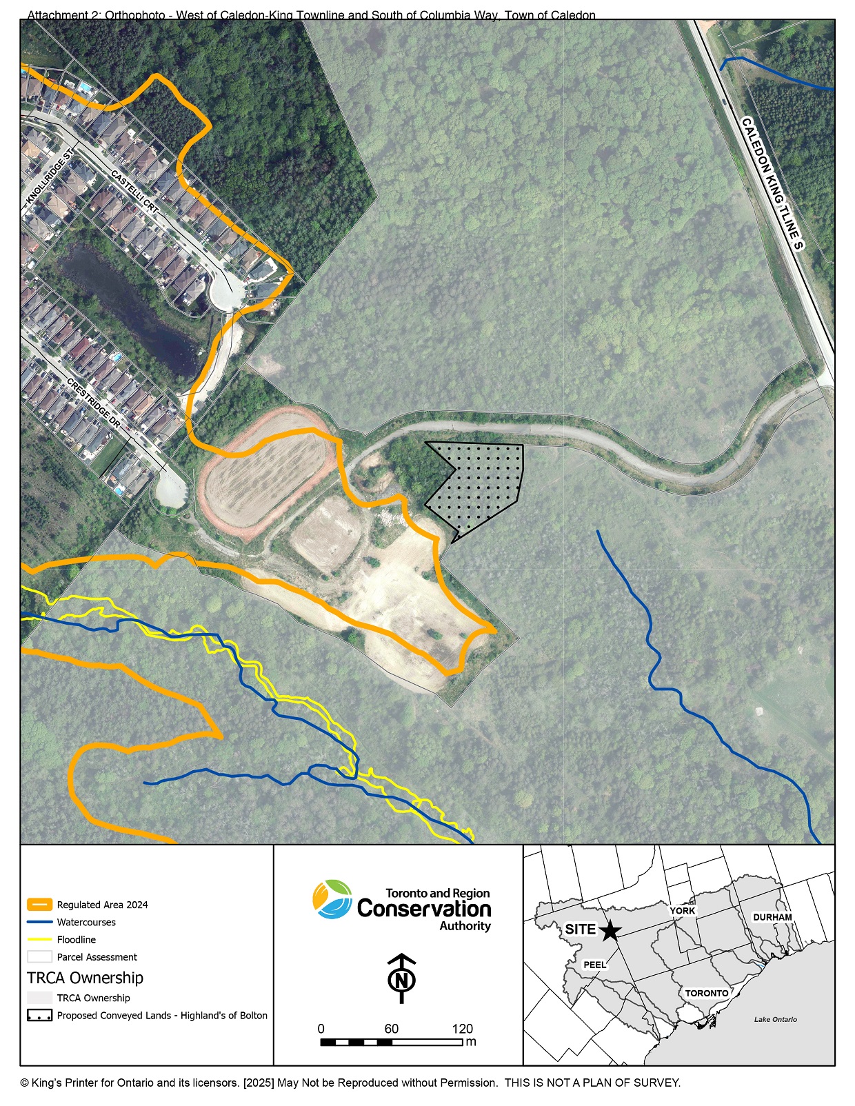
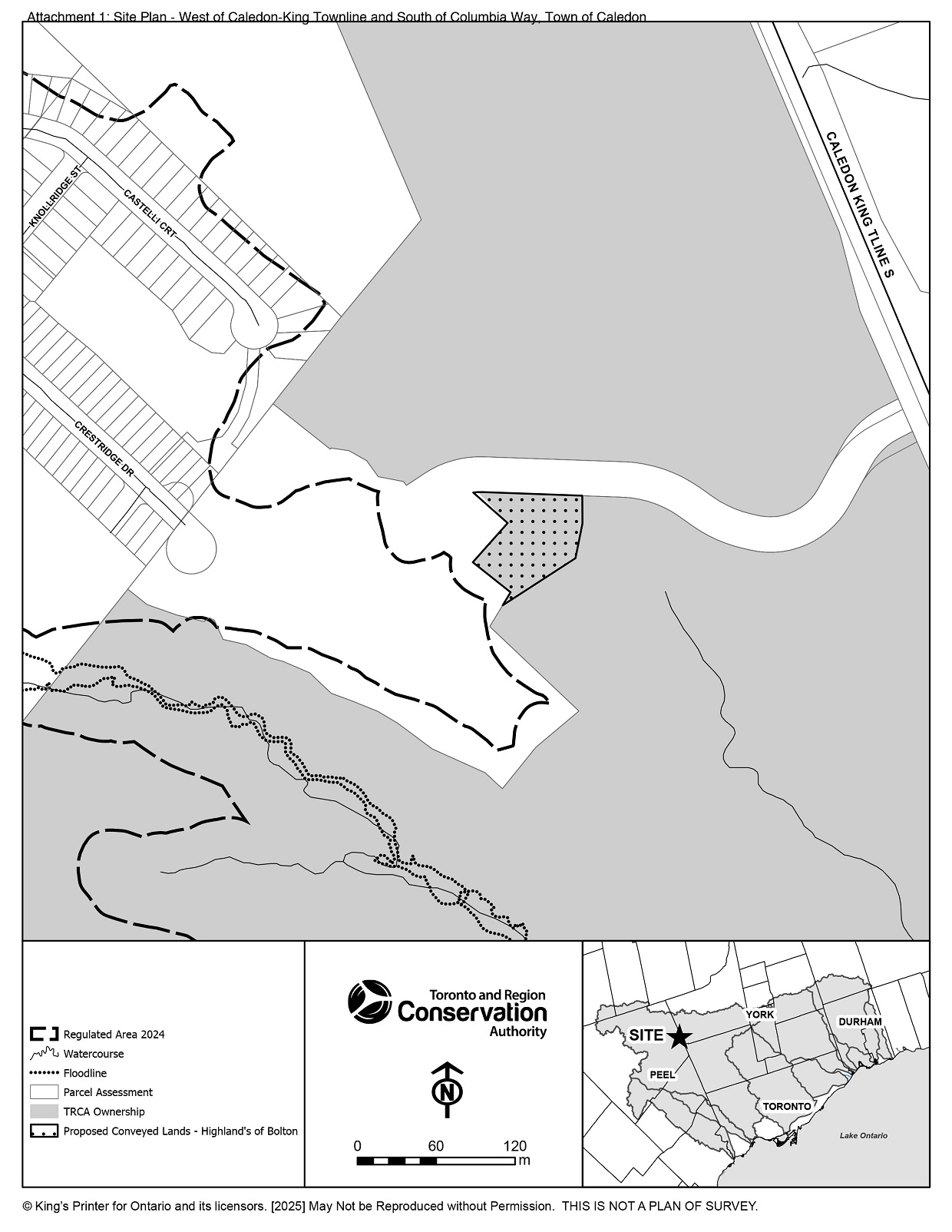
CLOSED – Disposition of TRCA-owned Lands West of Caledon-King Townline …
CFN 71039: Disposition of TRCA-owned lands
Located: West of Caledon-King Townline and South of Columbia Way, Town of Caledon
Toronto and Region Conservation Authority (TRCA) is conducting a public consultation regarding the proposed disposition of TRCA-owned lands to Hi-Lands of Bolton Corp. The purpose of this disposition is to facilitate grading and the construction of a stormwater management (SWM) pond.
Circulation Summary:
TRCA Property staff are currently working with Hi-Lands of Bolton Corp. Through this process, approximately 0.45 hectares (1.12 acres) of TRCA-owned parcels (view maps) within the Town of Caledon have been identified for disposition.
- The disposition will be completed once all required due diligence has been completed and no later than December 31, 2026.
Public consultation on this disposition is now closed.
View Maps of the TRCA-owned Lands
Identified for Disposition:
Select the images below to view the full-sized maps.
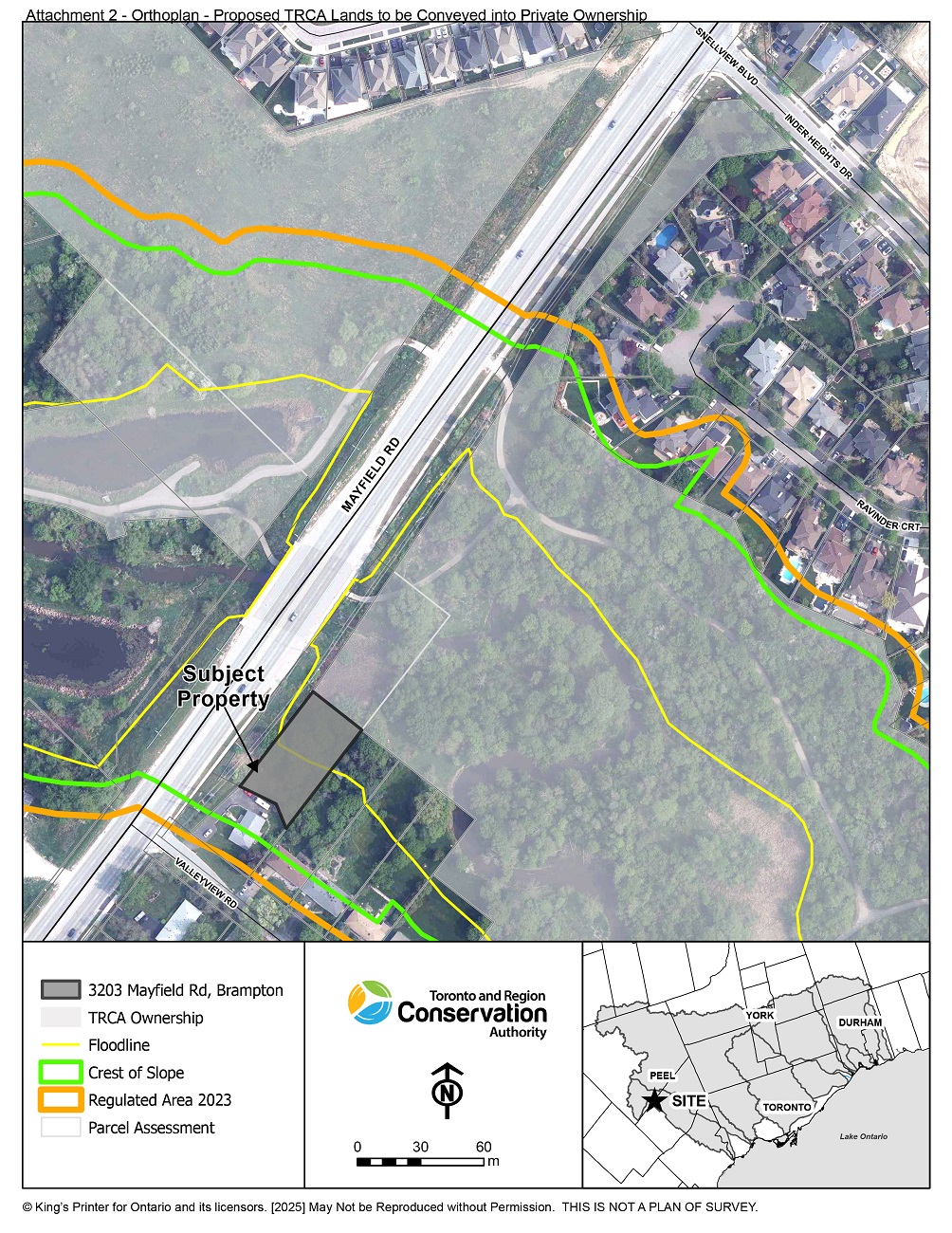
CLOSED – Disposition of TRCA-owned Lands Adjacent to 3203 Mayfield Road, Brampton
Toronto and Region Conservation Authority (TRCA) has been approached by the homeowner of 3203 Mayfield Road, Brampton, to convey the TRCA-owned lands (0.4 acres) adjacent to the east into private ownership.
- To correct a historical error in which the septic system servicing the residential dwelling is currently situated on TRCA lands, the homeowner of 3203 Mayfield Road, Brampton is seeking to own the lands containing the private infrastructure.
- Following failure of the septic system in 2024, the homeowner paid for the urgent replacement to mitigate leeching of hazardous waste.
- The disposition has been approved by TRCA’s Board of Directors, and the City of Brampton Committee of Adjustment has conditionally approved for both the Consent to Sever the lands, and two Minor Variance applications.
- The Agreement of Purchase and Sale will include the requirement to register a Restrictive Covenant on the subject lands indicating continued use and maintenance of the existing septic system to be the sole permitted use, and that no structures are to be added to the lands.
- This land conveyance is expected to be completed no later than December 31, 2026.
Public consultation on this disposition is now closed.
View Map of the Proposed TRCA Lands
to be Conveyed into Private Ownership:
Select the image below to view the full-sized map.
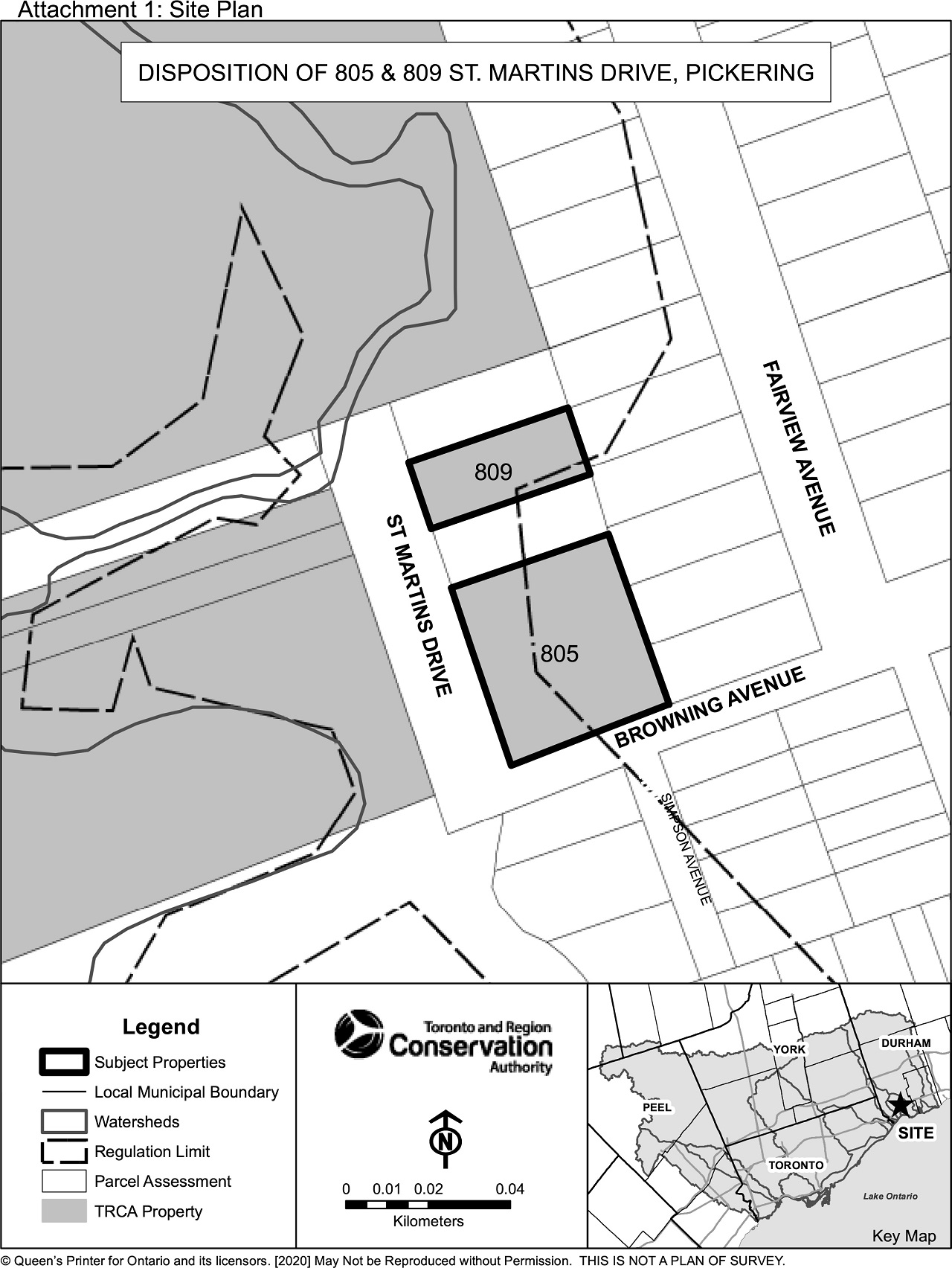
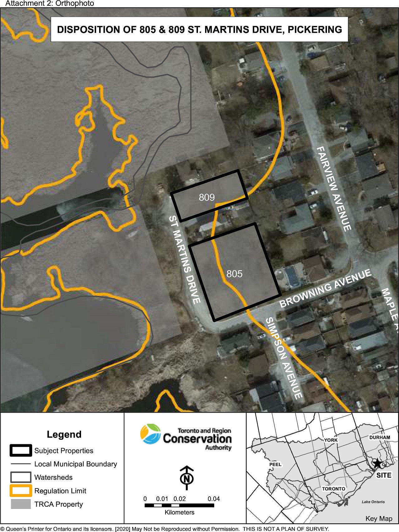
CLOSED – Disposition of 805 and 809 St. Martins Drive, Pickering
The subject lands are to be disposed of in accordance with the Memorandum of Understanding between Toronto and Region Conservation Authority (TRCA) and the City of Pickering.
Proceeds from the sale will support the enhancement of waterfront trail connectivity within the City of Pickering.
- The properties consist of vacant lots of record, located within an area zoned for residential use and are not serviced.
- The disposition is expected to be completed no later than December 31, 2025.
Public consultation on this disposition is now closed.
View Maps of 805 and 809 St. Martins Drive:
Select the images below to view the full-sized maps.
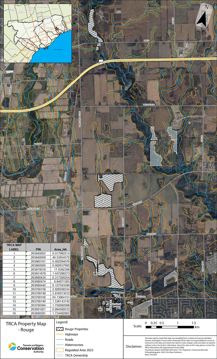
CLOSED – Rouge National Urban Park
TRCA is conducting a public consultation on the disposition of TRCA-owned properties to Parks Canada for the Expansion of the Rouge National Urban Park.
Circulation Summary:
TRCA Property staff are currently working with Parks Canada on the expansion of the Rouge National Urban Park. Through this process, 16 TRCA-owned parcels (see map below) within the City of Pickering have been identified as surplus for disposition to Parks Canada. This disposition will be completed once all required due diligence has been completed.
Public consultation on this disposition is now closed.
View the Rouge Property Map:
Select the image below to view the full-sized map.
CLOSED – Proposed Easement, North of Sheppard Avenue E & West of Leslie Street
TRCA has been approached by a third party to register existing stormwater infrastructure on the TRCA owned lands north of Sheppard Avenue East and west of Leslie Street.
- The area of the proposed easement is already disturbed. The third party will undertake upgrades to existing stormwater infrastructure.
- TRCA negotiated an easement with the third party to permit the stormwater infrastructure.
- The easement is for the construction, access, and maintenance of the stormwater infrastructure.
- This disposition is expected to be completed no later than December 31, 2024.
Public consultation on this disposition is now closed.
View Maps of the Stormwater Infrastructure Location:
Select the images below to view the full-sized maps.

