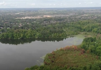
The Etobicoke Creek watershed is approximately 22,404 hectares in size and is the westernmost watershed in Toronto and Region Conservation Authority’s (TRCA) jurisdiction. It is bordered by the Credit River watershed to the west and the Mimico Creek and Humber River watersheds to the east.
Etobicoke Creek Watershed Plan
The Etobicoke Creek Watershed Plan (ECWP) 2024-2034 was approved by TRCA’s Board of Directors on November 22, 2024 following adoption/endorsement by our partner municipalities. Implementation of the watershed plan is now underway.
Explore the Watershed
Explore the quick links and map below to learn more about the Etobicoke Creek watershed:
Cultural Heritage
The origin of the watershed‘s name:
- Adoopekog: Place of the black alder
- Atobi Coake: Black alder creek
- Eobicoke: The place of the alders
All of these Treaties are signed with the Mississaugas of the Credit First Nation (an Anishinaabe First Nation).
Treaties 13 and 14 reserved Etobicoke Creek as a fishery for the Mississaugas of the Credit.
The Mississauga peoples used the land around Etobicoke Creek seasonally and as a salmon fishery before being displaced by settlers. This led to the collapse of the traditional economy.
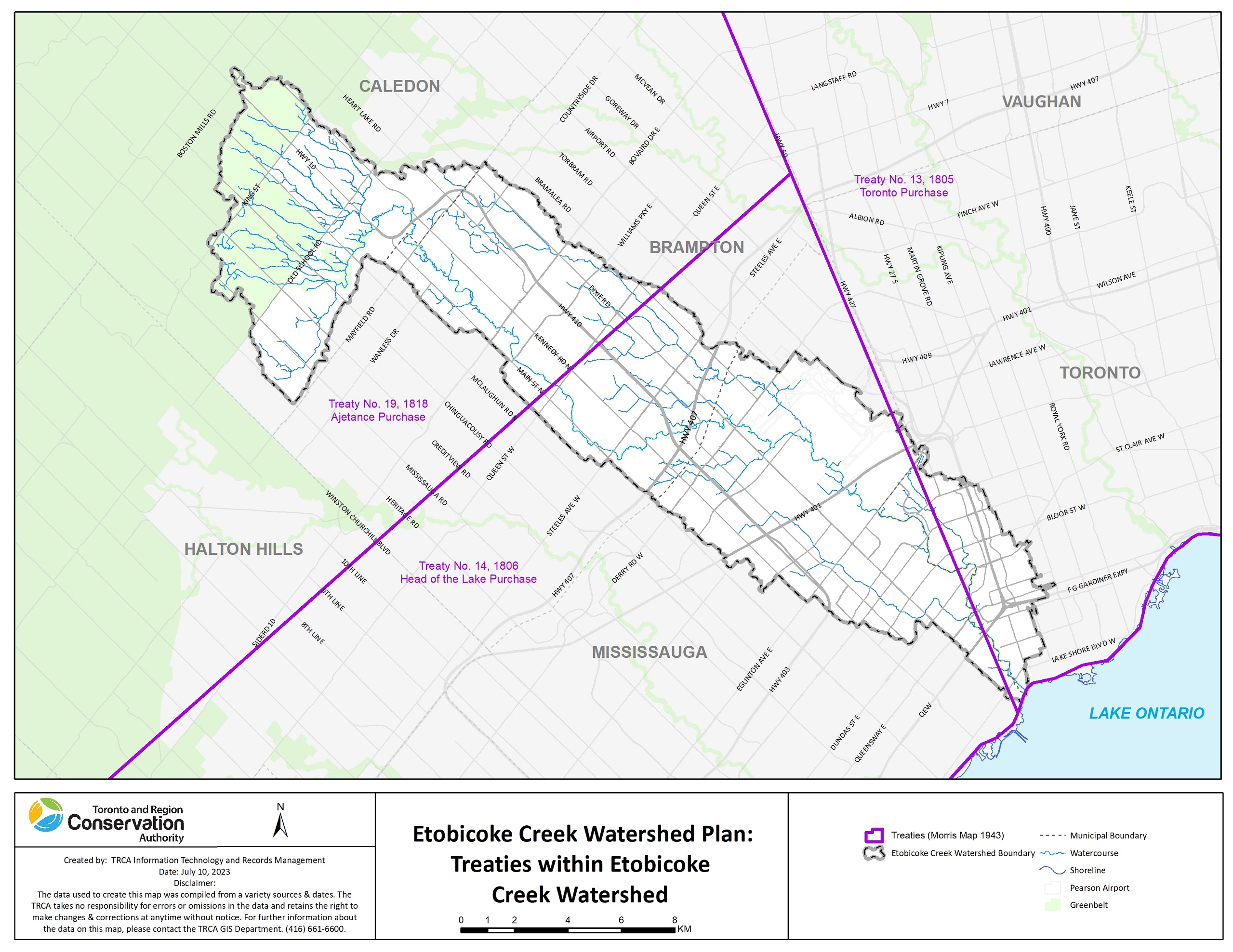
The lands and waters in the watershed are the traditional territory of the Mississaugas of the Credit First Nation, and the traditional territory of the Haudenosaunee (including the Six Nations of the Grand River) and the Huron-Wendat peoples, and are now home to many diverse First Nations, Inuit, and Métis peoples.
Through work with lands and waters, TRCA appreciates and respects the history and diversity of these lands and is grateful to have the opportunity to work and be in relation with this territory. We are also grateful for the continued work of many First Nations and Indigenous peoples, who are the original and current caretakers of these lands and waters. We humbly acknowledge our responsibility to respect First Nations’ rights and Indigenous perspectives, elevate Indigenous voices, and honour our relationship with First Nations and Indigenous peoples.
Land Use & Climate
Urbanization and climate change continue to be major stressors affecting the health and resilience of the Etobicoke Creek watershed.
As of 2019, the watershed was heavily urbanized, with approximately 60% of the area classified as urban land use, an increase from 53.4% in 2002.
The watershed also includes a significant amount of industrial and commercial land uses, including most of Toronto Pearson Airport.
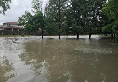
The high degree of urbanization has contributed to challenges such as flooding and erosion, poor water quality, and degraded terrestrial and aquatic habitats.
Urban expansion has also resulted in the loss of both natural and rural cover.
As of 2019, natural areas made up only 12.3% of the watershed, down from 14.1% in 2002. Approximately 28.2% of the watershed area was classified as rural land use (as of 2019), a decrease from 32.5% in 2002.
Due to ongoing growth pressures in Peel Region, further urbanization, especially in the Headwater areas, is anticipated.
Increasing natural areas (including urban forest canopy cover) and implementing stormwater management controls can help to mitigate flooding and erosion risks, improve water quality, and provide additional environmental benefits.
KEY CHARACTERISTICS
- AREA: The watershed covers a drainage area of approximately 22,404 hectares and is heavily urbanized. It includes eight subwatersheds: Headwaters, Little Etobicoke Creek, Lower Etobicoke, Main Branch, Spring Creek, Tributary 3, Tributary 4, and West Branch.
- POPULATION: 379,089 (Census 2024)
- LAND USE: The watershed is about 60% urban, 28% rural, and 12% natural, as of 2019, and it continues to urbanize with losses of both natural cover and rural cover.
- IMPERVIOUS COVER: Except for the Headwaters, the subwatersheds are covered by greater than 50% hard surfaces (such as roads, buildings, and driveways). As of 2019, the Little Etobicoke Creek subwatershed had the highest amount of impervious cover at 68.7%.
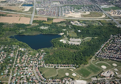
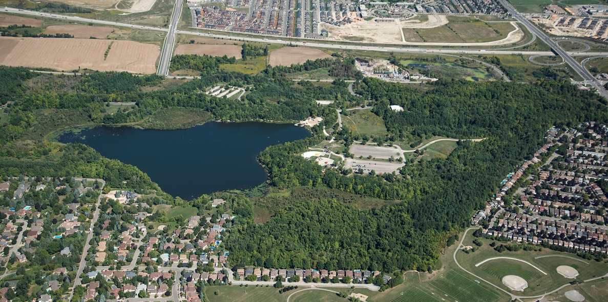
CONSERVATION AREAS AND PARKS
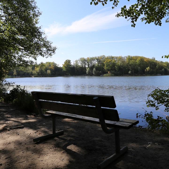
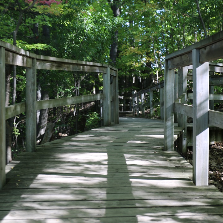
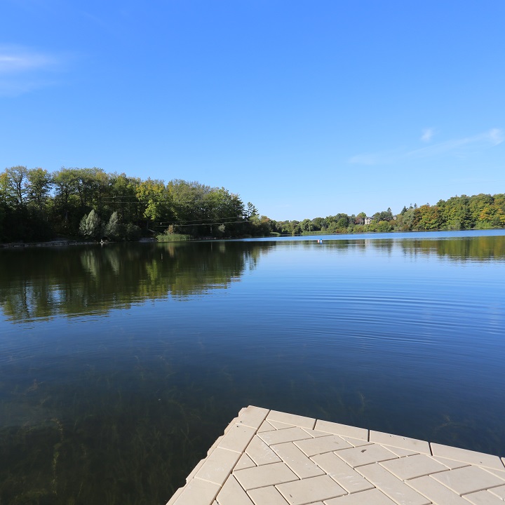
Heart Lake Conservation Park.
CLIMATE
Climate change impacts are being seen and felt locally in TRCA’s jurisdiction. Extreme heat and heavy rains are leading to more heat advisories and flooding, which affect the health and safety of the watershed and its residents.
These impacts will get worse unless we act to reduce the effects of greenhouse gas emissions. We also need to find ways to help our watersheds and communities better handle the effects of climate change.
Climate trends in the Toronto region are based on an analysis of climate parameters for the historical climate period between 1971 to 2000, and include:
- Temperatures are projected to increase across all seasons throughout the year.
- The number of very hot days above 30°C and 35°C are expected to increase.
- Very cold days below -10°C and -20°C are expected to decrease.
- Total annual precipitation is expected to increase.
- More frequent and intense storms are expected to occur.
LEARN HOW TRCA IS TAKING ACTION ON CLIMATE CHANGE.
Natural Hazards
Climate change is expected to increase precipitation, raise annual average temperatures, and heighten the frequency of extreme weather events, all of which can contribute to increased flooding and erosion in Etobicoke Creek.
There are already six Flood Vulnerable Clusters within this watershed (covering 508 hectares). These areas, located in the floodplain, have higher concentrations of roads and structures that are at greater risk of flooding and damage.
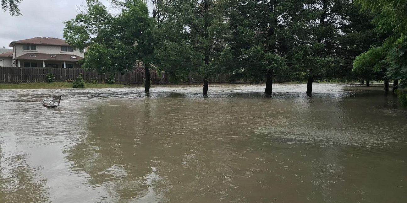
This watershed also faces moderate to high erosion sensitivity, which is likely to escalate with more frequent and intense precipitation events unless significant interventions are made in the watershed.
Moreover, the fragmented and degraded natural cover, both in terms of quality and quantity, further reduces the watershed’s resilience to extreme weather events.
Do you live in an area at risk of riverine flooding?
USE TRCA’s MAP VIEWER TO FIND OUT.
Natural Heritage and Urban Forest
In the Etobicoke Creek watershed, natural cover is limited, and overall habitat quality is generally rated as “poor”.
A few patches of “fair” quality habitat remain in the Headwaters area, supporting some sensitive plant and animal species. The remaining natural areas are highly vulnerable to the effects of climate change.
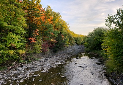
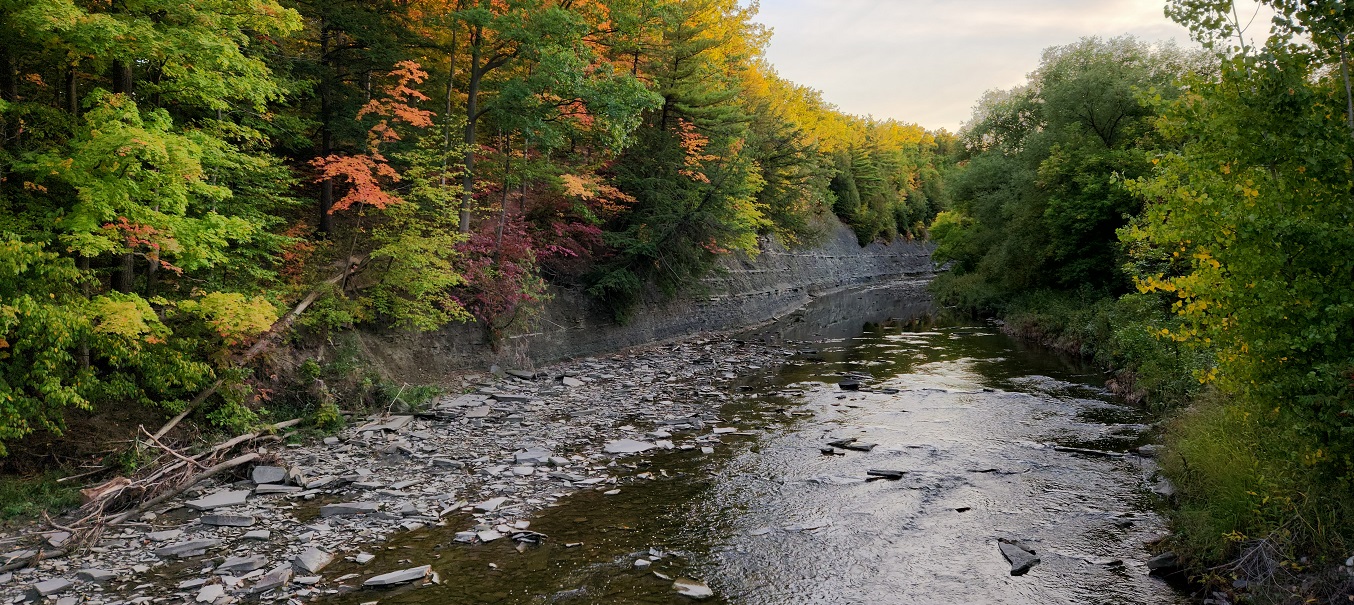
Most of the natural cover in the Etobicoke Creek watershed is found within river valleys or stream corridors.
While habitat may not be continuous in some places, these habitat patches create a “stepping stone” effect, allowing species to move north and south.
These valley corridors are crucial for facilitating the movement of both resident and migrant species.
Even with optimal enhancements to natural cover, the watershed remains below recommended federal guidelines for natural cover quantity, as well as TRCA’s terrestrial Natural Heritage System target.
However, any increase in natural cover would benefit biodiversity and enhance ecosystem services.
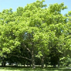
With very limited natural cover, urban forests are extremely important for supporting healthy natural heritage in this watershed.
There are opportunities to improve both the quantity and quality of the urban forest. Enhancing urban forests can provide valuable ecosystem goods and services, improve climate resilience, and offer socio-economic benefits.
View TRCA’s Urban Forest, Natural Cover, and Forest Cover StoryMap to learn more.
A healthy natural heritage system that can resist harmful changes and recover from damage is important for the health and safety of ecosystems and people.
It helps to reduce the impacts of changing land use and climate, supports different types of plants and animals, and offers many services to people, such as better protection from floods and erosion, clean drinking water and air, and more opportunities for recreation.
KEY CHARACTERISTICS
- NATURAL COVER: Currently, only about 12% of the watershed consists of natural cover, well below the recommended minimum federal target of 30% for long-term sustainability and resilience.
- URBAN FORESTS: Urban forest canopy cover, which includes trees and tall shrubs, is approximately 15% and remained stable between 2009 and 2018. The average condition of the urban forest is rated at 80% (good), with 20% of trees classified as being in poor or critical condition, dying, or dead.
- BIODIVERSITY: Based on limited inventory surveys conducted between 2010 and 2019, 139 animal species have been identified in the watershed (likely an underestimation of the actual number of species). This indicates that the watershed has the capacity to support a variety of species, though sensitive species are primarily found outside of the urban areas. Enhancing habitat quantity, quality, and connectivity would help support these species across the watershed.
Some sensitive species present in the Etobicoke Creek watershed include:
- American Eel (Anguilla rostrata): Endangered in Ontario (found only at the mouth of Etobicoke Creek)
- Bobolink (Dolichonyx oryzivorus): Endangered in Ontario
- Butternut (Juglans cinerea): Threatened in Ontario
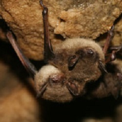
- Little Brown Myotis (Myotis lucifugus): Endangered in Ontario
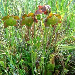
- Pitcher-plant (Sarracenia purpurea): Species of regional concern
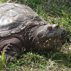
- Snapping Turtle (Chelydra serpentina): Special concern in Ontario


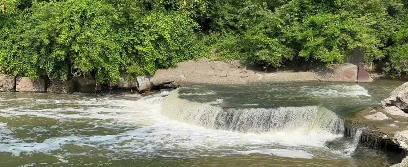
Water Resources
A healthy Water Resource System is essential for keeping watersheds safe and resilient. It provides vital services to communities, such as storing water to reduce flooding, naturally filtering water to maintain its quality, and supporting habitats for wildlife, like fish, that also contribute to recreational opportunities.
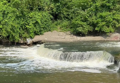
In the Etobicoke Creek watershed, aquatic habitat conditions are currently poor.
The area experiences high levels of runoff, and fish movement is impacted by numerous in-stream barriers; both of these factors have a negative impact on aquatic ecosystem health.
Without action to improve natural cover, expand urban forests, enhance stormwater management, and implement low impact development (LID) measures, groundwater discharge and recharge in the Headwaters area will likely continue to decline, further affecting the health of the entire watershed.
Enhancing natural cover can help improve conditions by increasing the number of coolwater, coldwater, and stable-temperature stream reaches.
These improvements would strengthen the watershed’s resilience to the effects of climate change.
KEY CHARACTERISTICS
- SOURCE WATER: The watershed originates within the Greenbelt in the Town of Caledon, flowing south through the City of Brampton and the City of Mississauga before ultimately entering Lake Ontario in the City of Toronto.
- FEATURES & AREAS: The Etobicoke Creek watershed contains approximately 451 km of rivers, streams, and headwater drainage features. It also includes 85 hectares of inland lakes, 509 hectares of wetlands, and significant groundwater areas such as Ecologically Significant Groundwater Recharge Areas (2,823 ha) and Highly Vulnerable Aquifers (6,008 ha).
- BIODIVERSITY: The watershed is home to 40 known fish species. The average habitat rating for fish communities in the watershed is “fair”, while benthic invertebrate communities are rated as “poor”. There has been little to no change in aquatic habitat quality since 2002. The watershed continues to see increases in impervious cover with few areas capable of providing good quality aquatic habitat. As urbanization increases, more sensitive fish species are likely to be replaced by disturbance-tolerant species, and benthic communities are expected to shift toward more pollution-tolerant species.
- ISSUES OF CONCERN:
- Impervious Surfaces: The large amount of impervious surface in the watershed (approximately 60%) disrupts the natural flow of water and alters both water temperature and quality. These changes degrade aquatic habitats and negatively affect aquatic species and ecosystems. To reduce these impacts, it is recommended that effective impervious cover be kept below 25%.
- Runoff: As a result of the extensive impervious cover, Etobicoke Creek experiences the second-highest annual runoff (402 mm/year), second only to the Don River.
- In-Stream Barriers and Riparian Health: Many in-stream barriers block the movement of aquatic species, disrupting natural habitat connectivity. In addition, only about 50% of the riparian corridor (defined as the 30-metre zone alongside streams) is currently covered by natural vegetation, further reducing habitat quality and ecological function.
Water Quality
Clean water is essential for the health and safety of a watershed, its residents, and ecosystems.
It is vital not only for drinking, household use, and recreational activities like swimming and fishing, but also for economic activities such as agriculture and manufacturing.
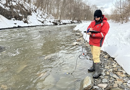
TRCA’s Regional Watershed Monitoring Program currently monitors water quality monthly at eight stations within the Etobicoke Creek watershed, two of which are monitored in partnership with the Provincial Water Quality Monitoring Network administered by the Ministry of the Environment, Conservation and Parks.
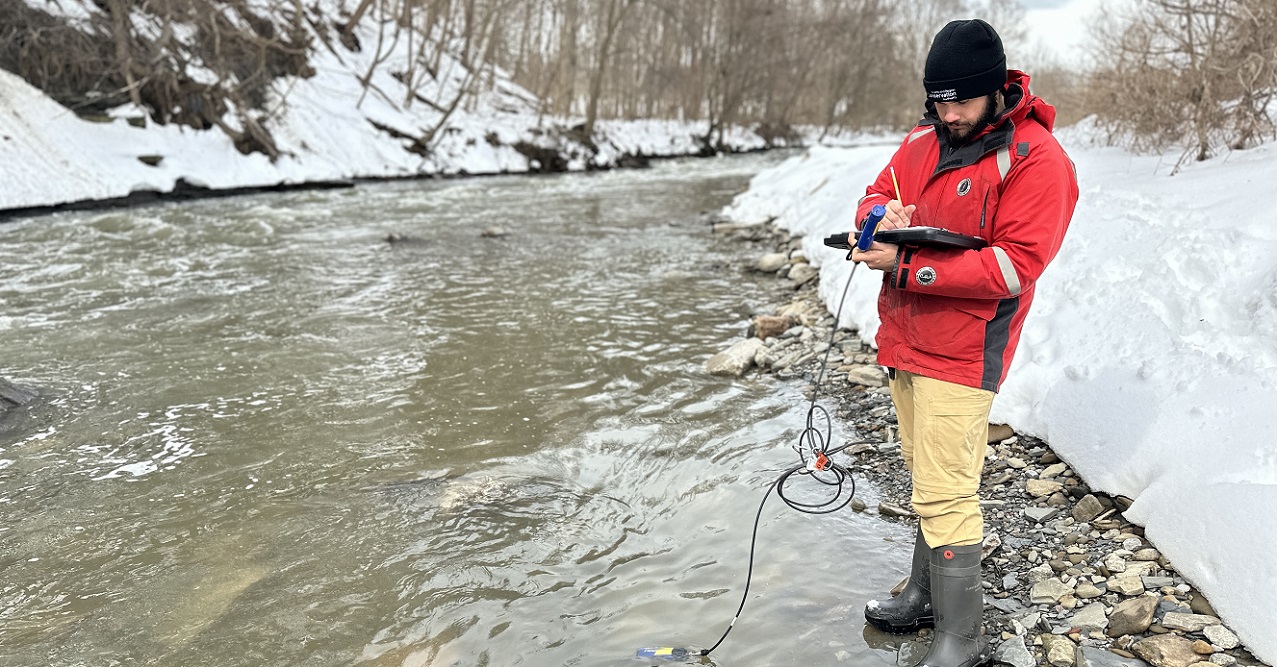
Data from all eight stations for the years 2015 to 2019 were used to determine current conditions and found that water quality in the Etobicoke Creek watershed is generally poor compared to other TRCA watersheds, especially for chlorides, phosphorus, metals, and E.coli bacteria.
In addition to exceedances of chlorides and nitrates in the groundwater, chemicals of emerging concern, microplastics, and spills further compromise water quality in the watershed.
By monitoring water quality over time and in different areas, we can identify issues and their causes and find ways to fix them.
KEY CHARACTERISTICS
- CHLORIDES (e.g., from road salt):
- Chloride concentrations exceeded water quality objectives for the protection of aquatic life from chronic effects (e.g., decreased reproductive output) at all water quality stations.
- The highest concentrations are in the Tributary 3 and Little Etobicoke Creek subwatersheds.
- On February 17, 2016, Tributary 3 recorded the highest chloride concentration of 6,470 mg/L of all samples reviewed, which is equivalent to about 32% of the average chloride concentration in seawater.
- PHOSPHORUS (e.g., from fertilizers, animal wastes, and sanitary sewage):
- Phosphorus levels are still a concern in many parts of the watershed.
- Lower Etobicoke and Tributary 4 had the highest concentrations of phosphorus.
- METALS (e.g., from natural and industrial sources and roadways):
- Levels of metals like copper and zinc are increasing.
- High amounts of metals are present in the Lower Etobicoke, Main Branch, and Tributary 3 subwatersheds.
- E. coli BACTERIA (e.g., from sewage and animal waste):
- E. coli continues to be a concern throughout the watershed but is particularly problematic in the Tributary 4 and Little Etobicoke Creek subwatersheds.
- A 2018 research project tracked the sources of fecal contamination at several sites along Etobicoke Creek between Highway 407 and Marie Curtis Park (i.e. the mouth of Etobicoke Creek) following a record-setting, extreme rain event (126 mm over 24 hours) and over the two days prior to the event. Overall, results suggested that stormwater outfalls may be a major source of E. coli in Etobicoke Creek.
- CHEMICALS OF EMERGING CONCERN (e.g., industrial chemicals, household chemicals, fragrances, pharmaceuticals, and personal care products):
- A 2019 study found that polycyclic musks (PCMs) from personal care products were present in Etobicoke Creek at levels similar to Mimico Creek and the lower Humber River, with higher concentrations at urban sites. Sources included stormwater, sewer cross connections, and wastewater discharges. This emphasizes the need for better source management to protect aquatic life.
- MICROPLASTICS (i.e., plastic particles less than 5 mm long):
- Etobicoke Creek has the highest number of microplastic particles per kg of dry sediment of all tributaries (i.e. streams and rivers) along the Canadian shoreline of Lake Ontario. Microplastics slowly degrade, releasing toxic chemicals and impacting wildlife.
- SPILLS:
- Between 2003 and 2005, 247 spills occurred in the Etobicoke Creek watershed. Of these spills, most were to land, followed by water and air, and were primarily caused by equipment failure.
- Between 1988 and 2000, most spills within the Etobicoke Creek watershed occurred in the industrial areas of Brampton and Mississauga, and at Pearson International Airport.
Resources
Watershed Report Cards
Etobicoke Creek Watershed Plans
Management Plans
Supporting Documents
- Heart Lake Road Ecology and Turtle Population Study (May to October, 2018)
- Wildlife Road Ecology Citizen Science Monitoring Study (2017)
- Road Ecology Citizen Science Project (2016)
- Heart Lake Road Ecology Wildlife Passage, Directional Fencing and Monitoring (April to October, 2016)
- Heart Lake Road Ecology and Turtle Population Study (April to October, 2015)
- Heart Lake Road Ecology Volunteer Monitoring Project -Turtle Population Study (August 4-8, 2014)
- Heart Lake Road Ecology Volunteer Monitoring Project (2013)
- Heart Lake Road Ecology Volunteer Monitoring Project (2012)
- Heart Lake Conservation Area Master Plan (2006)
- State of the Environment Report: Etobicoke and Mimico Creeks (December 1998)
Learn More


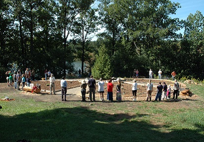
Get Involved
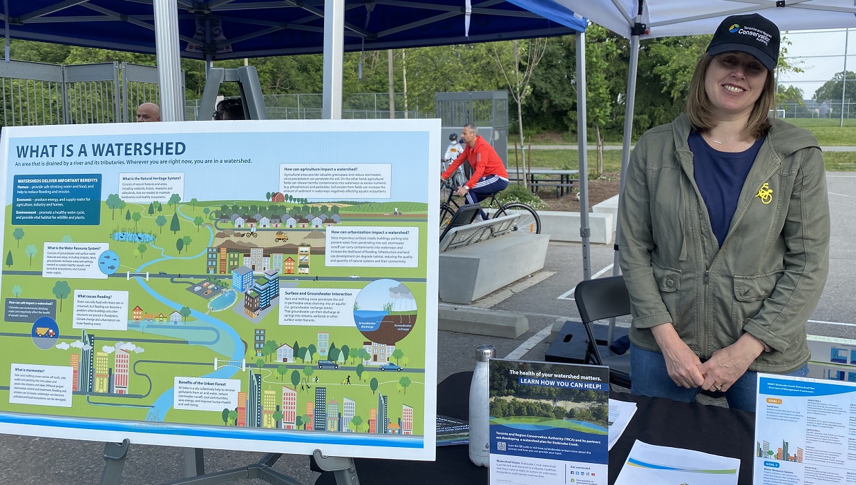
Join TRCA for our annual Bike the Creek event, or report your Salmon sightings along the Etobicoke Creek using our interactive Story Map!
You can also check out:
Don’t forget to check out the TRCA calendar to learn about events near you, such as public plantings, educational presentations, nature walks, and more!
Visit TRCA’s Get Involved webpage to find something that interests you!
Contact
Questions about the Etobicoke Creek watershed? Contact etobicoke@trca.ca.