Climate change has increased the likelihood of more severe and frequent storms, which in turn raises the risk of flooding. Toronto and Region Conservation Authority (TRCA) Flood Risk Management plays a key role in providing municipalities with the information they need to respond to flooding.

What Is a Flood?
A flood is an overflow or inundation that comes from a river or other body of water and causes or threatens damage. Within a riverine system floods are a natural process that occurs as the result of relatively high flow of water overtopping the channel within a valley system.
What Causes Flooding?
Most flooding occurs when the volume of water in a river or stream exceeds the capacity of the channel. Flooding also takes place along lake and coastal shorelines, when higher than normal water levels inundate low-lying areas.
When rain falls, or when snow melts, the water either infiltrates the soil or becomes surface flow (also known as runoff). Surface flow rapidly travels overland and through storm sewers, reaching watercourses and causing water levels within the rivers to rise quickly.
There are many processes within the natural water cycle, such as evaporation and groundwater flow. However, flooding generally is caused by precipitation, surface runoff and infiltration amounts. These transactions are highly dependent on land use cover, surface elevation, and human-made water systems.
Flood Risk Factors in the Greater Toronto Area
Factors that contribute to flooding within TRCA’s jurisdiction include the amount of surface runoff, the characteristics of the watershed (percentage of impervious surface, soil type, slope, etc), and historic land use practices.
Due to the urbanized nature of the GTA, the majority of rainfall becomes surface runoff. Runoff is conveyed quickly to the receiving watercourse through a number of drainage systems, causing water levels in streams and rivers to rise quickly. Watersheds with these characteristics are called “flashy”.
Did you know there are several types of flooding? LEARN MORE.
Flooding in the GTA: A Look Back
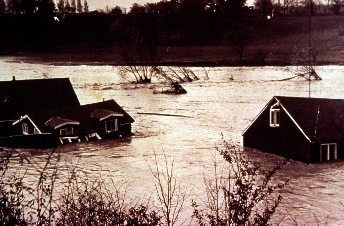

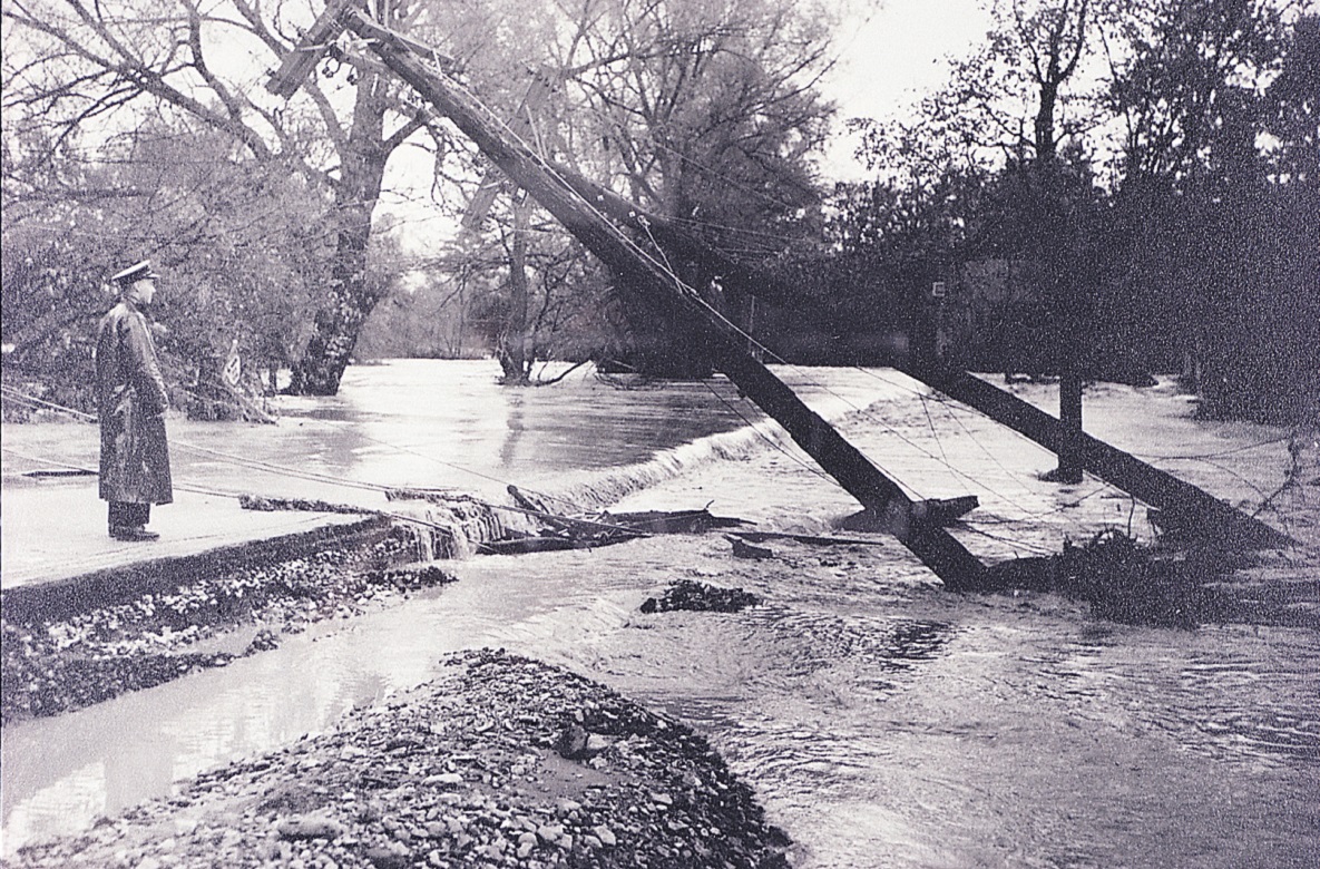
As the Greater Toronto Area has expanded and urbanized, the need to prevent and mitigate flood damage has steadily grown. It was the catastrophic impact of Hurricane Hazel in 1954 that led to the expansion of TRCA’s responsibilities to include flood control.
Our story map Toronto – A City of Rivers examines the profound and lasting impact of Hurricane Hazel.
Select the image below to open the story map in a new tab.

Flood Risk Through the Seasons
Flooding can happen at any time of year. It’s important to know the risks present during each season.
| WINTER – Ice Jams: When temperatures and/or water levels rise, river ice breaks into pieces. These pieces of ice can become jammed at bridges or other obstructions. Rivers can become backed up and can overflow their banks. LEARN MORE. | |
| SPRING – Spring Thaw: Accumulation of snow during the winter season can lead to flooding during the early spring if conditions are right. When temperatures rise, snow melts and turns to runoff. LEARN MORE. | |
| SUMMER – Thunderstorms: Thunderstorms can bring large amounts of rain in a short period of time. These intense, localized downpours can lead to flash flooding. LEARN MORE. | |
| FALL – Seasonal Weather Systems: Large wet weather systems, including tropical storms such as hurricane remnants (like Hurricane Hazel), can last for several days. This prolonged and heavy precipitation, on top of already saturated soils, can cause rivers to rise. LEARN MORE. |
LEARN MORE ABOUT SEASONAL FLOODING

Lake Ontario Water Levels:
Flood Risks and Impacts
Lake Ontario water levels seasonally rise in the spring and early summer. Great Lakes water levels also fluctuate between multi-year periods of higher and lower water levels according to natural processes.
Elevated levels can cause flooding, and the combination of high water levels and wave action also leads to shoreline erosion. Shoreline erosion occurs when the movement of water removes natural or man-made materials along the shoreline.
The greatest risk of shoreline flooding and erosion occurs when elevated water levels are coupled with wave action from high winds. Impacts can include shortened beaches, inundation of low-lying areas adjacent to the lake, and erosion to trails.

Lake Ontario water levels depend primarily on three factors:
- Inflows from Lake Erie, which are unregulated and account for approximately 85% of inflows into Lake Ontario
- The seasonal runoff from watersheds, like those in TRCA’s jurisdiction, that drain directly into Lake Ontario
- The outflow from Lake Ontario, which is regulated at the Moses-Saunders Dam by the International Lake Ontario St. Lawrence River Board (ILOSRB) of the International Joint Commission (IJC)
TRCA and its municipal partners work together proactively on projects and restoration works along shoreline areas in preparation for elevated Lake Ontario water levels.
These projects include flood and erosion hazard mitigation work to protect public safety and municipal infrastructure from these hazards.

Flooding in Ontario: Roles and Responsibilities
The responsibility for dealing with flood contingency planning in Ontario is shared by municipalities, Conservation Authorities (CAs), and the Ministry of Natural Resources on behalf of the Province.
Upper and Lower Tier Municipalities
They have the authority to respond not only to flooding and flood emergencies, but to all types of emergencies under the Emergency Management and Civil Protection Act.
Province of Ontario
In addition, Emergency Management Ontario is responsible for the effective emergency management programs throughout Ontario and for coordination with federal government.
Conservation Authorities
- Operate a flood forecasting and warning system
- Issue flood messages to municipalities, the public, and media
- Operate CA owned dams
- Provide advice to municipal partners and stakeholders
- Maintain communication/liaison with municipal and other partner agencies
Individuals
More Flooding Resources
Development and Planning: Real Estate
Consult with TRCA Planning and Permits to find out if a property is affected by TRCA regulations.
QUICK LINKS


