Welcome to our photo blog series featuring the work of talented media intern Maxine Bisera, who spent six weeks capturing the work of Toronto and Region Conservation Authority’s (TRCA) environmental monitoring, applied research, and watershed planning and reporting teams.
Maxine documented our teams in action, creating stunning photos and videos that showcase the hands-on work that goes into conservation. Thank you to Maxine for her visual storytelling talents in bringing our mission to life!
Week One
During my first week with TRCA, I joined the Watershed Planning and Reporting team on a tour of the Humber River watershed.
We visited a number of locations in Toronto and Brampton, ranging from urban to more rural and natural areas, including the mouth of the Humber River, Home Smith Park, the Claireville Dam, and Claireville Conservation Area.
Visiting these sites was a reminder of the rich ecosystems that exist right in our backyard, and how important it is to plan for future watershed conditions as the landscape changes.
TRCA is currently developing a new watershed plan for the Humber River in collaboration with Mississaugas of the Credit First Nation and our partner municipalities. The watershed plan will identify priority actions to improve watershed health and build resilience to climate change.
Learn more about TRCA’s watershed plans.
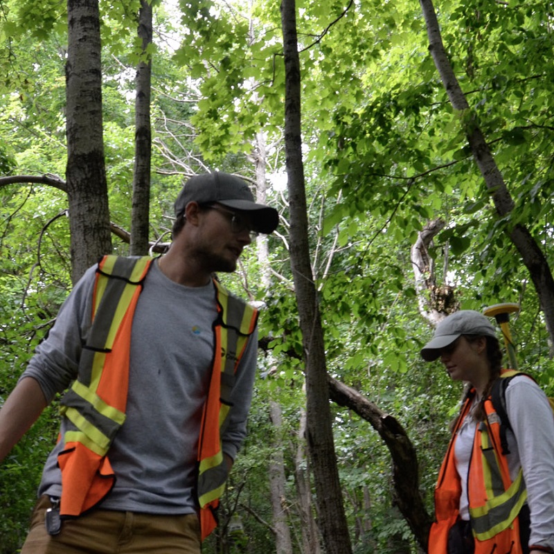
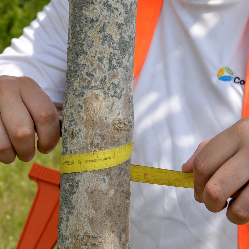
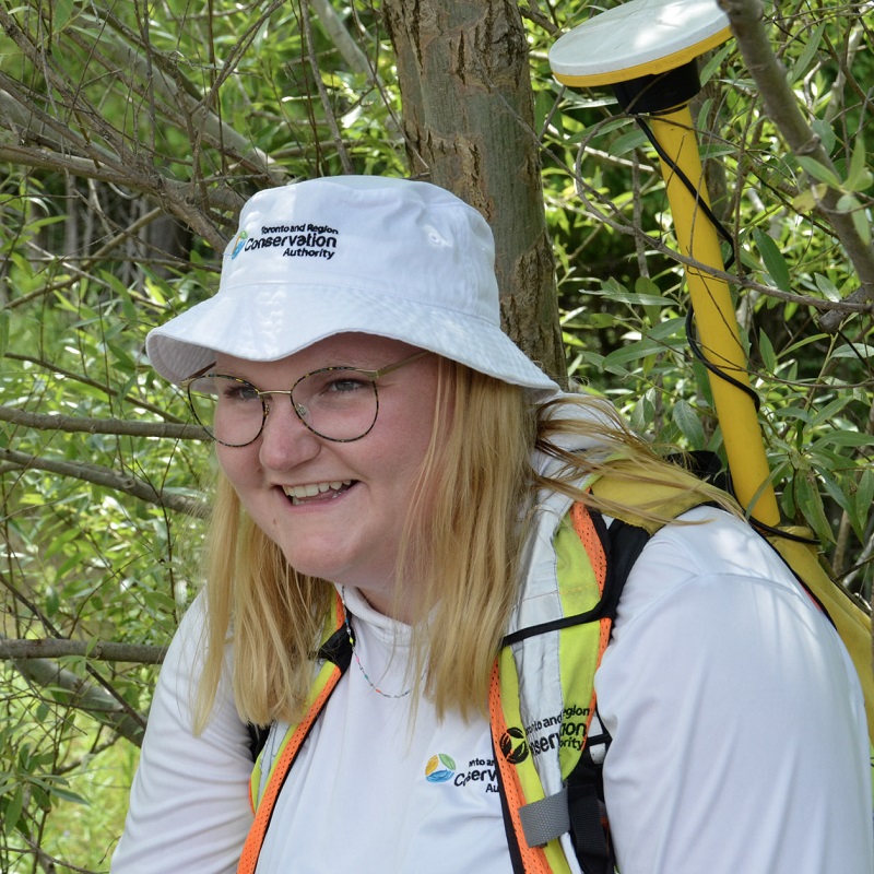
The next day, I joined the Urban Forestry field team in Bolton as they carried out a natural green infrastructure inventory.
This team collects data on tree species, size, and health across Peel Region, specifically along roads and on regionally owned and managed properties.
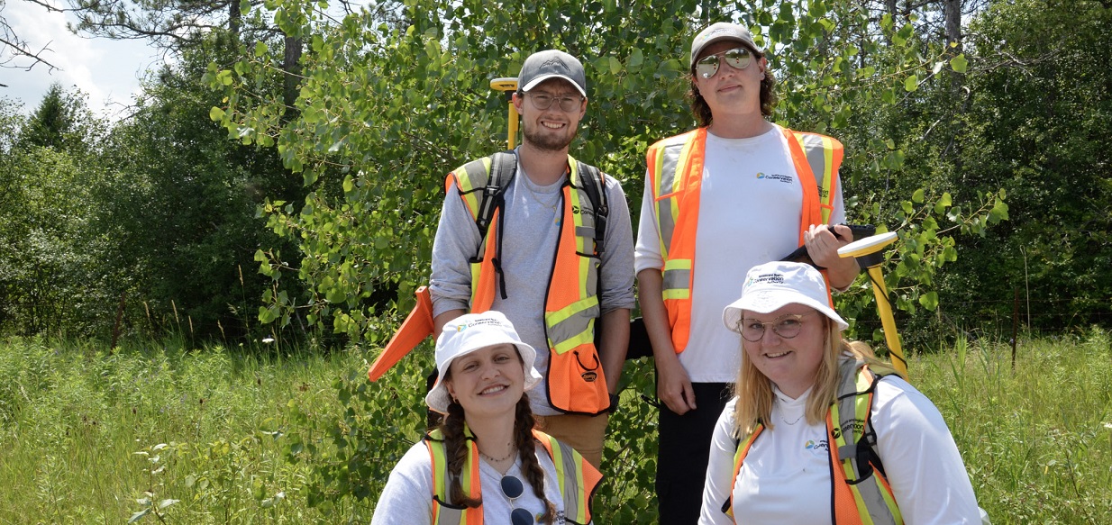
Despite the hot and humid conditions, the team worked efficiently and enthusiastically. Their efforts will support Peel Region’s natural asset management planning and urban forest health and maintenance objectives.
Learn more about TRCA’s applied research focused on green infrastructure.
Week Two
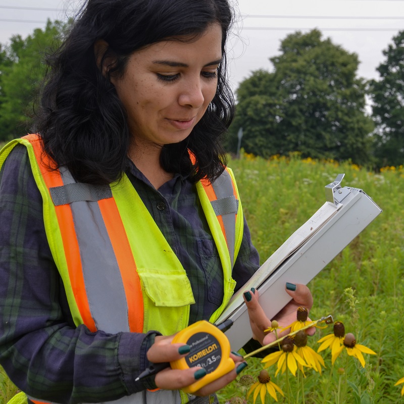
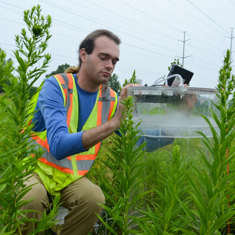
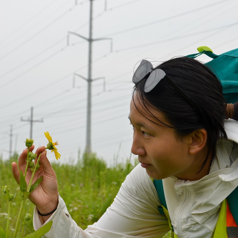
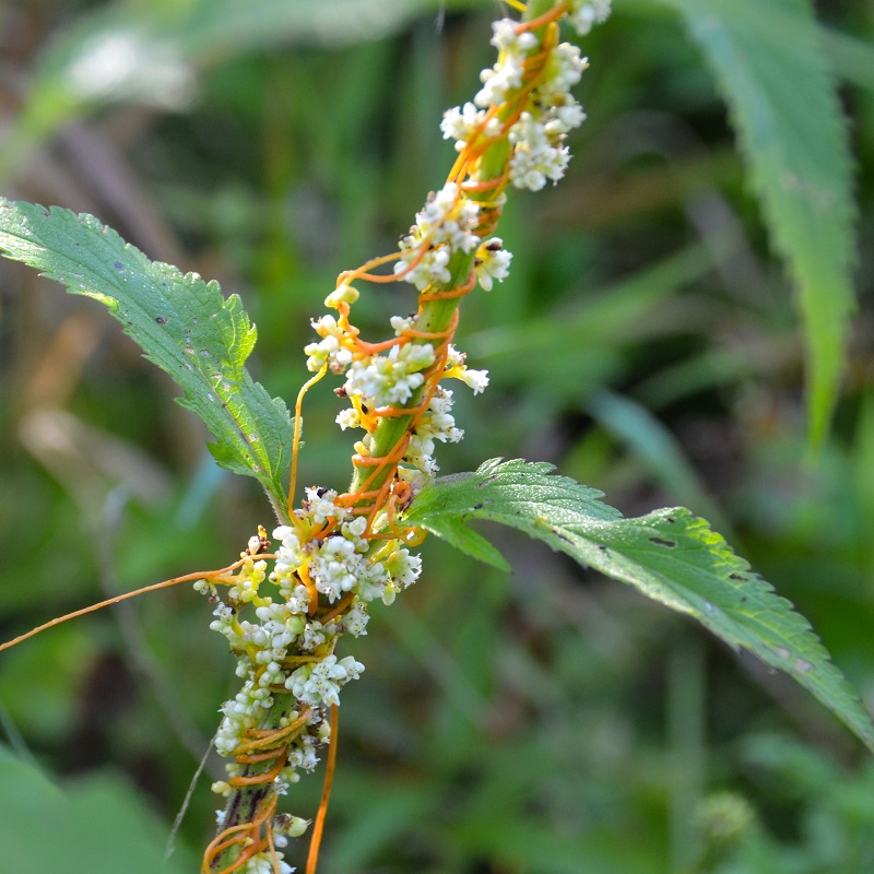
During my second week I joined field staff for various terrestrial monitoring activities, including surveys of vegetation, bats, and butterflies!
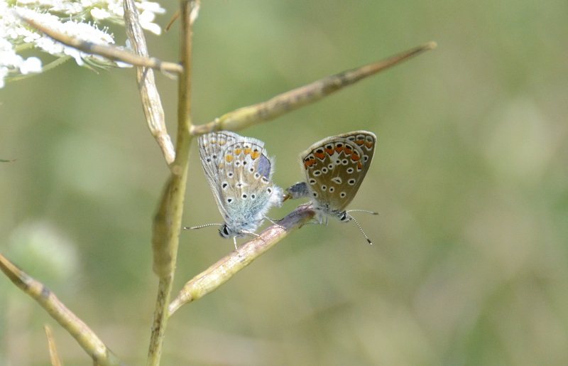
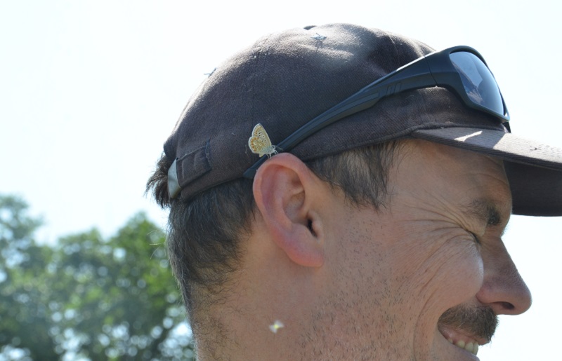
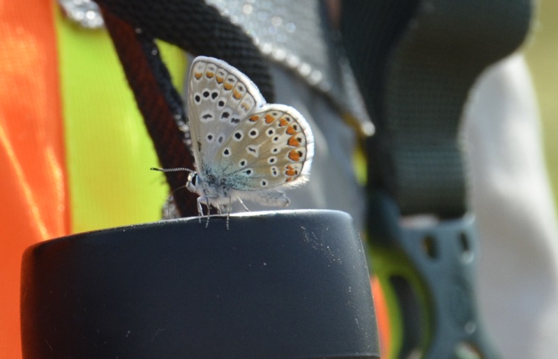
One day, I joined biologist Dell at a restoration meadow in Richmond Hill for butterfly monitoring.
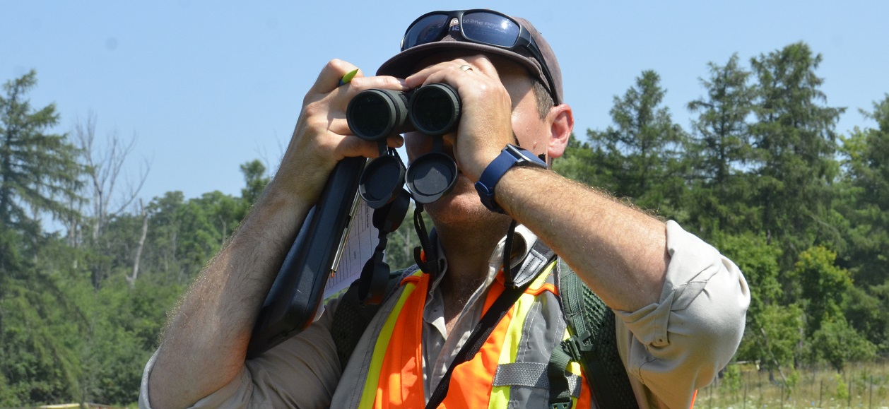
Biologists survey this site to identify species and estimate their numbers to determine the effect of the meadow restoration on local butterflies.
The most abundant species by far was the European Common Blue (pictured below), a recent introduction to the region from Europe that has quickly spread across the GTA.
Butterfly species have different flight periods throughout the summer, so Dell will repeat the survey after a month to record species that fly in late summer.
Learn more about TRCA’s biological inventories and assessments.
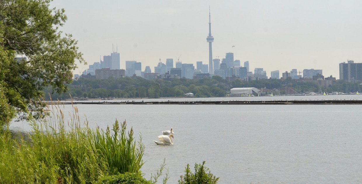
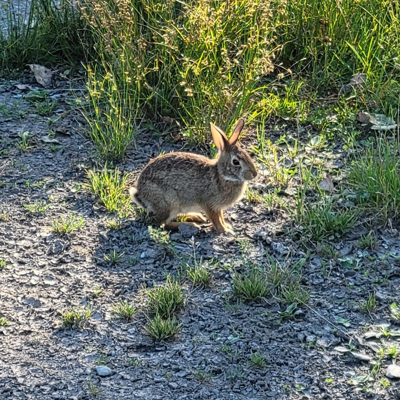
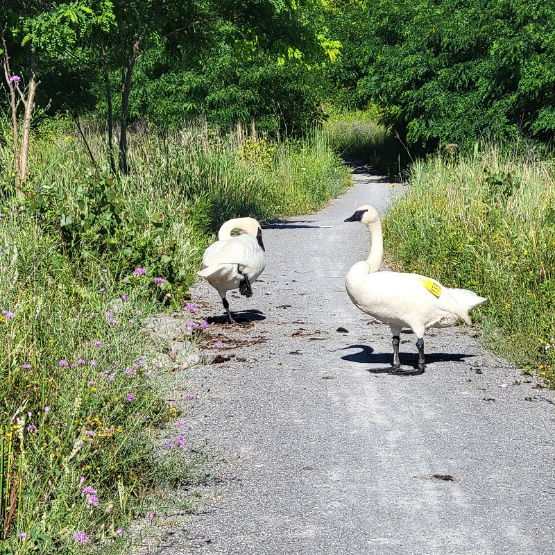
I wrapped up my week at Tommy Thompson Park, a man-made peninsula that extends into Lake Ontario.
Managed by TRCA, the park is home to diverse wildlife and features winding trails and roads for hikers and cyclists.
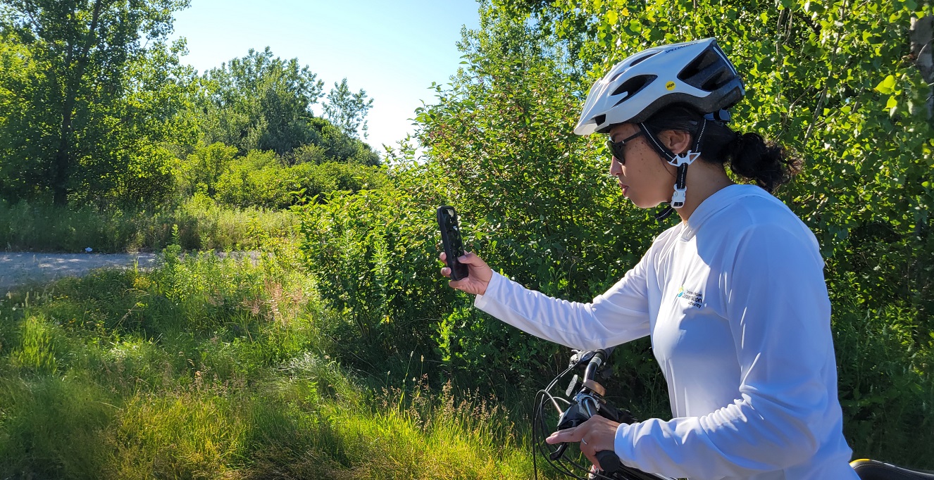
To better understand wildlife conflicts with road and trail infrastructure, researchers like Sonia conduct road ecology surveys to observe the impact of these structures on local wildlife.
As Sonia and I biked down the peninsula, we spotted minks, swans, and rabbits, all while enjoying views of the Toronto skyline.
Learn more about TRCA’s wildlife and habitat connectivity research.
Week Three
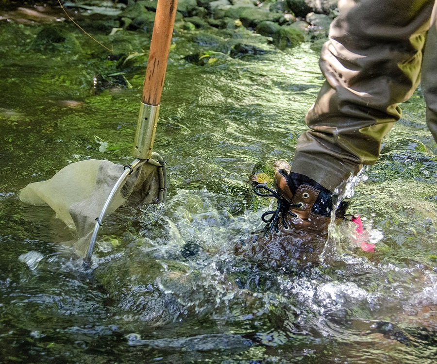
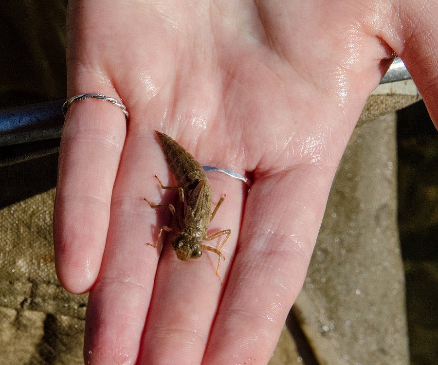
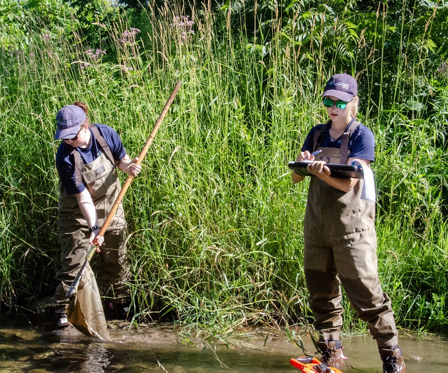
This week, I shadowed the Aquatic Monitoring and Management team, joining them in a wide variety of fieldwork activities.
One of these was benthic sampling at sites along the Rouge and Duffins Creek watersheds.
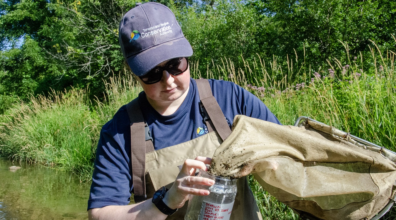
Field staff kick up sediment across the stream, dislodging and collecting hundreds of tiny aquatic insects hiding between the rocks.
Larger specimens, like crayfish, are recorded and then released back into the stream, while the rest of the samples are brought to TRCA’s lab for further analysis.
Studying aquatic life, no matter how small, helps us assess the overall health of our streams.
Learn more about TRCA’s benthic macroinvertebrate monitoring program.
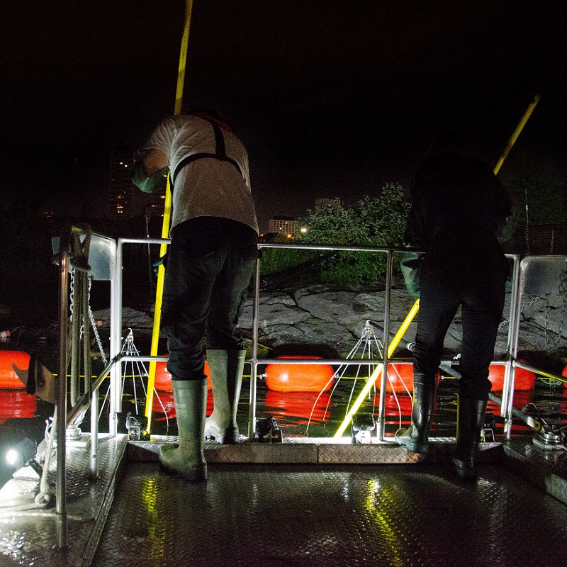
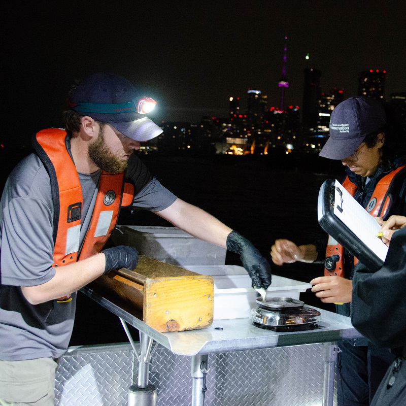
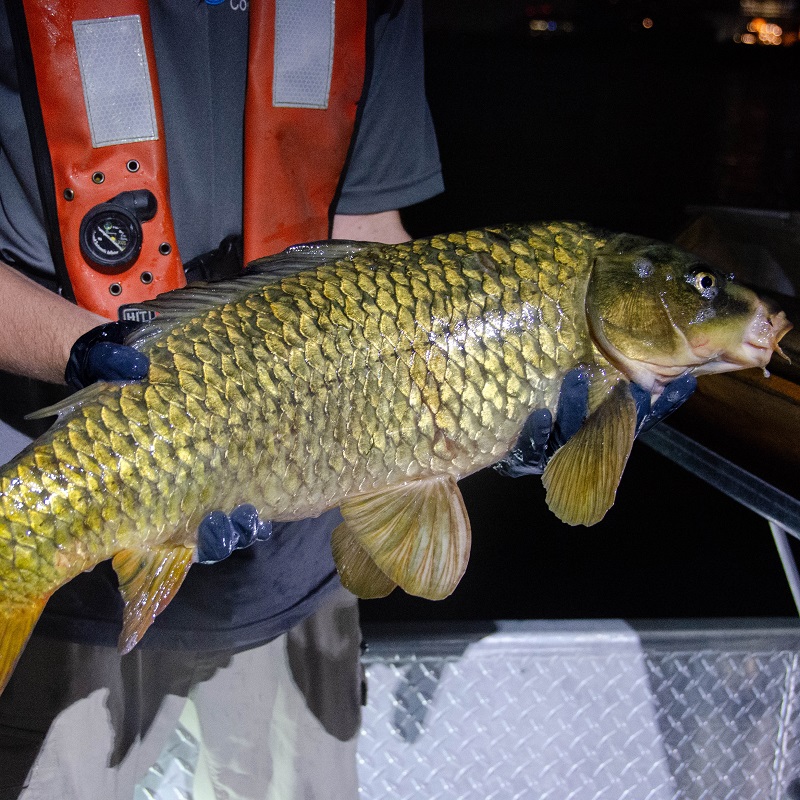
The next day, I joined the waterfront team for a nighttime electrofishing survey.
The electrofishing boat produces a local electrical field that temporarily stuns nearby fish, so they can be caught, recorded, and safely released back into the lake
That night, our focus was the newly revitalized Don River Mouth, where electrofishing surveys were conducted at night for the first time.
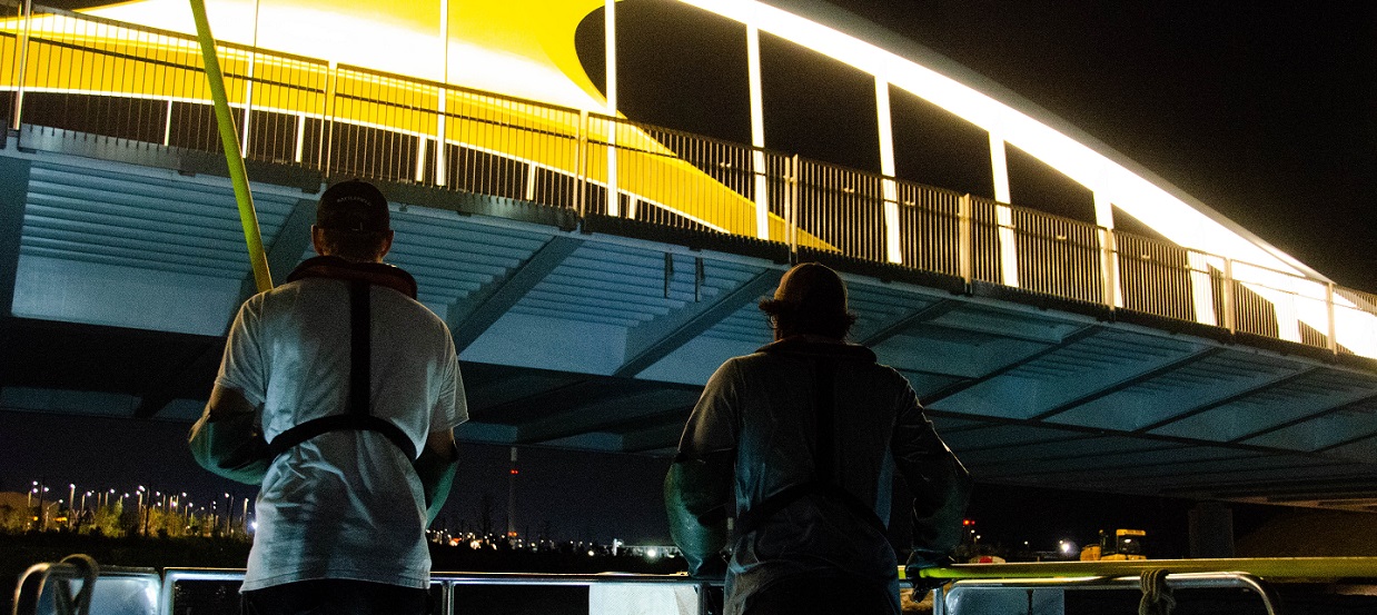
Despite the rain, the crew stayed energized and enthusiastic with each fishing run. While the rest of the city slept, we worked late into the night to monitor fish communities along the waterfront.
Learn more about TRCA’s fish and aquatic habitat surveys.
Week Four
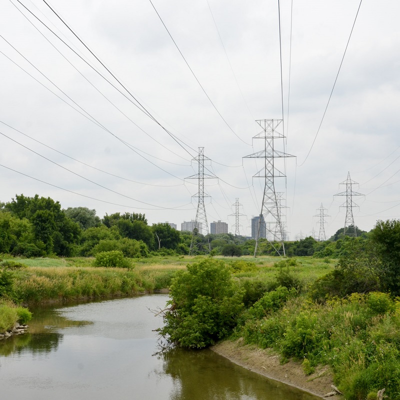
This week, I had the opportunity to meet researchers from the University of Waterloo and Trent University who are conducting studies at The Meadoway, an infrastructure project led by TRCA and its partners to transform a hydro corridor in Scarborough into 16 km of urban meadow.
Their research includes identifying effective methods to combat invasive species, studying the dynamics of butterfly and meadow plant communities, and examining carbon sequestration potential. These studies not only support the restoration of The Meadoway but also offer valuable insights for future meadow restoration efforts.
It was inspiring to learn about the innovative work shaping the future of urban ecology and the pivotal role TRCA plays in supporting this research.
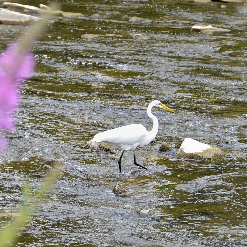
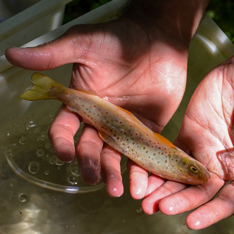
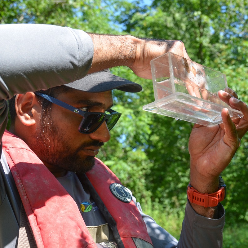
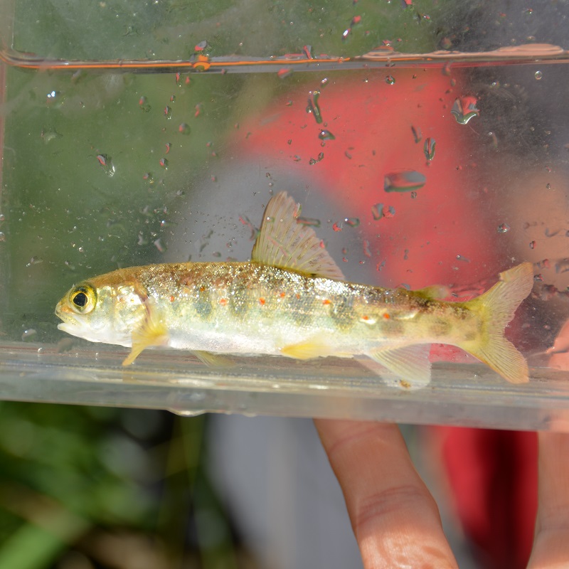
I wrapped up the week with a stream electrofishing survey within the Duffins Creek watershed.
This team carried a backpack electrofisher to temporarily stun fish inhabiting the shallow streams.
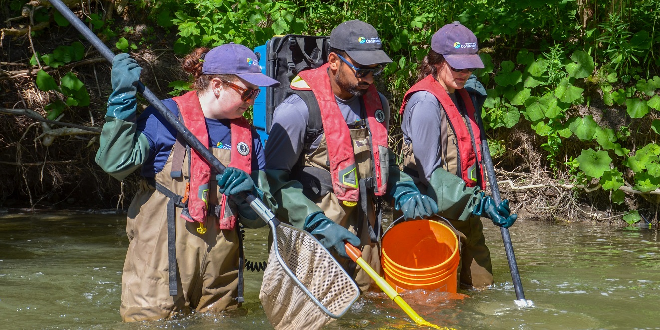
The day’s survey was rewarding, resulting in the observation of many juvenile Rainbow Trout and Atlantic Salmon. After recording species that were found, all fish were safely returned to the stream to continue maturing.
Learn more about TRCA’s fish and aquatic habitat surveys.
Week Five
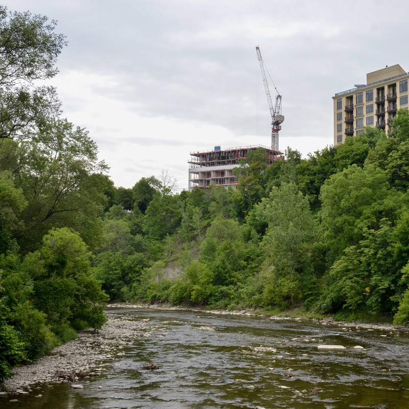
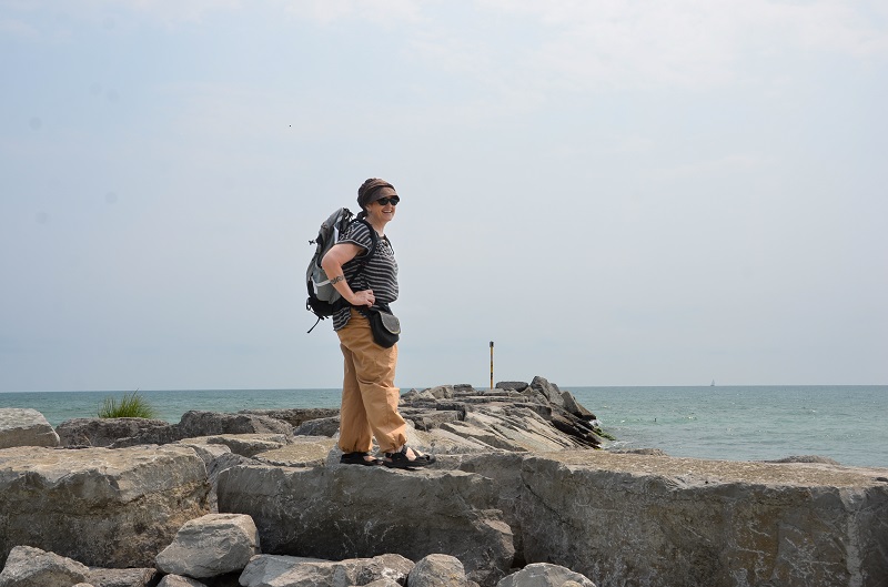
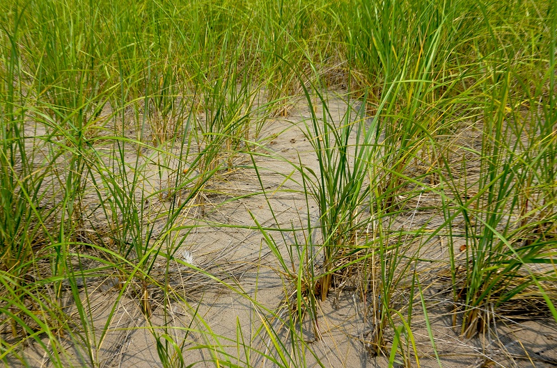
This week, I met Jenny, a research scientist studying shoreline strategies to combat erosion along the shoreline of Western Lake Ontario.
We spent the day inspecting natural dune regeneration at Woodbine Beach, flood prevention measures at the newly revitalized Don River, and a TRCA-led project at Gibraltar Point to restore sand dunes and protect the island’s beaches.
Although we explored less than 10 km of Western Lake Ontario, we learned so much about the diverse and innovative approaches used to safeguard our shoreline.
Learn more about the TRCA’s Land to Lake Initiative and the other types of projects supported by this new initiative.
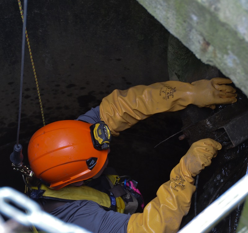
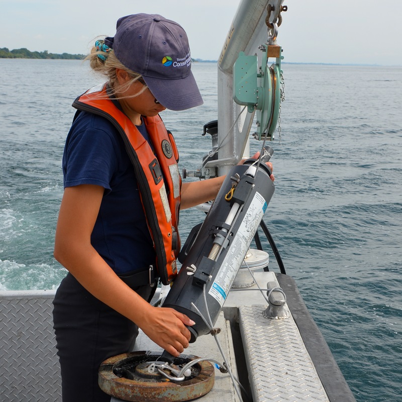
Later in the week, I joined the Real-Time Monitoring team as they performed maintenance on equipment used for stormwater monitoring.
TRCA maintains a network of real-time sensors across the GTA to measure water quality and quantity.
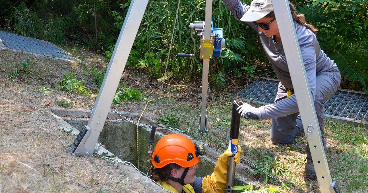
We visited two monitoring sites at Earl Bales Park in Toronto, where the crew safely accessed underground stormwater infrastructure to service the equipment.
Learn more about TRCA’s surface water quality monitoring.

Week Six
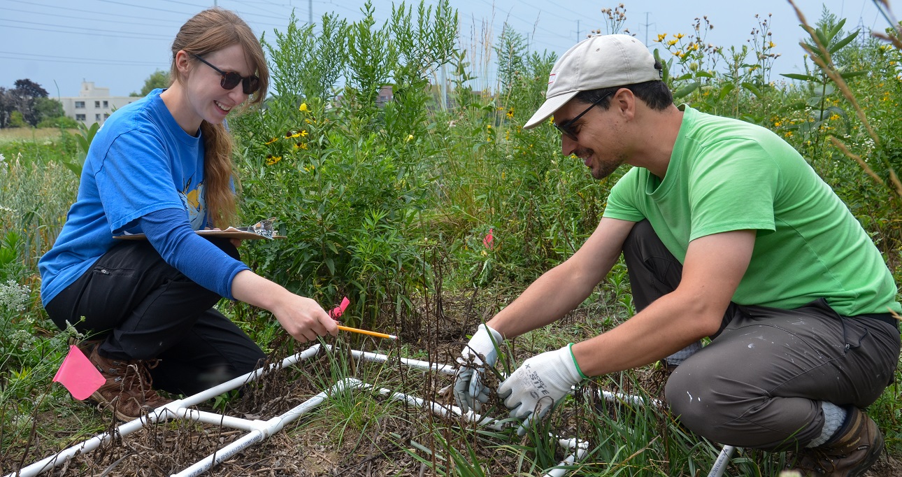
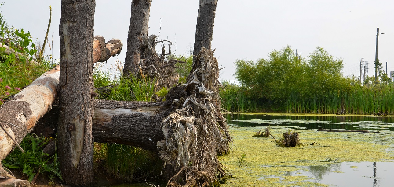
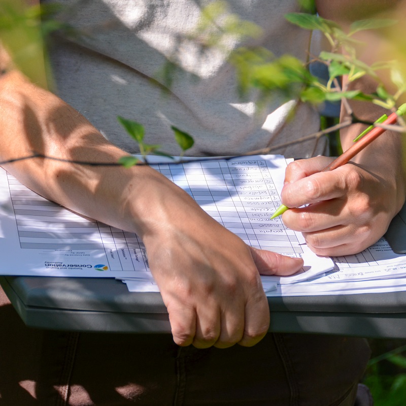
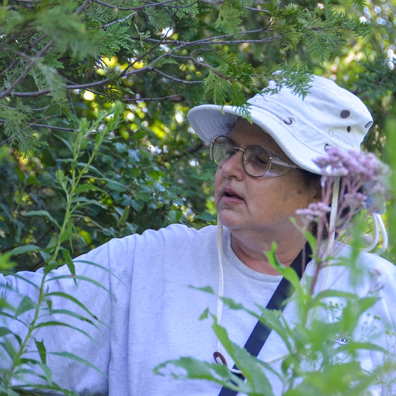
This week, I joined the Terrestrial Inventories and Monitoring team at Bruce’s Mill Conservation Park for wetland vegetation monitoring.
Across its jurisdiction, TRCA maintains several plots to carry out long-term monitoring surveys of forest, meadow, and wetland vegetation communities.
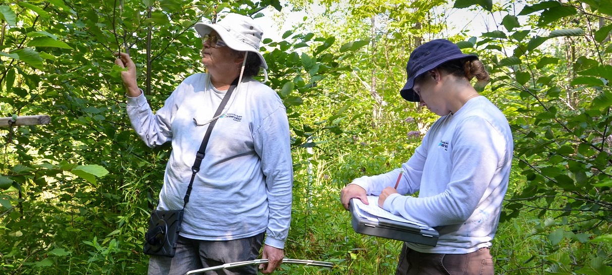
By returning to these fixed plots each year, staff are better able to determine trends in ecosystem health.
It was interesting to survey a wetland site that was rich in biodiversity. The team identified both new and long-established plants, carefully recording their characteristics.
Learn more about TRCA’s Terrestrial Monitoring and Inventories program.
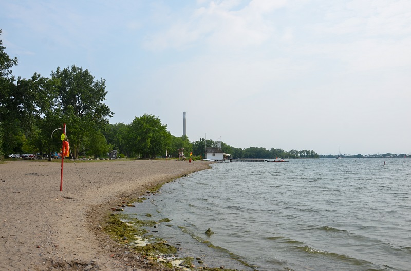
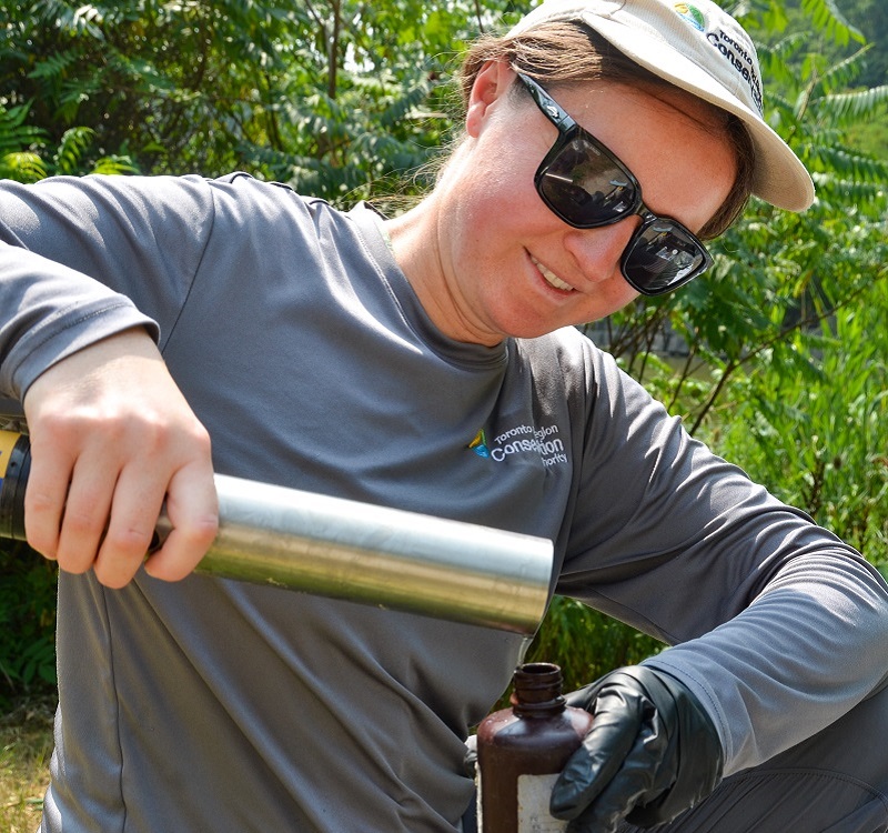
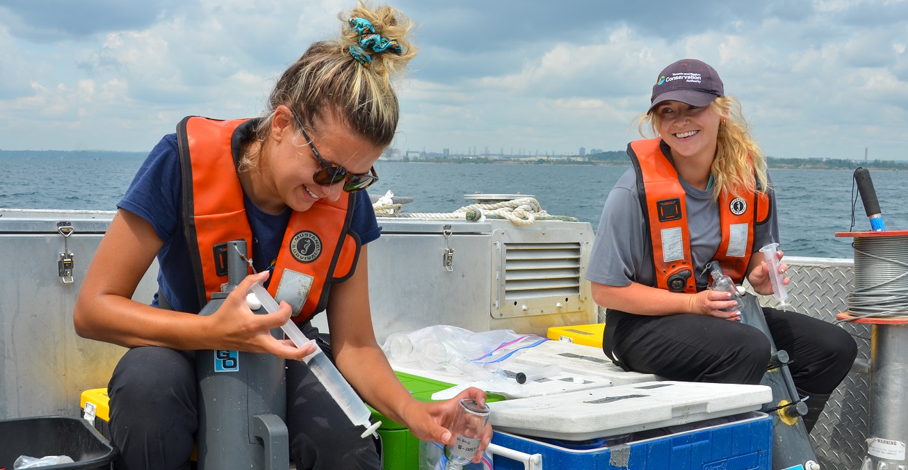
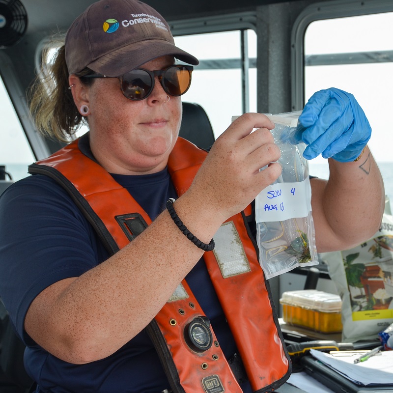
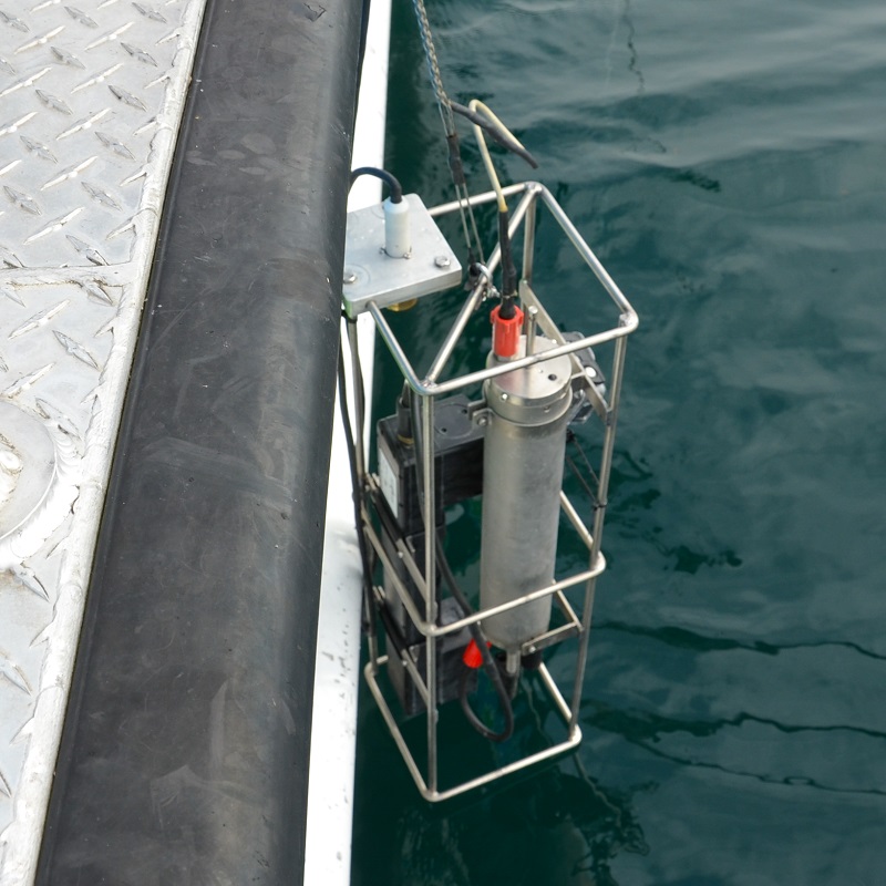
For my final day documenting environmental monitoring activities with TRCA, I joined staff as they collected Lake Ontario water quality and algae samples along the Western Durham waterfront.
Using specialized samplers, sensors, and an underwater camera, we gathered data and filled container after container with lake water for further lab analysis.
Occasionally, green algae would get caught on the equipment, which is also collected for further testing.
After a rewarding day of sample collection, we began our journey back to the docks. As we sped across the water, I looked out at shorelines, forests, and streams that have become familiar to me during my time with TRCA.
Seeing these landscapes reminded me how vast and complex the organization’s jurisdiction is, and the dedication and effort required to monitor its health.
Learn more about TRCA’s Western Durham Nearshore Monitoring program.
Scientific data collection and research informs decisions affecting the natural areas and watercourses within our region. Learn more!