March 3, 2026, Toronto, ON — Spring is a common time of year for river flooding. Warmer temperatures and melting snow and ice can create hazardous conditions near rivers, lakes, and streams. Toronto and Region Conservation Authority (TRCA) reminds residents to be cautious of changing water conditions during the spring season.
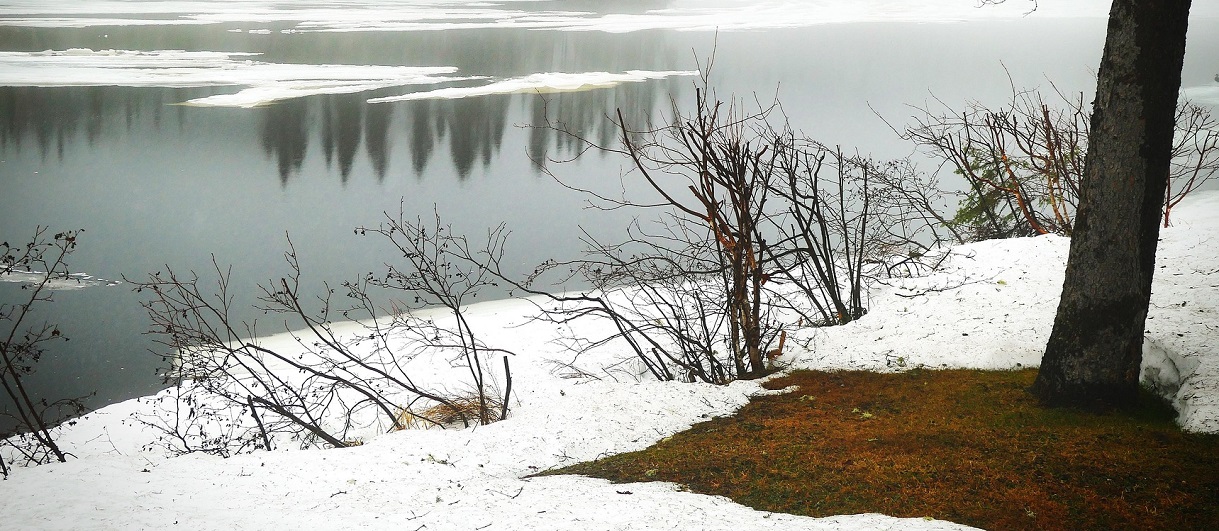
As temperatures rise, winter snow begins to melt, releasing large volumes of water into local rivers and streams. At the same time, the ground is often still frozen and unable to absorb this runoff.
When warmer weather is combined with rainfall, even more water can flow into rivers, causing water levels to rise very rapidly and potentially overtop riverbanks.
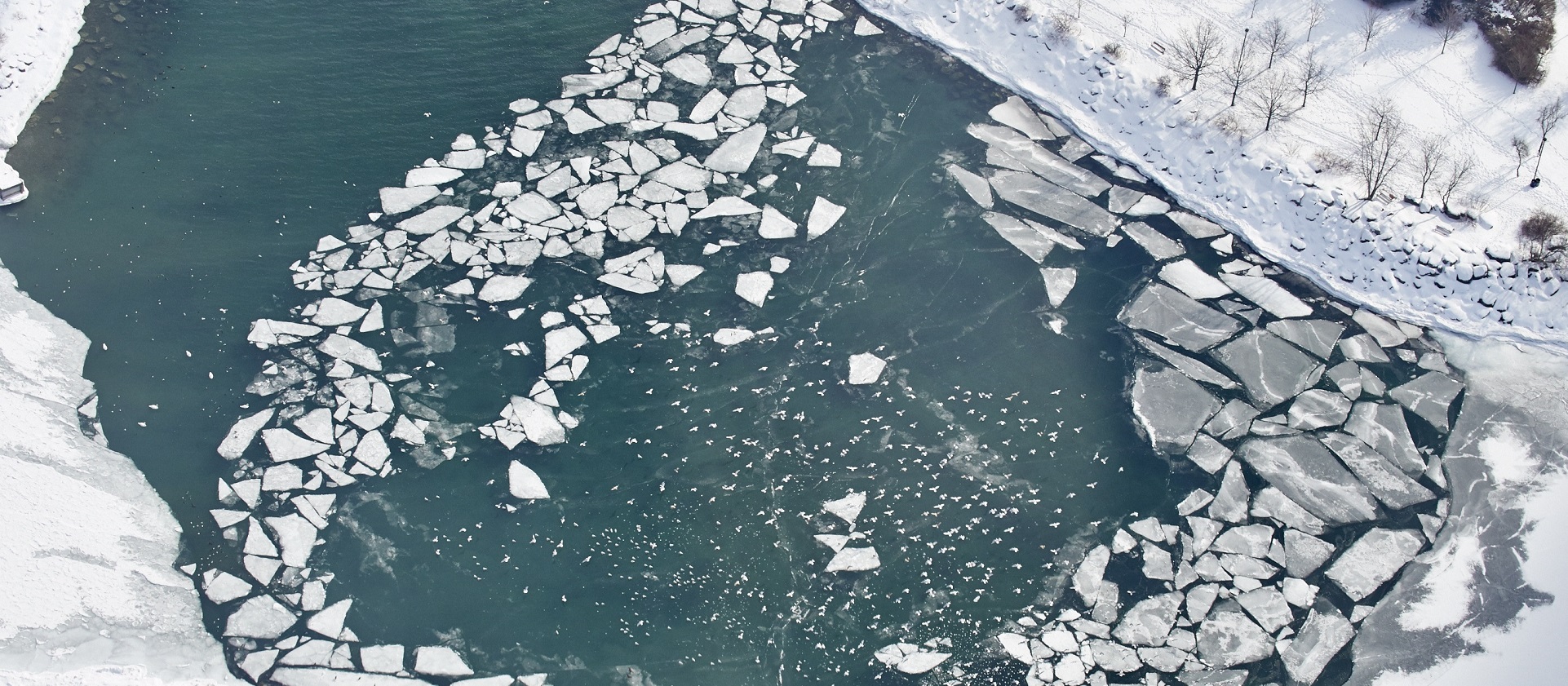
Higher flows can also break up the ice covering the river surface, sending large pieces downstream, where they can create ice jams. To learn more about ice jams, read TRCA’s Ice Jam Factsheet.
Always protect yourself and your family from floods by knowing your risk, being prepared, and staying informed. Visit trca.ca/spring-safety for more information.
CURRENT CONDITIONS FOR SPRING 2026
This winter was colder than last year, with plenty of snow and river ice across local TRCA watersheds. Most rivers are covered with about 15cm of ice, very similar to last year. Snow amounts are also similar to last winter, averaging about 30cm, with more snow in northern and eastern areas of TRCA watersheds.
This year’s accumulated snow is holding more water than it did last year, especially in northern sections of the watersheds. As temperatures begin to rise in the coming weeks, melting snow and river ice could raise water levels in rivers and streams higher than usual this spring.
If warm weather arrives quickly and is combined with rain, flooding could happen, and river areas could become dangerous. Remaining cautious around rivers this spring and following the safety tips below makes a difference.
Follow These Safety Tips Around Water
- Call 911 in an emergency. Rescuing someone from cold or fast-moving water is extremely dangerous.
- Exercise caution around all water bodies. Riverbanks, shorelines, and trails near water will be slippery due to melting snow and ice.
- Avoid recreational activities in or around water. Stay off ice-covered rivers, ice jams, and all bodies of water.
- Keep family and pets away from rivers and streams. Cold, fast-moving water poses a serious risk if you fall in.
- Never drive through flooded roads. Even shallow water may be deeper than it appears.
KNOW YOUR RISKS
During the spring thaw, residents and properties are more vulnerable to flooding and changing water conditions, especially those living in flood-prone and low-lying areas near rivers, streams, or shorelines.
If you’re not sure whether your home is in a flood plain, use TRCA’s Flood Plain Map Viewer to find out.
If you live or spend time near water, it’s always important to stay informed of changing river conditions and weather alerts, including local official municipal messaging.
BE PREPARED AND STAY INFORMED
- Stay informed of potential riverine flooding by signing up for flood messages at trca.ca/floodmessages.
- Read TRCA’s Flood Preparedness Factsheet.
- Visit your local municipality’s preparedness webpage for information on how to prepare a family emergency plan and 72-hour preparedness kit, or visit getprepared.ca.
How Does TRCA Monitor Flood Risk?
- TRCA actively monitors watershed conditions through its Flood Forecasting and Warning Program.
- In the winter and early spring, staff assess weather forecasts against current TRCA river ice and snowpack conditions to evaluate flood risks from ice jams, spring rainfall, and melting snow.
- TRCA shares this information with municipalities and if conditions show a potential flood risk, TRCA will issue a public flood message with more information.
- To learn about the different types of flood messages, click here.
- Sign up for flood messages at trca.ca/floodmessages.
SHORELINE RESIDENTS:
Seasonal Spring Water Levels on Lake Ontario
TRCA may issue flood messages related to the Lake Ontario shoreline, within its jurisdiction, which includes areas within the Cities of Toronto, Pickering, and the Town of Ajax.
In late spring, water levels in the Great Lakes rise as part of their yearly cycle. In years where there is more water input into the Lakes, water levels can rise well above normal and sometimes cause shoreline flooding and erosion.
Lake Ontario’s current water level is below the lake-wide average at this time of year, by 9cm as of February 26, 2026, and is not projected to exceed flood levels this spring.
To learn more about Lake Ontario’s risks and impacts, visit trca.ca/understanding. Water level forecast information for Lake Ontario can be found on the International Lake Ontario-St. Lawrence River Board website as they regulate outflows from Lake Ontario and are responsible for developing water level forecasts.
For more spring safety information, please contact your local conservation authority:
- Toronto and Region Conservation Authority: (416) 661-6514
- Lake Simcoe Region Conservation Authority: (905) 895-1281
- Conservation Halton: (905) 336-1158
- Credit Valley Conservation: (905) 670-1615
- Central Lake Ontario Conservation Authority: (905) 579-0411
- Ganaraska Region Conservation Authority: (905) 885-8173
- Nottawasaga Valley Conservation Authority: (705) 424-1479
- Kawartha Conservation: (705) 328-2271