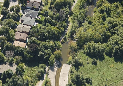
The Mimico Creek watershed is a heavily urbanized watershed in Toronto and Region Conservation Authority’s (TRCA) jurisdiction. It is approximately 7,700 hectares in size and is bordered by the Etobicoke Creek watershed to the west and the Humber River watershed to the east.
Mimico Creek Watershed Plan
There are currently plans to develop a watershed plan for Mimico Creek in the future. Previously, a Technical Update was completed in 2010 to inform conservation management decisions in this watershed.
Explore the Watershed
Explore the quick links and map below to learn more about the Etobicoke Creek watershed:
Cultural Heritage
The origin of the watershed‘s name:
- “Mimico” comes from the Algonkian word “Omimeca” meaning “resting place of wild pigeons”. The extinct passenger pigeon used the mouth of Mimico Creek as a migratory stopover.
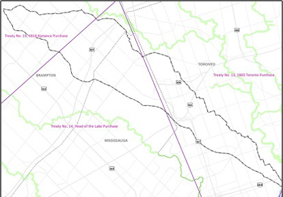
All of these Treaties are signed with the Mississaugas of the Credit First Nation (an Anishinaabe First Nation).
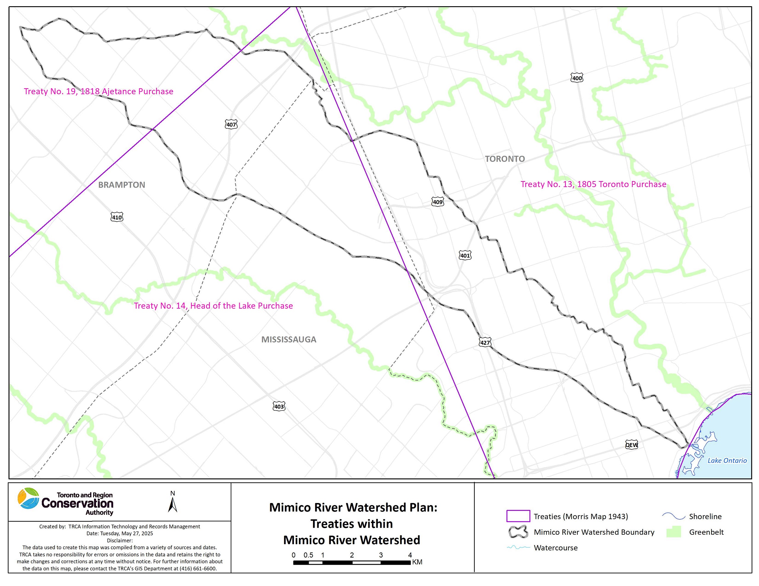
The lands and waters in the watershed are the traditional territory of the Mississaugas of the Credit First Nation, the Haudenosaunee (including the Six Nations of the Grand River) and the Huron-Wendat peoples, and are now home to many diverse First Nations, Inuit, and Métis peoples.
Through work with lands and waters, TRCA appreciates and respects the history and diversity of these lands and is grateful to have the opportunity to work and be in relation with this territory. We are also grateful for the continued work of many First Nations and Indigenous peoples, who are the original and current caretakers of these lands and waters. We humbly acknowledge our responsibility to respect First Nations’ rights and Indigenous perspectives, elevate Indigenous voices, and honour our relationship with First Nations and Indigenous peoples.
Land Use & Climate
Urbanization and climate change continue to be major stressors affecting the health and resilience of the Mimico Creek watershed.
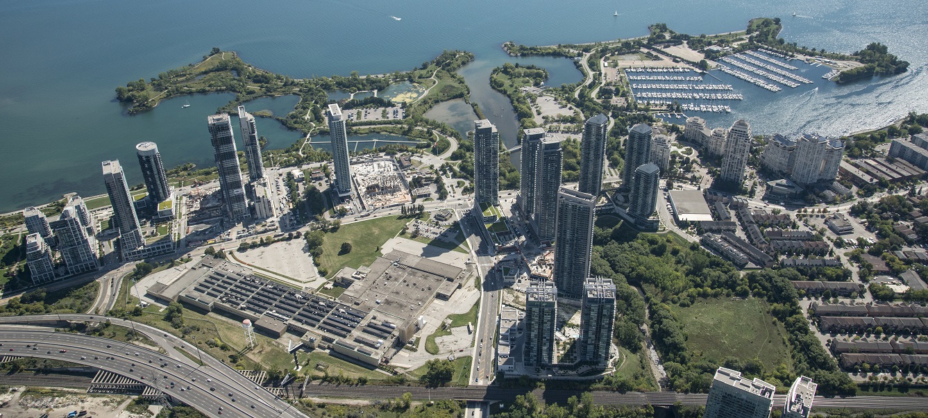
As of 2020, the watershed was heavily urbanized, with approximately 89% of the area classified as urban land use. The only remaining rural areas are located within valley corridors.
Most of the urban land uses are industrial-commercial-institutional, and residential areas, which comprise approximately 89% of the watershed.
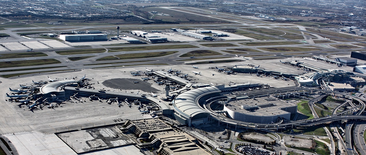
The area covered by Toronto Pearson Airport is 6%, and other transportation uses, including major highways, make up approximately 5% of the Mimico Creek watershed.
The high degree of urbanization has contributed to challenges such as flooding and erosion, poor water quality, limited natural cover, and degraded terrestrial and aquatic habitats.
Increasing natural areas (including urban forest canopy cover) and implementing stormwater controls can help mitigate flooding and erosion risks, improve water quality, and provide additional environmental benefits.
KEY CHARACTERISTICS
- AREA: The watershed covers a drainage area of approximately 7,709 hectares and consists of a main channel fed by an upper west branch and upper east branch. Mimico Creek begins on the South Slope of the Oak Ridges Moraine and drains into Lake Ontario.
- POPULATION: 169,173 (Census 2024)
- LAND USE: Land use in the Mimico Creek watershed is 89% urban, 9% natural (this includes 7.4% natural cover, waterbodies, and streams), and 2% rural as of 2020. It was previously reported that urban land use in Mimico Creek watershed increased from 54% in 1978 to 77% in 1998.
- IMPERVIOUS COVER: The percentage of impervious surfaces is about 89% in the Mimico Creek watershed.
CONSERVATION AREAS AND PARKS
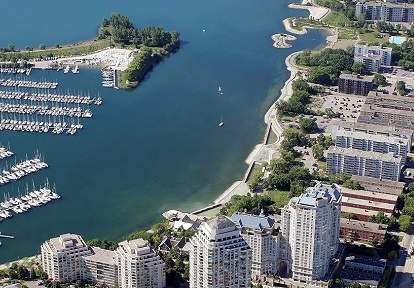
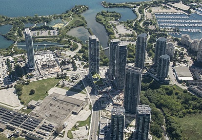
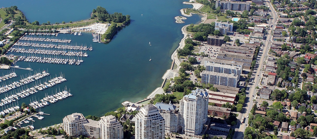
Humber Bay Park on Toronto’s waterfront is often mistaken as the mouth of the Humber River, but is in fact the mouth of Mimico Creek.
Until the 1970s, when the two large landfill parks (Humber Bay Parks East and West) were constructed on either side of the Mimico’s mouth, the creek flowed directly into the lake below Lake Shore Boulevard West.
CLIMATE
Climate change impacts are being seen and felt locally in TRCA’s jurisdiction. Extreme heat and heavy rains are leading to more heat advisories and flooding, which affect the health and safety of the watershed and its residents.
These impacts will get worse unless we act to reduce the effects of greenhouse gas emissions. We also need to find ways to help our watersheds and communities better handle the effects of climate change.
Climate trends in the Toronto region are based on an analysis of climate parameters for the historical climate period between 1971 to 2000, and include:
- Temperatures are projected to increase across all seasons throughout the year.
- The number of very hot days above 30°C and 35°C are expected to increase.
- Very cold days below -10°C and -20°C are expected to decrease.
- Total annual precipitation is expected to increase.
- More frequent and intense storms are expected to occur.
LEARN HOW TRCA IS TAKING ACTION ON CLIMATE CHANGE.
Natural Hazards
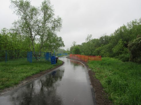
Climate change is expected to increase precipitation, raise annual average temperatures, and heighten the frequency of extreme weather events, all of which can contribute to increased flooding and erosion in Mimico Creek.
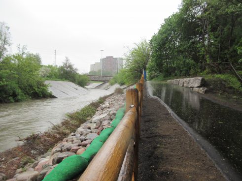
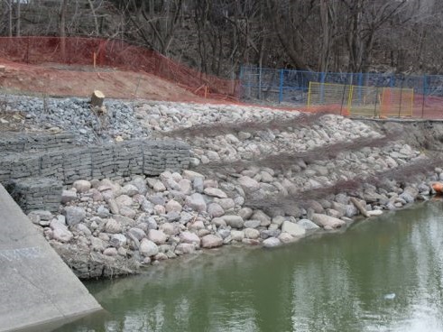
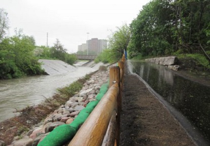
TRCA conducted bank stabilization and trail realignment work in West Deane Park in 2017 to protect against the the erosive forces of Mimico Creek.
There are three Flood Vulnerable Clusters within this watershed. These areas, located in Malton, Dundas West, and South Mimico, have higher concentrations of roads and structures that are at greater risk of flooding and damage.
Only about 10% of the developed areas in the Mimico Creek watershed have erosion controls.
Moreover, the fragmented and degraded natural cover, both in terms of quality and quantity, further reduces the watershed’s resilience to extreme weather events.
Do you live in an area at risk of riverine flooding?
USE TRCA’s MAP VIEWER TO FIND OUT.
Natural Heritage and Urban Forest
The terrestrial natural heritage system comprises the forest, wetland, and meadow habitats and the communities of species they support.
A healthy natural heritage system that can resist harmful changes and recover from damage is important for the health and safety of ecosystems and people.
It helps to reduce the impacts of changing land use and climate, supports different types of plants and animals, and offers many services to people, such as better protection from floods and erosion, clean drinking water and air, and more opportunities for recreation.
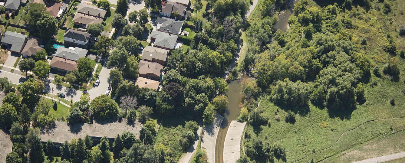
The existing natural heritage system of the Mimico Creek watershed, however, is degraded with impaired ecological function. Natural cover is limited, and overall habitat quality is generally rated as “fair” or “poor”.
The Mimico Creek watershed has a long history of human land use. Much of the habitat was originally cleared for agricultural purposes, and over the last several decades most of these agricultural lands have been converted to urban development.
Most of the remaining natural cover in the Mimico Creek watershed is found within river valleys or stream corridors.
While habitat may not be continuous in some places, these habitat patches create a “stepping stone” effect, allowing species to move north and south. These valley corridors are crucial for facilitating the movement of both resident and migrant species.
In terms of the east/west connectivity, very few linkages remain. This inhibits the ability for species to move between habitat patches both within the watershed, as well as to the natural systems beyond in the Etobicoke Creek, Credit River, and Humber River watersheds.
The watershed does not meet the recommended federal guidelines for natural cover quantity, and falls below TRCA’s terrestrial Natural Heritage System target of 30%. However, any increase in natural cover would benefit biodiversity and enhance ecosystem services.
With very limited natural cover, urban forests are extremely important for supporting healthy natural heritage in this watershed.
There are opportunities to improve both the quantity and quality of the urban forest. Enhancing urban forests can provide valuable ecosystem goods and services, improve climate resilience, and offer socio-economic benefits.
Currently, 1.7% of the watershed has been identified as having potential natural cover, and 29.4% of the watershed has been identified as contributing areas. LEARN MORE.
KEY CHARACTERISTICS
- NATURAL COVER: TRCA’s Reporting Hub calculates that 7.4% of the watershed (570 ha) consists of natural cover, well below the recommended minimum federal target of 30% for long-term sustainability and resilience.
- BIODIVERSITY: Based on biological inventory surveys conducted before 2010, the Etobicoke and Mimico watersheds combined are home to 503 species of plants and animals. This indicates that the watershed has the capacity to support a variety of species, including some TRCA Regional Species of Conservation Concern.
Water Resources
A healthy water resource system is essential for keeping watersheds safe and resilient. It provides vital services to communities, such as storing water to reduce flooding, naturally filtering water to maintain its quality, and supporting habitats for wildlife, like fish, that also contribute to recreational opportunities.
In the Mimico Creek watershed, however, aquatic habitat conditions are currently poor.
The watershed experiences high levels of stormwater runoff and is fragmented by numerous in-stream barriers to fish, both of which have a negative impact on aquatic ecosystem health.
To improve water conditions, we must restore a more natural water balance by enhancing natural cover, and through a combination of low impact development (LID) measures and end-of-pipe stormwater retrofit projects, particularly for extensive areas of impervious urban surface.
KEY CHARACTERISTICS
- SOURCE WATER: Mimico Creek begins south of Bovaird Drive in the City of Brampton, just south of Professor’s Lake. Similar to the Etobicoke Creek watershed, the Mimico Creek is not directly fed by the Oak Ridges Moraine feature. However, the flow distribution of Mimico Creek is similar to that of watersheds that are directly influenced by the Moraine, where the headwaters contribute approximately 50% of the watershed’s total discharge. The headwaters of Mimico Creek do not have evenly distributed flows however, and 43% of the total watershed baseflow originates from the Upper East Mimico Creek, while the Upper West tributaries contribute only 7%.
- ISSUES OF CONCERN:
- Historical streamflow data analysis showed that mean annual streamflow in the Etobicoke and Mimico Creek watersheds has increased over the past 40 years by 27%, and the increase has been accelerating for the past 10 years. It is not surprising that the watershed would be highly runoff-driven due to its urbanized nature.
- Only 49% of riparian areas in Mimico Creek have natural cover.
- Of the 338 instream structures, 145 are barriers to non-jumping fish species, and of those, 126 barriers prevent passage of jumping species.
Water Quality
Clean water is essential for the health and safety of a watershed, its residents, and ecosystems.
It is vital not only for drinking, household use, and recreational activities like swimming and fishing, but also for economic activities such as agriculture and manufacturing.
Water quality issues are correlated to the amount of urbanization within a watershed. Non-point sources of contamination from urbanization (e.g., stormwater runoff) continue to be the largest contaminant contributor to surface water quality within the Mimico Creek watershed.
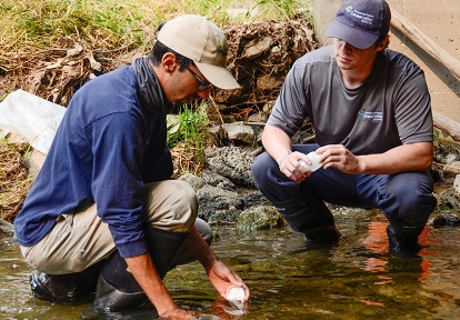
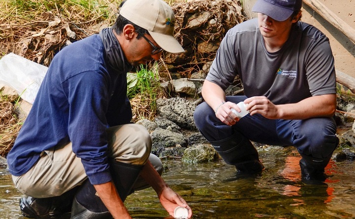
TRCA’s Regional Watershed Monitoring Program currently monitors water quality monthly at two stations within the Mimico Creek watershed, one of which is monitored in partnership with the Provincial Water Quality Monitoring Network administered by the Ministry of Environment, Conservation and Parks.
By monitoring water quality over time and in different areas, we can identify issues and their causes and find ways to fix them.
TRCA’s Reporting Hub data from both stations for the year 2022 was used to determine water quality conditions, and found that water quality in the Mimico Creek watershed is generally poor, especially for chlorides and E.coli bacteria.
KEY CHARACTERISTICS
- CHLORIDES (e.g., from road salt):
- Median chloride concentrations exceeded the objective of 640 mg/L at the mouth of Mimico Creek.
- The station located at the mouth of Mimico Creek had a very high median chloride concentration (758 mg/L).
- TOTAL PHOSPHORUS (e.g., from fertilizers, animal wastes, and sanitary sewage):
- The data from 2022 suggests that total phosphorus trends are staying the same over time. The monitoring station located higher up in the watershed did have a median of 0.07 mg/L, which is considered high.
- E. coli BACTERIA (e.g., from sewage and animal waste):
- In general, E. coli concentrations were lowest in the headwaters and increased downstream toward the stream outlets. The median E. coli values for both stations in the Mimico Creek watersheds exceeded the PWQO of 100 CFU/100 mL.
Resources
Watershed Report Cards
Mimico Creek Watershed Plans & Reports
Learn More


Get Involved
Don’t forget to check out the TRCA calendar to learn about events near you, such as public plantings, educational presentations, nature walks, and more!
Visit TRCA’s Get Involved webpage to find something that interests you!
Contact
Mimico Creek watershed? Contact Mimico@trca.ca.