Toronto and Region Conservation’s (TRCA) Environmental Monitoring team has a unique approach to the protection of natural heritage within its regional watersheds. All flora and fauna species, as well as vegetation communities, are assigned a local rank from L1 to L5, based on ecological criteria collected by TRCA and other agencies.
Based on this usage of a local ranking and scoring approach, 681 species in TRCA’s jurisdiction are now designated as Regional Species of Conservation Concern (L1 to L3 ranks). That is, they are flagged as being at risk within the entire TRCA jurisdiction over the long term. These species may not currently be rare, but they are highly sensitive to habitat loss and disturbances associated with changes in the surrounding landscape.
Species and communities assigned an L4 rank are those that are widespread regionally but are vulnerable to long-term declines in urban areas. L5 ranked species and communities are not of conservation concern at the present time.
Red-tailed hawk & common yellowthroat observed during early morning breeding #bird surveys! https://t.co/6GUn9yoHNa pic.twitter.com/zbLCMON9zh
— TRCA Monitoring (@TRCA_Monitoring) June 30, 2016
This systems parallels the provincial (or state) ranks of S1 to S5, as well as the corresponding national (N) and global (G) ranks. The difference is that the latter ranks are based almost entirely on population criteria, while the L-ranks, which include sensitivity criteria, take a more pro-active approach and can identify Regional Species of Conservation Concern before they become rare.
2016 marked the first year that an Annual Local Occurrence Score and Local Rank Update report has been published by TRCA, although L-rank re-assessments have been occurring since 2010. Information on these natural heritage changes are summarized in the report, which lists L-rank changes for 43 plants, animals and vegetation communities.
The report discusses why approximately half this group received a higher L-rank and the other half showed a decrease in L-rank. Information on population declines and increases, including locally extinct (i.e. extirpated) and rediscovered species and communities are also discussed.
A Change in Rank
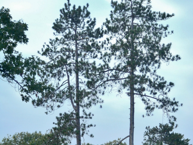
A total of 19 plants had a change of rank since the last update a year ago. Five of these received an increase in L-rank as a result of declining records regionally. For example, red pine changed from an L2 rank to an L1 rankl The other plants that are experiencing significant population declines include ebony spleenwort, fragrant cudweed and silky dogwood.

An additional 14 plant species saw a decrease in L-rank, due to a more accurate accounting of previously under-reported species that are actually abundant.

When re-assessing vegetation communities, four communities showed a decrease in L-rank and ten showed an increase in L-rank. Reasons why some vegetation communities received a higher L-rank relate to either a decline in area, impacts from invasive species or pests, or due to the simple reason that vegetation community data records older than 15 years are not included in the re-assessments.

Moving on to our feathered friends, six bird species showed a climb to the next highest L-rank, while three species slipped down to a lower L-rank.
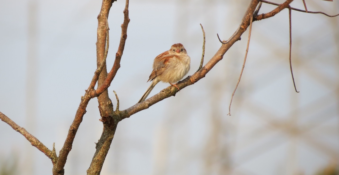
Some of the L-rank changes were influenced by the latest updates to the USGS North American Breeding Bird Survey (now incorporating data from 1966 to 2013). The northern harrier and field sparrow, for example, have both received higher L-ranks. Being open country birds, these species nest either on the ground or low in shrub vegetation and are extremely susceptible to increased traffic and disturbance from recreational hikers, bikers and domestic pets.

The veery is another bird species that received a higher L-rank. This bird is a relatively abundant forest species that is very sensitive to ground-borne disturbances in its forest habitats.

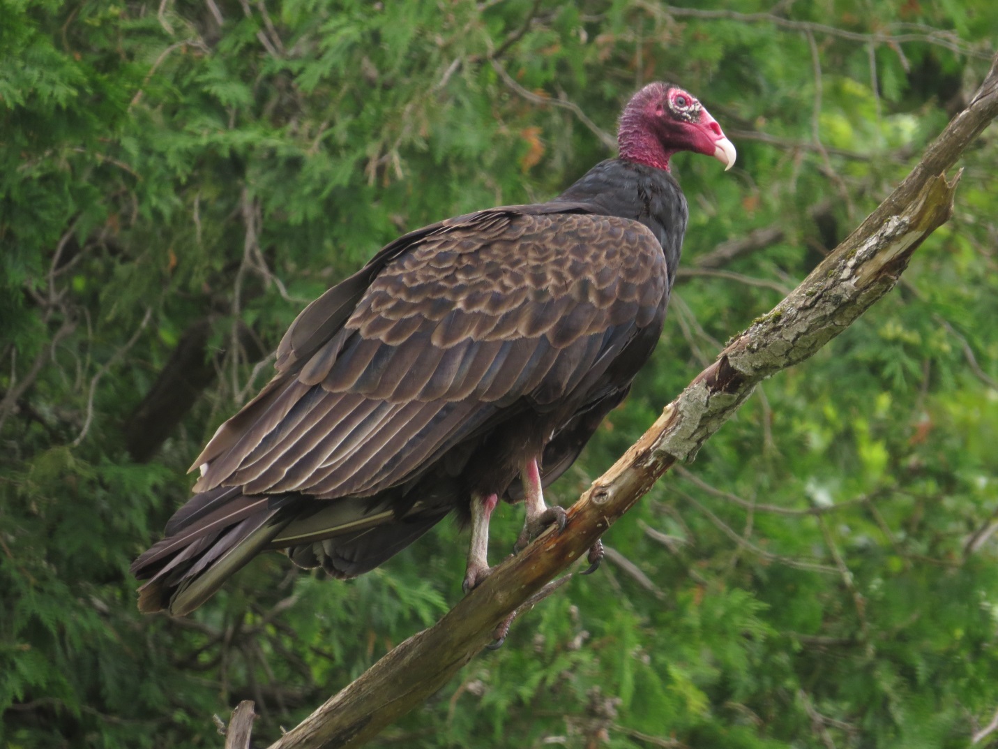
Two additional regional bird species received a lower L-rank due to population increases at the continent-wide level: ruffed grouse and turkey vulture.
Most likely these species would have retained a higher L-rank if local occurrence data at the regional level was the only consideration. For instances like these, where species L-ranks are at odds with regional data, they are flagged in data mapping exercises to alert ecologists to any changes in local population status.
Despite these examples, the L-ranks and scores are largely in agreement with the published nation-wide trends for breeding birds.

Other than bird species, the snapping turtle was the only herptile to receive a change in L-rank, having been downgraded from L2 to L3. This move is entirely due to increased reports of this turtle species from recent road ecology studies in the region. Despite the decrease in L-rank, the snapping turtle continues to maintain its status as a Species of Regional Conservation Concern.

Significant Population Increases and Decreases
Twenty-four bird species are showing increases in local occurrence (but not in L-rank). A few of these birds, like the merlin, are experiencing a shift in distribution while other species populations are increasing due to successful adaptations to suburban areas, artificial nest opportunities, and reintroduction programs.
More details on these species are available in the 2016 Annual Local Occurrence Score and Local Rank Update.

An additional 20 bird species are showing signs of population declines. The majority of these birds prefer meadow and forest habitats, with most being ground-nesters and therefore sensitive to disturbance.
The bobolink showed the most significant population decline of these species; this is in keeping with the larger global picture for this species.

For plants and vegetation communities, we recorded numerous increases in local occurrence since the last scoring update was performed.
For example, a total of 703 plants increased in local occurrence between the two inventory periods, 2000-2015 and 2001-2015. This is a result of a more thorough collation of plant species lists across the jurisdiction and the continuing benefits of an increase in surveyed area, and not necessarily a function of increased plant populations.
The same can be said for vegetation communities, as this assessment is the first time we have a clear 15-year dataset using the current Ecological Land Classification protocol.
Future reassessments may serve better to uncover actual changes in conservation status of plant species and vegetation communities, especially any changes in L-rank.
#Species of concern! Despite male & female grey #catbirds looking the same, this is a male #bird based on its song: https://t.co/UCtZHAxhVh
— TRCA Monitoring (@TRCA_Monitoring) June 21, 2016
Species now Locally Extinct (i.e. Extirpated)
A total of five species were removed from the current TRCA fauna list as they have not been observed in the past ten years within Toronto and region.
Northern watersnake was last reported in the lower Humber River in 2005. It is quite possible that this species is still present in the jurisdiction but is missed during our surveys as monitoring activities focus on the breeding calls of frogs and birds.
The four other species are all birds; great black-backed gull, Wilson’s snipe, white-winged crossbill, and yellow-breasted chat. The decline of Wilson’s snipe regionally, for example, is likely caused by the continued loss of marginal agricultural land in the rural zone. Such land is often adjacent to or associated with wetland habitats, which are favoured by the Wilson’s snipe.
In terms of flora thought to be locally extinct, the small purple-fringed orchis has been removed from the TRCA flora list as no new records have been found in the last 15 years. The wetland area that provided ideal habitat for this plant over 15 years ago has been transformed into a rich cattail marsh that is no longer suitable for this species.
Rediscovered species!
A mudpuppy, a species thought to be locally extinct, was rediscovered accidentally last year by TRCA staff in a lamprey-trap on the Humber River. This was precisely the same location where the previous mudpuppy was trapped in the spring of 2002!
This highlights the need for targeted searches for many of the non-calling species within the region, or at least the need to be cautious about assigning “extirpated” status to any cryptic species.
Today's flora discovery: Spring whitlow-grass, a cryptic plant that has not been observed regionally since 1982! pic.twitter.com/2PKRqI1r4P
— TRCA Monitoring (@TRCA_Monitoring) May 10, 2016
Two other regional plant species, the early saxifrage and the sessile-fruited arrow-head, were re-located again! It is also important to mention that the smooth ground-cherry and Billing’s three-seeded sedge were officially confirmed to be of existence regionally.

New Additions
Northern shoveler was added to the regional terrestrial fauna list based on an observation of a male at Carruthers Marsh during the 2015 breeding season. Although breeding may not have actually occurred, its presence is significant because the species is known to have recently bred nearby in Cranberry Marsh.
A total of 25 non-native flora species were added to the database in 2015. The large majority of these are found to be reproducing from plantings.
Eight new vegetation communities have also been added to the database (five in 2014 and three in 2015). Four of these were highly-significant dynamic barren, cliff and oak savannah communities identified in Rouge Park in 2014.
One community, the Fresh-Moist Beech – Hardwood Deciduous Forest, was an unusual association discovered in 2015. The other three communities were either plantations or derived from them.

Through scientific data collection, TRCA’s Environmental Monitoring and Data Management team tell the stories about the changes affecting the natural areas and watercourses within our regions. For more information, please visit our website, follow us on Twitter, subscribe to our Monitoring Matters e-newsletter, or visit our YouTube playlist.

