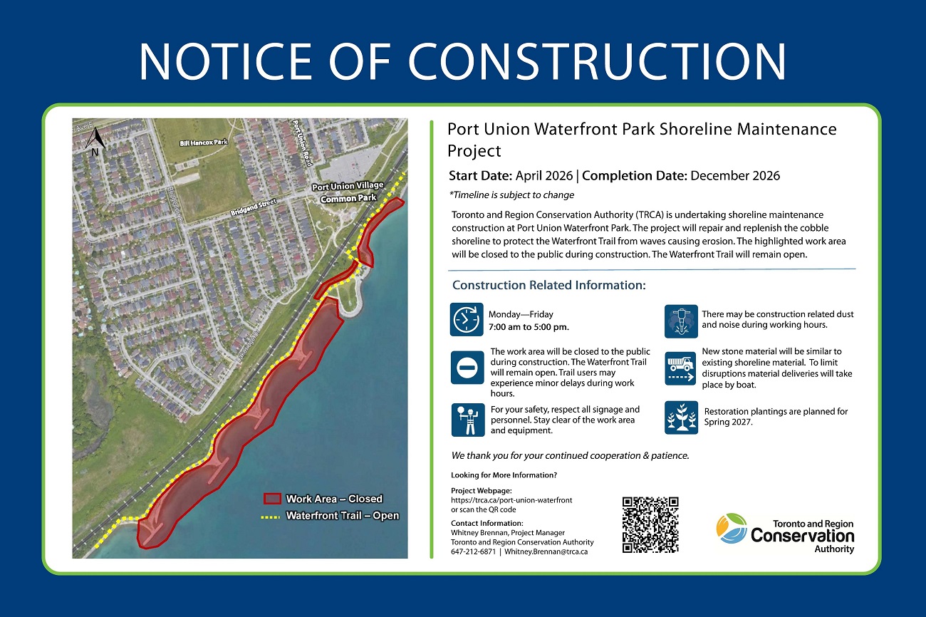
Toronto and Region Conservation Authority (TRCA), in partnership with the City of Toronto, is undertaking shoreline maintenance work on existing shoreline erosion control structures in Port Union Waterfront Park. This work will provide long-term protection for the park from erosion and address public safety concerns.
Project Location
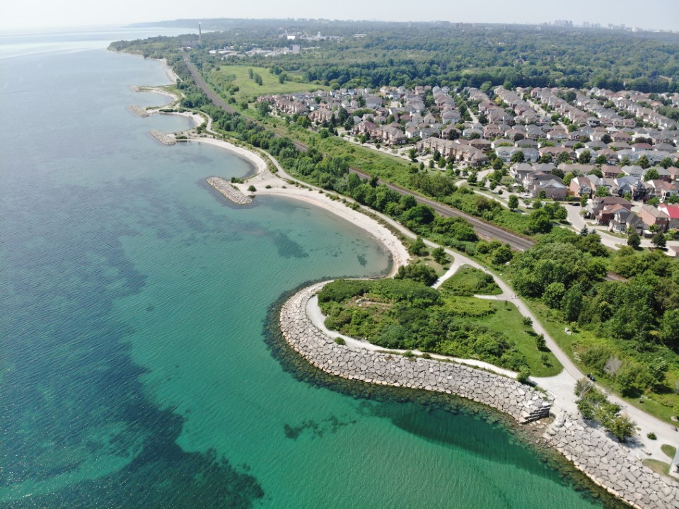
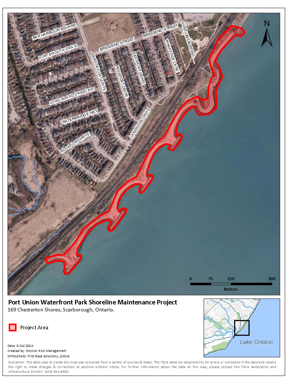
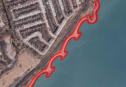
The Project Area is within Port Union Waterfront Park, near the intersection of Port Union Road and Bridgend Street in Scarborough, City of Toronto.
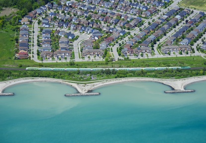
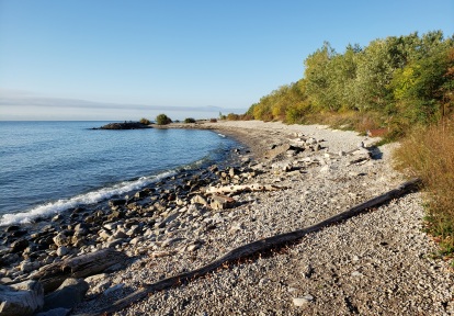
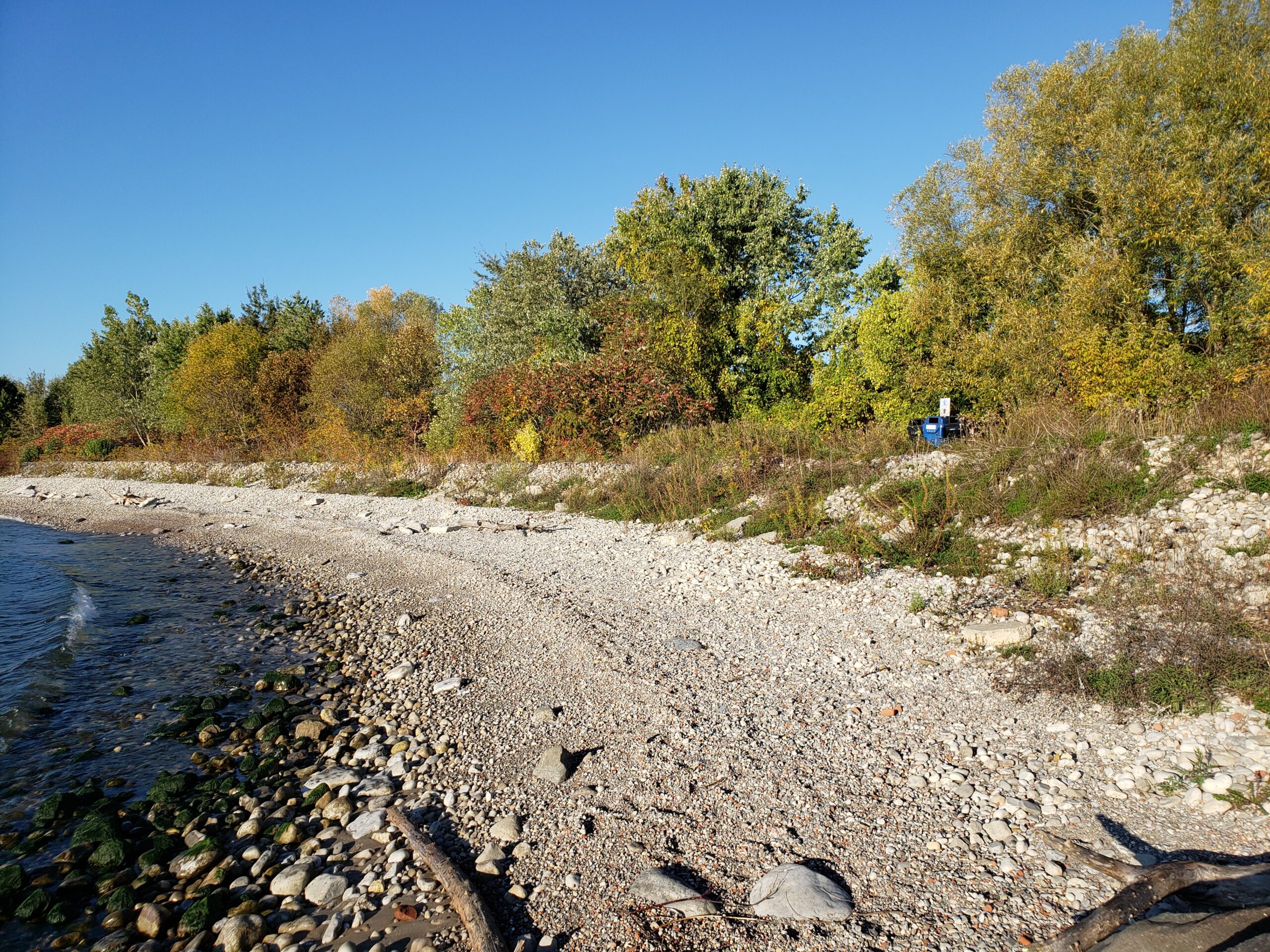
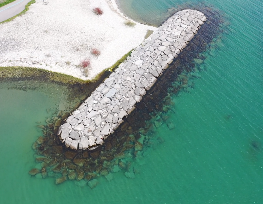
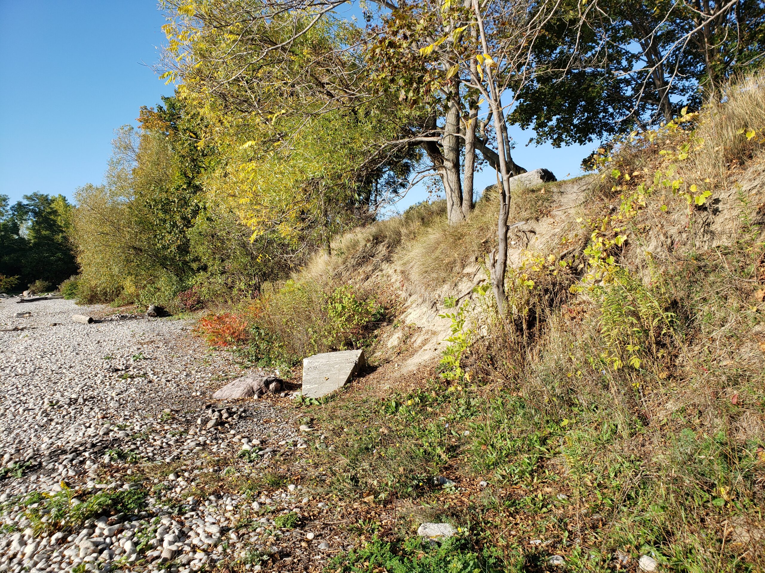
The area of concern is the shoreline located along Lake Ontario, consisting of approximately 1 km of shoreline erosion control structures five damaged cobble shoreline areas between a series of rocky structures called armourstone headlands.
Learn More About the Project


Project Background
Port Union Waterfront Park is part of a long stretch of shoreline parks and trails system that runs from East Point Park to Rouge Beach, along Lake Ontario in the east end of the City of Toronto.
The park features a multi-use trail, picnic areas, benches, and clear views of Lake Ontario. It is a popular area for walking and cycling, since it connects to a larger network of waterfront trails.
The park was constructed in the mid 2000s as part of efforts to create continuous trail and greenspace for public use and to provide erosion protection to nearby neighbourhoods and infrastructure, including the Metrolinx rail line.
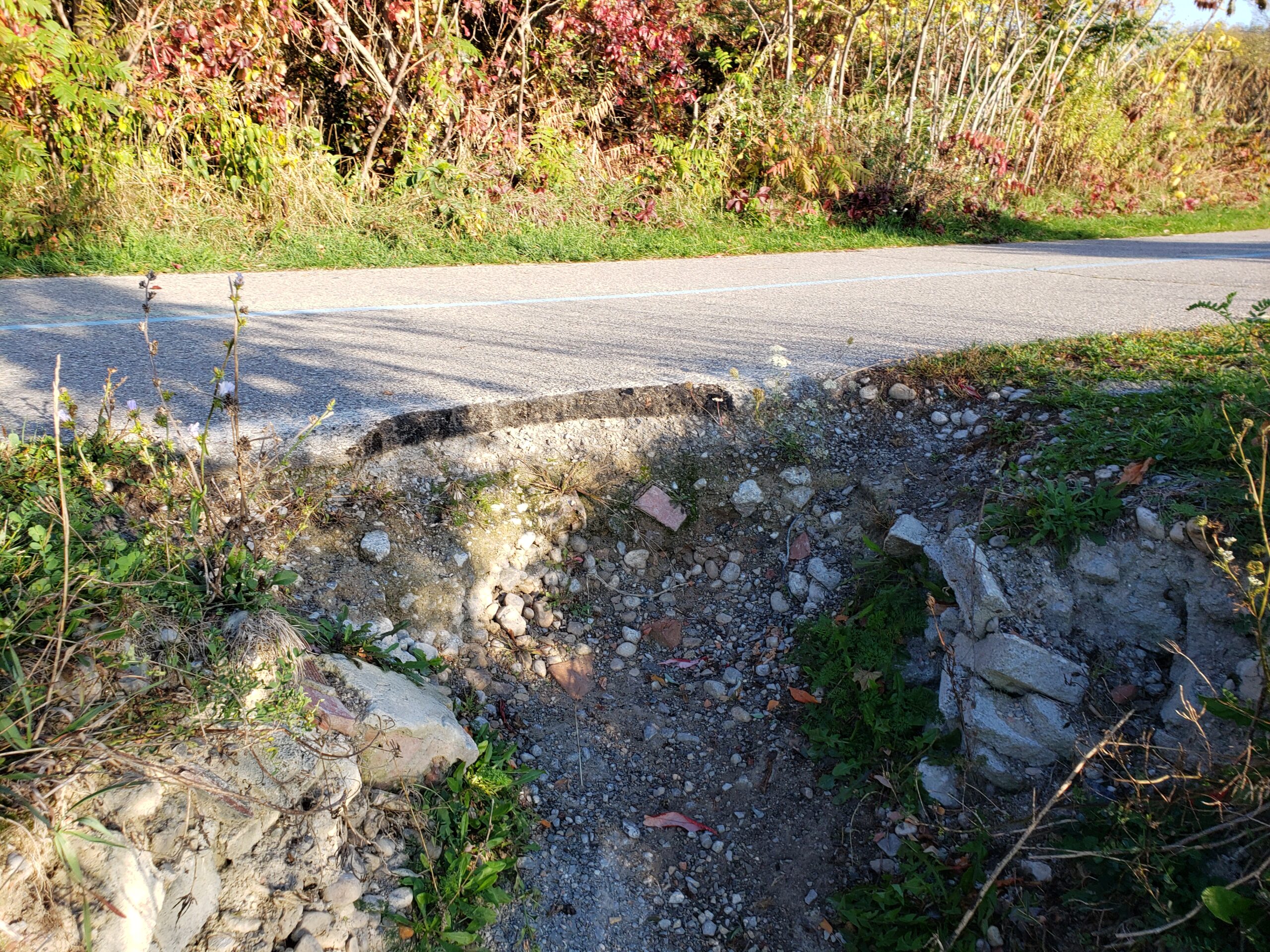
Since the park’s construction, the shoreline has been exposed to continued wave and wind action as well as recent severe weather events, such as high Lake Ontario water levels in 2017 and 2019, and the April 14/15, 2018 wind storm. This has mostly affected the cobble shorelines in the project area, which has been damaged by storms that move material away from the shore.
This has impacted the areas behind and around the shoreline which have not been as well protected. The multi-use trail trails have become damaged and potentially dangerous to use. In order to ensure public safety and stability of the park, these issues must be addressed with long-term erosion solutions.
In 2024, TRCA worked with GHD Limited, a coastal engineering consulting firm, to complete a coastal analysis of the full project area to determine the erosion risk areas along the shoreline. Of the twelve structures, five of the cobble shoreline structures were identified as being at risk and requiring maintenance.
GHD developed detailed designs for repairs of the five cobble shorelines and determined appropriate stone sizing for each shoreline section. The stone sizing takes recreational use into account, and the new cobble will be similar in size to the existing materials.
Scope of Work
The Project will repair and replenish the cobble shorelines to protect the park and Waterfront Trail from erosion. The scope of work for this project includes:
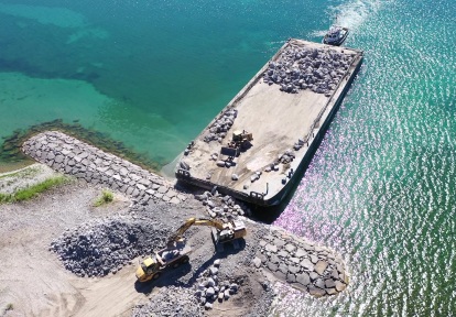
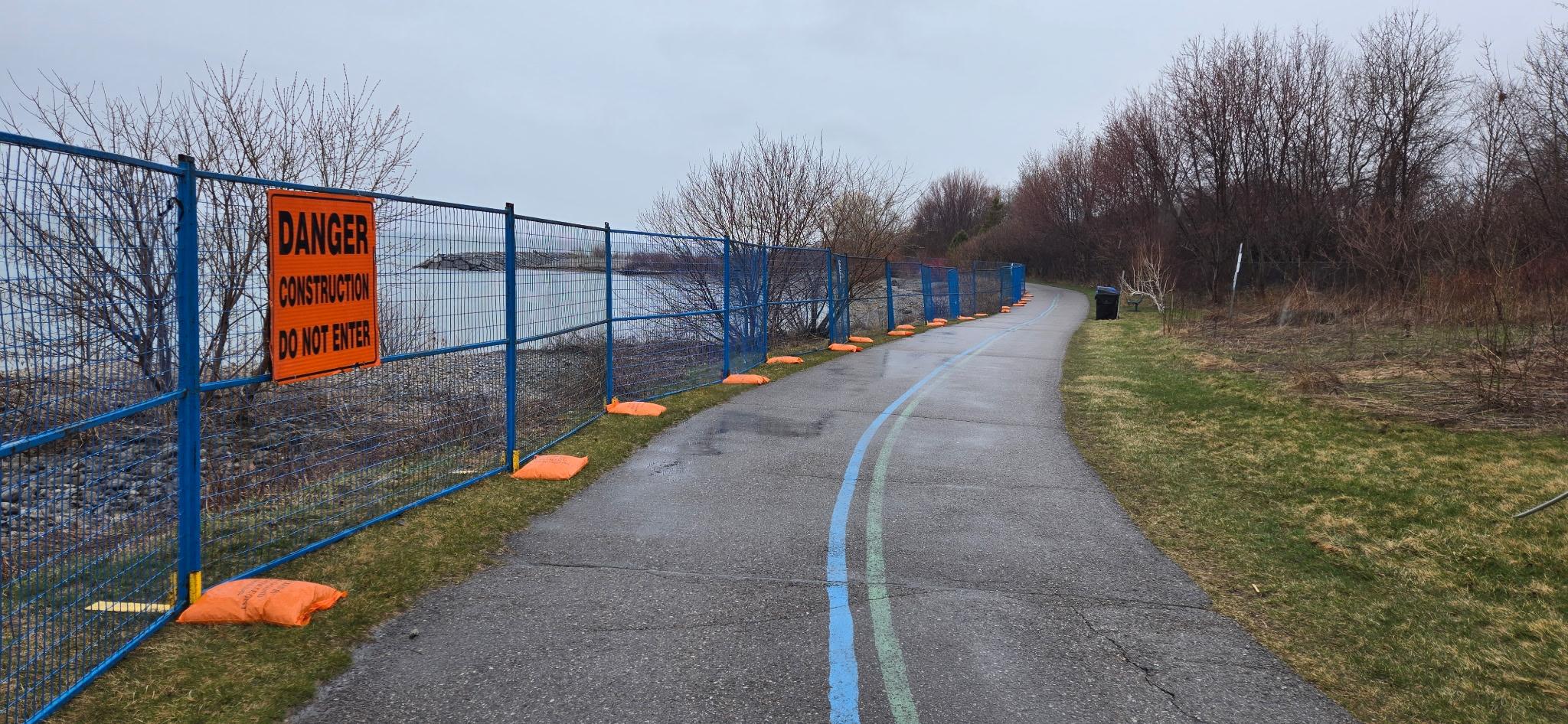
- Site preparation, including any necessary tree removals/protection, installing Erosion and Sediment Control (ESC) measures and construction fencing, creating staging/stockpiling areas and building temporary barge access docks on two of the headlands
- Delivering the new cobble material by barge. Smaller deliveries and vehicles will access the site through the tunnel at Port Union Village Common Park
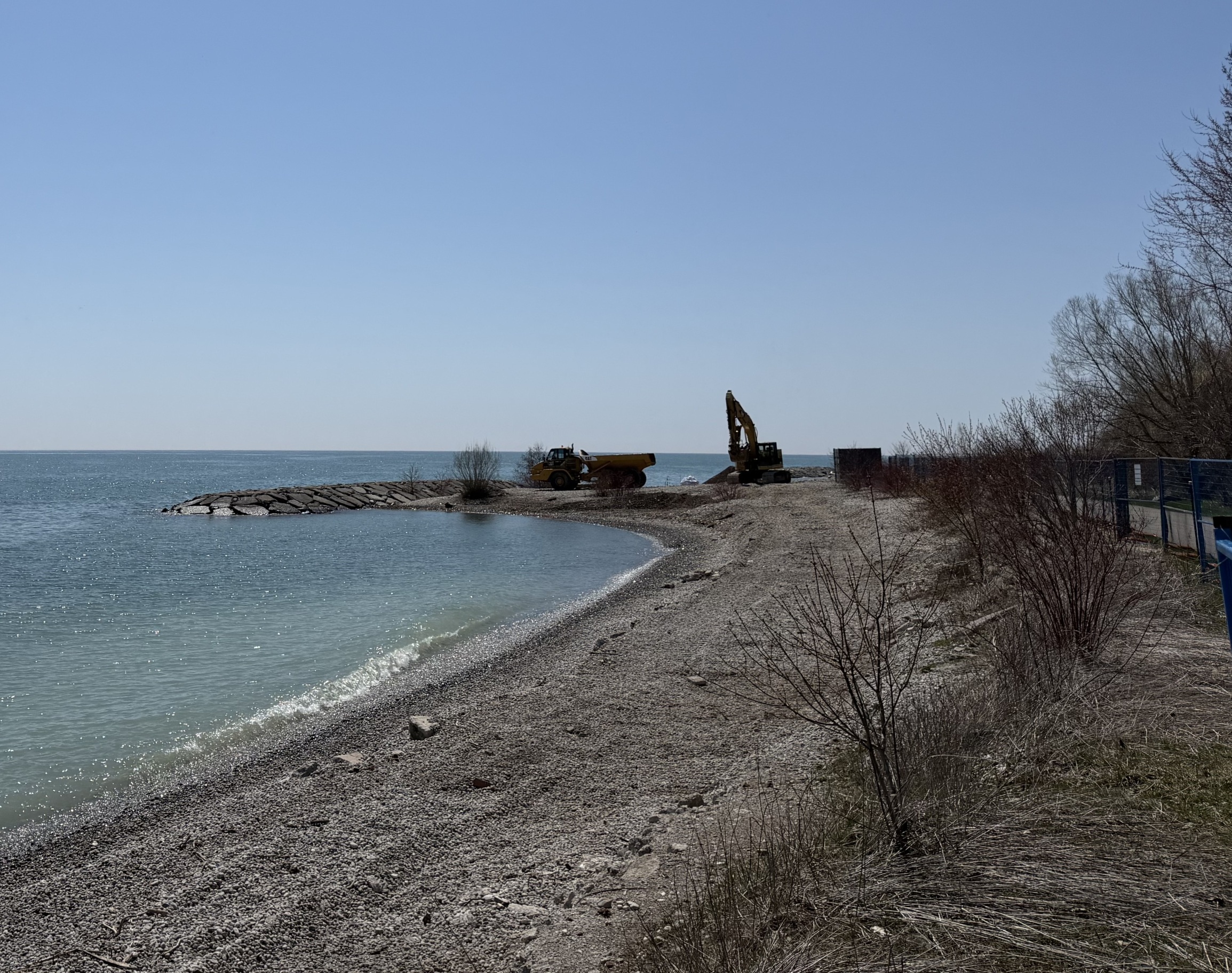
- Placing the new cobble material along the shoreline. Cobble size will be similar to material already present on site to maintain recreational use
- Restoring the site including reseeding and tree planting
The proposed modifications will allow the shoreline erosion control structure to better absorb wave impact and be more resilient to changing to lake levels.
Construction Information
Work began in April of 2026 and is scheduled to be completed by winter of 2026. Any timeline updates will be posted here as the project progresses.
Construction activities will include material deliveries to the park by barge on weekdays during work hours where possible. Occasional conditions such as extreme weather or low water levels may require deliveries to occur outside this window.
Phasing
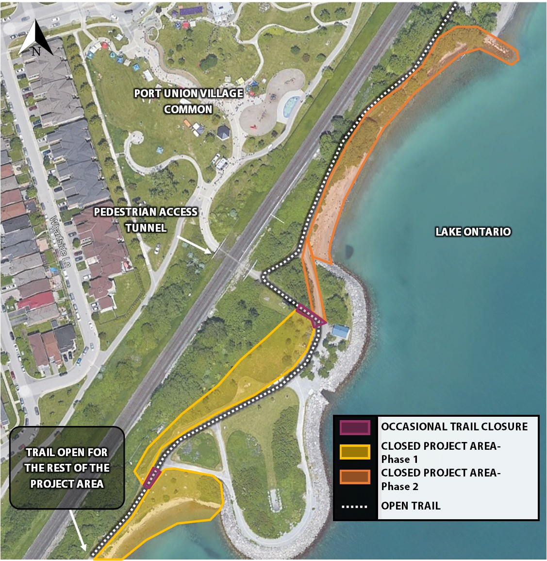
Work will generally be completed from west to east in two continuous phases. Phase 1 will occur from April to August 2026 and includes the four western beaches. Portions of the Phase 1 area may reopen as beaches are completed, subject to site conditions. Phase 2 will occur from September 2026 to December 2026 and includes the easternmost beach. This will likely require an access road and intermittent closures of the trail, however, if site conditions permit, this access road may not be required. Please see the phasing map below.
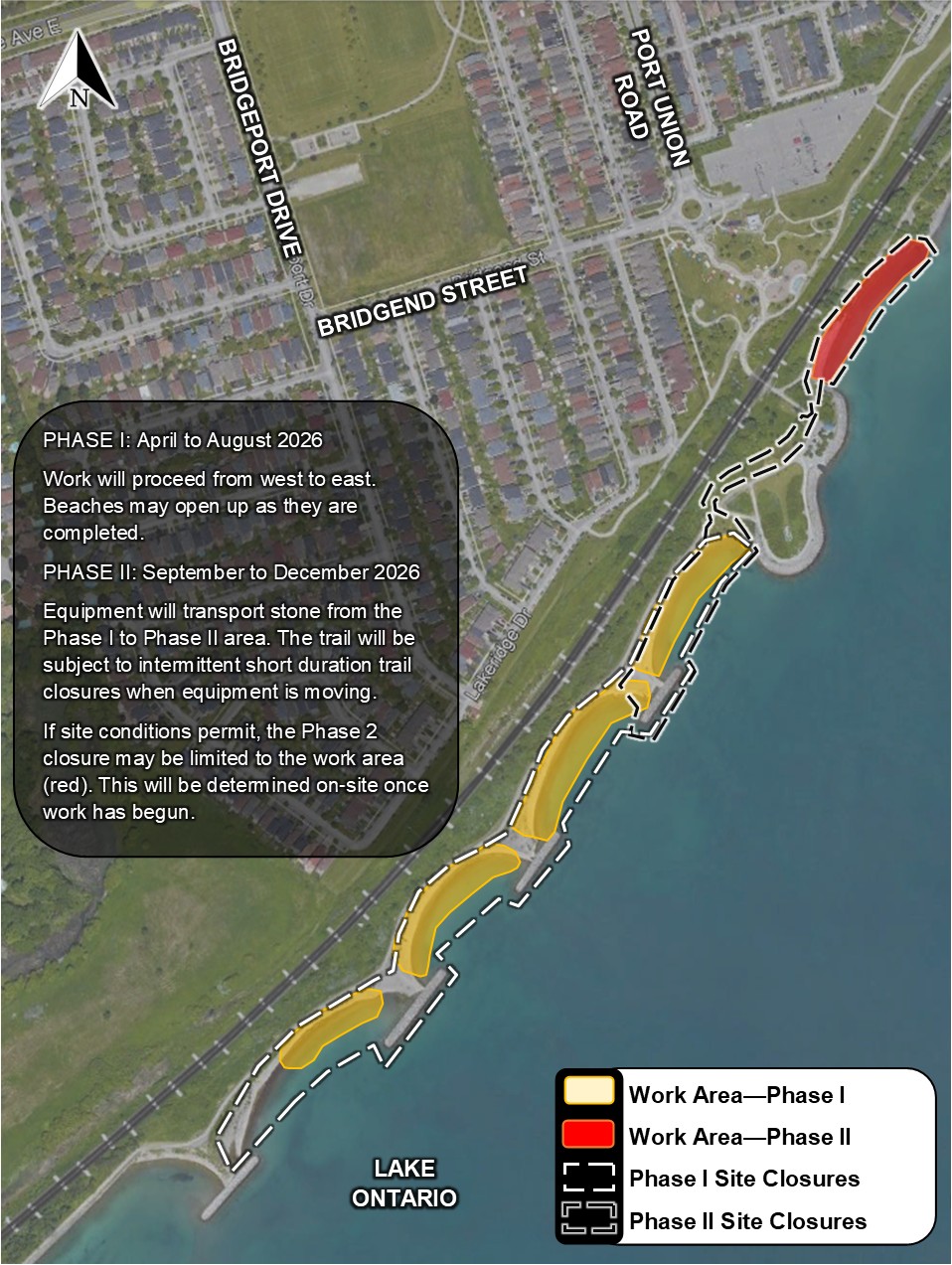
The trail will remain open and usable throughout the project. Please see the trail map below.
Public Notices
Public Information Session
The Project Team hosted a Public Information Session to engage with community members and answer questions about the upcoming shoreline work. The Session happened on Thursday, March 12, 2026 at the Port Union Community Recreation Centre. Please see below for the panels that were presented at the Information Session.
Public Information Session Panels
Notice of Construction
Select the image below to view full-sized.
Progress Updates
July 6, 2026
The crew has begun to prepare the site to receive stone from barge. The headland is being temporarily reconfigured as a barge dock and a stockpiling area.
April 14, 2026
Construction staff have mobilized on-site and begun setup work, including fence installation.
Frequently Asked Questions
Is this related to the project at Rouge Beach?
The Port Union project is separate from the Rouge Beach Improvements Project, which has been undertaken by Parks Canada. Please visit their website for more information.
The trail closure east of Chesterton Shores is part of the Rouge Beach project and is unrelated to TRCA’s work on the Port Union project.
Will the trail be closed during the project?
The trail will remain open throughout the project. There may be occasional minor delays when machines are crossing from the Phase I to the Phase II area. Please see the trail closures map in the Construction Information section.
Will the whole shoreline be closed throughout the project?
The project will be phased so that not all sections of the project area will be closed at once. Work will proceed from west to east, and as sections are completed, the shoreline will be opened up. Phase II will not be closed until Phase I is completed. Please see the phasing map in the Construction Information section.
How is the project being funded?
This project is funded by the City of Toronto and a federal grant funding program from Infrastructure Canada’s Disaster Mitigation Adaptation fund. The total cost for both Phase I and Phase II of the Port Union Waterfront Park Shoreline Maintenance Project is projected at $10 million, which will protect the park and habitat from erosion and flooding long-term.
You’re using material similar to what was there before – why?
A larger amount of material will be placed compared to the original designs from the mid-2000s, making it less likely for it to be washed out during storms.
A coastal analysis was completed to assess the conditions and to review how the designs will respond in severe weather events. The proposed shoreline nourishment life span is expected to provide enough protection for the trail for the next 25 years.
Will there be construction traffic in the nearby neighbourhoods?
Stone delivery will be done by using barges, which will reduce impact to the local community and allow us to maintain trail access. Small vehicles use can be expected in the local neighbourhoods for refueling and general maintenance.
What will it look and sound like during construction?
Construction noise can be expected during regular working hours from Monday to Friday from 7:00 a.m. to 5:00 p.m. Heavy equipment such as loaders, excavators, and rock trucks will be used along the waterfront, moving and placing stone. Trucks will also be using backup beepers during work hours.
What are you doing to protect vegetation and wildlife?
To protect vegetation, we are removing only necessary trees and shrubs, and we will protect remaining trees with hoarding and fencing. When the shoreline work is complete, disturbed areas will be restored with native plantings.
To prepare the site for planting, TRCA will be clearing the invasive dog-strangling vine from the restoration area in June/July of 2026.
To protect wildlife, we will avoid removing trees during sensitive periods to protect birds, and we will monitor fish communities to ensure we are not working while fish are spawning.
Contact Us
The Planning Team is located at TRCA’s Boyd Field Centre in Vaughan:
Restoration and Infrastructure Division, Erosion Risk Management
9755 Canada Company Avenue
Vaughan, Ontario
L4H 0A3
For more information regarding this project, please contact the Project Manager:
Whitney Brennan, Project Manager
Erosion Risk Management
Restoration & Infrastructure
whitney.brennan@trca.ca
(647) 212-6871