Toronto and Region Conservation Authority (TRCA), in partnership with the Canada Water Agency, is planning an innovative shoreline restoration and protection project along part of Ajax Waterfront Park.
Following the Ajax Waterfront Erosion Mitigation Project Class Environmental Assessment completed in 2024, TRCA sought funding through the Great Lakes Freshwater Ecosystem Initiative to implement a nature-based approach to shoreline protection that mimics the historic shoreline along approximately 1km of Ajax Waterfront Park.
SHORELINE WORK COMPLETE
JULY 2026
Ajax Shoreline Project in-water work is now complete, and restoration activities on site are set to begin shortly. Construction demobilization is expected to be complete by the end of July. While the staging area will remain fenced to ensure proper grass regrowth, The Waterfront Trail is now fully open for use. For more information on restoration activities on site, see Project Updates below.
LEARN MORE ABOUT THIS PROJECT


Project Area
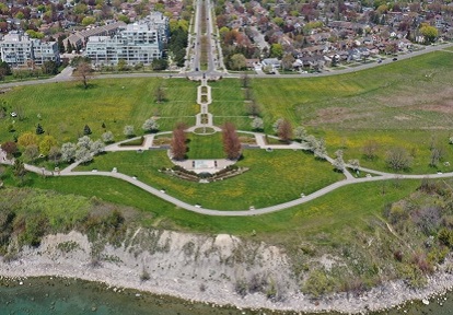
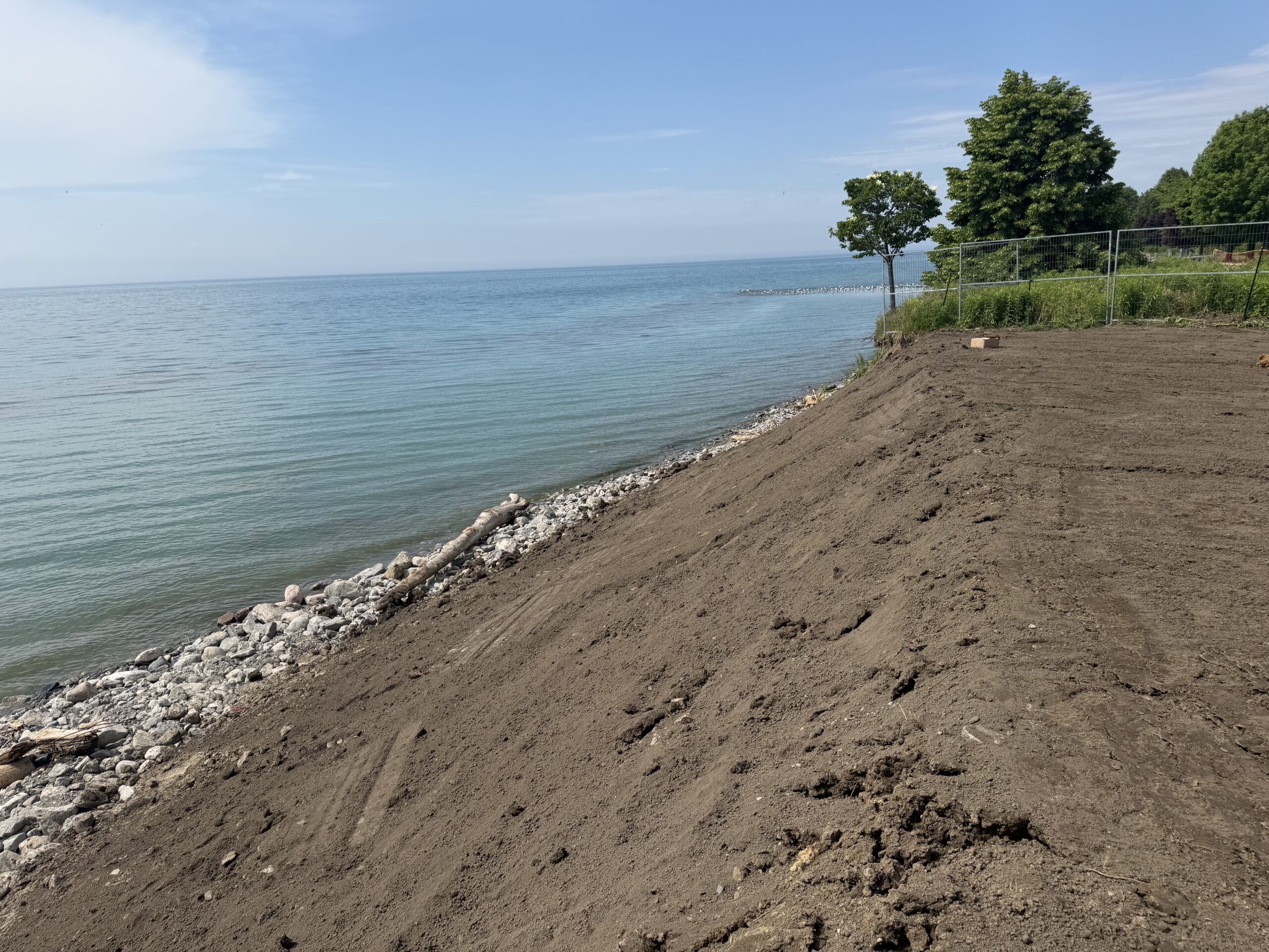
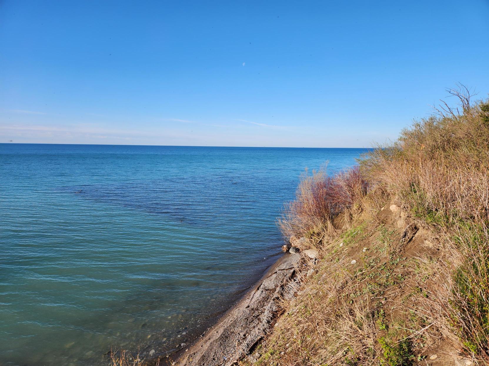
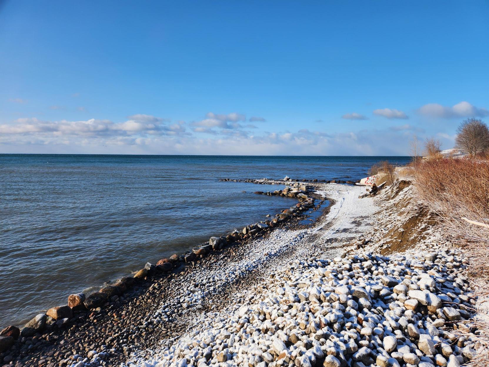
The Ajax Shoreline Project area is within Ajax Waterfront Park. The park has been a natural buffer between Lake Ontario and local development for over 60 years; once agricultural land, the waterfront area now exists as public space with the Waterfront Trail, playgrounds, gardens, and the Ajax Water Supply Plant.

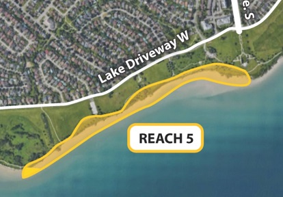
The project area is roughly 1 kilometer of Ajax Waterfront Park shoreline between Lion’s Point and Veteran’s Point.
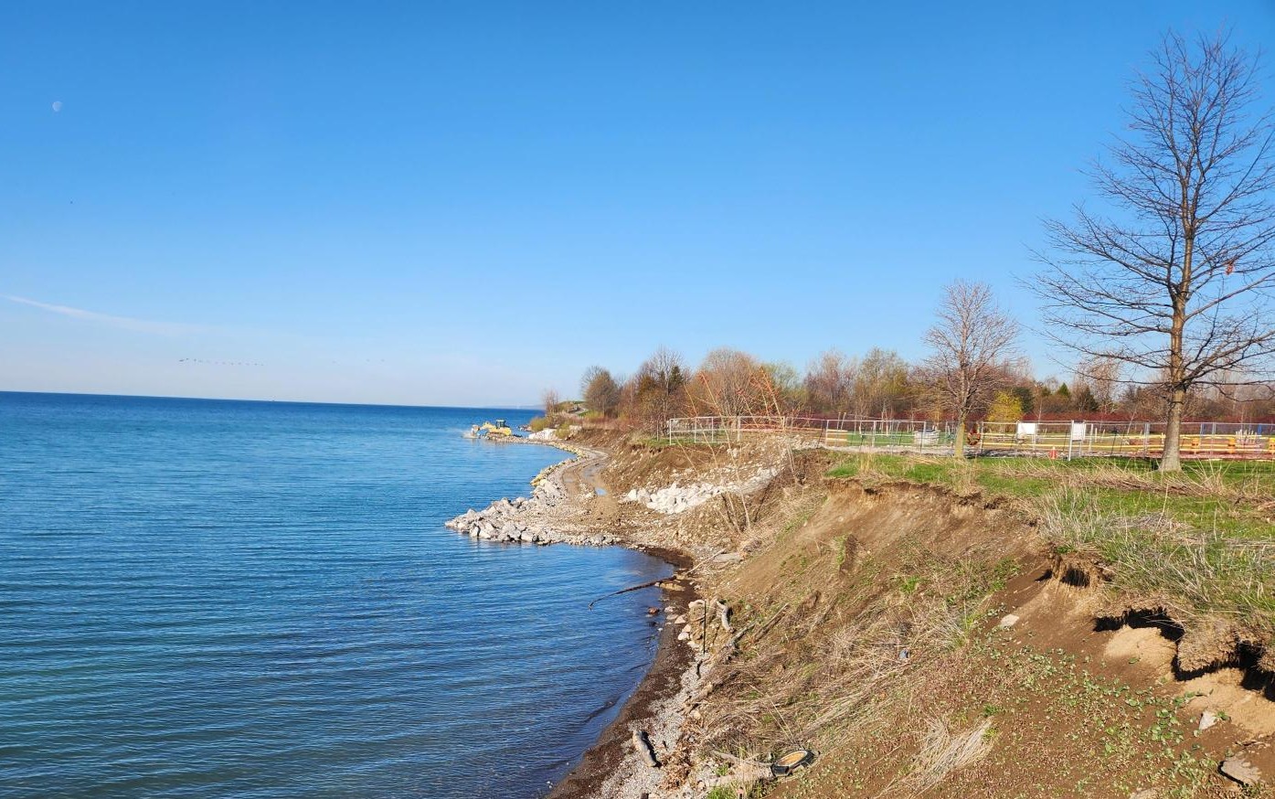
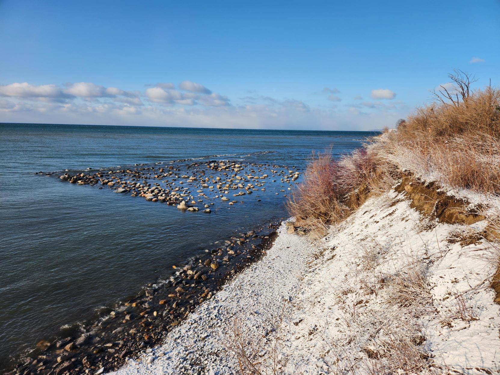
The area is characterized by high bluffs and sandy rocky beaches; it is experiencing visibly rapid erosion, which is becoming a public safety hazard and threatens infrastructure like The Waterfront Trail.
Through the Environmental Assessment process, TRCA identified this stretch of shoreline as one of two high priority areas to address in Ajax Waterfront Park.
The project will take place in two stages; stage 1 will focus on the area west of the Love Crescent parking lot to the storm drain outfall, and Stage 2 will address the area east towards Veteran’s Point Gardens and west of the outfall towards Lion’s Point.
Stage 2 work on site will depend on future funding opportunities.
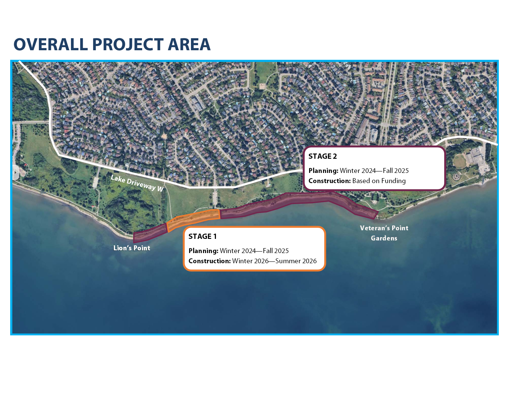
Ajax Shoreline Project Area, with Stages. Source: TRCA, 2026
Project Area Images
View slideshow:
Current Conditions
View slideshow:
Proposed Work
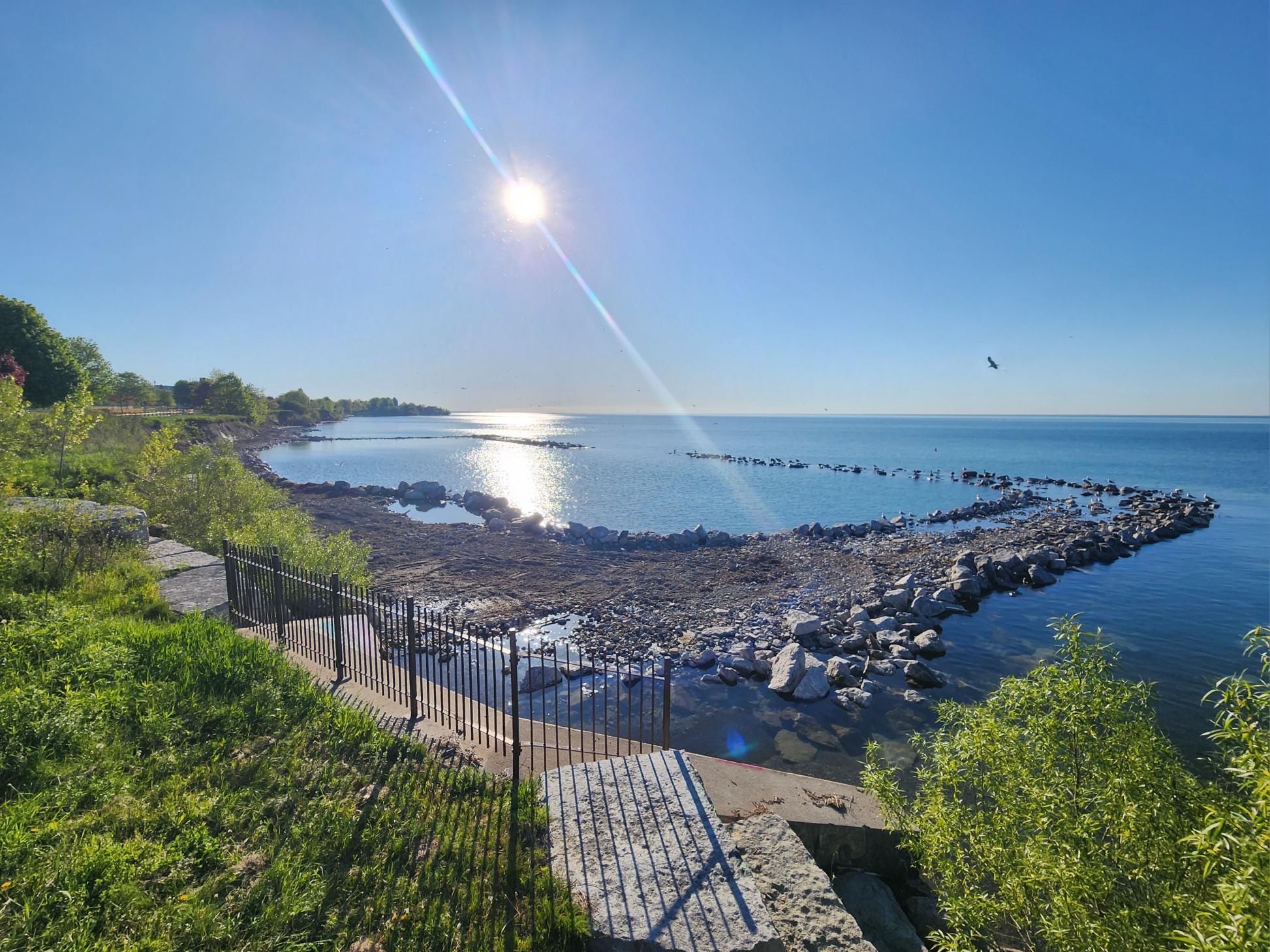
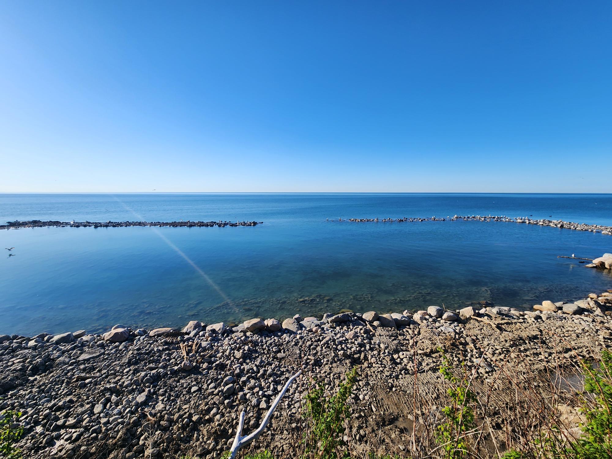
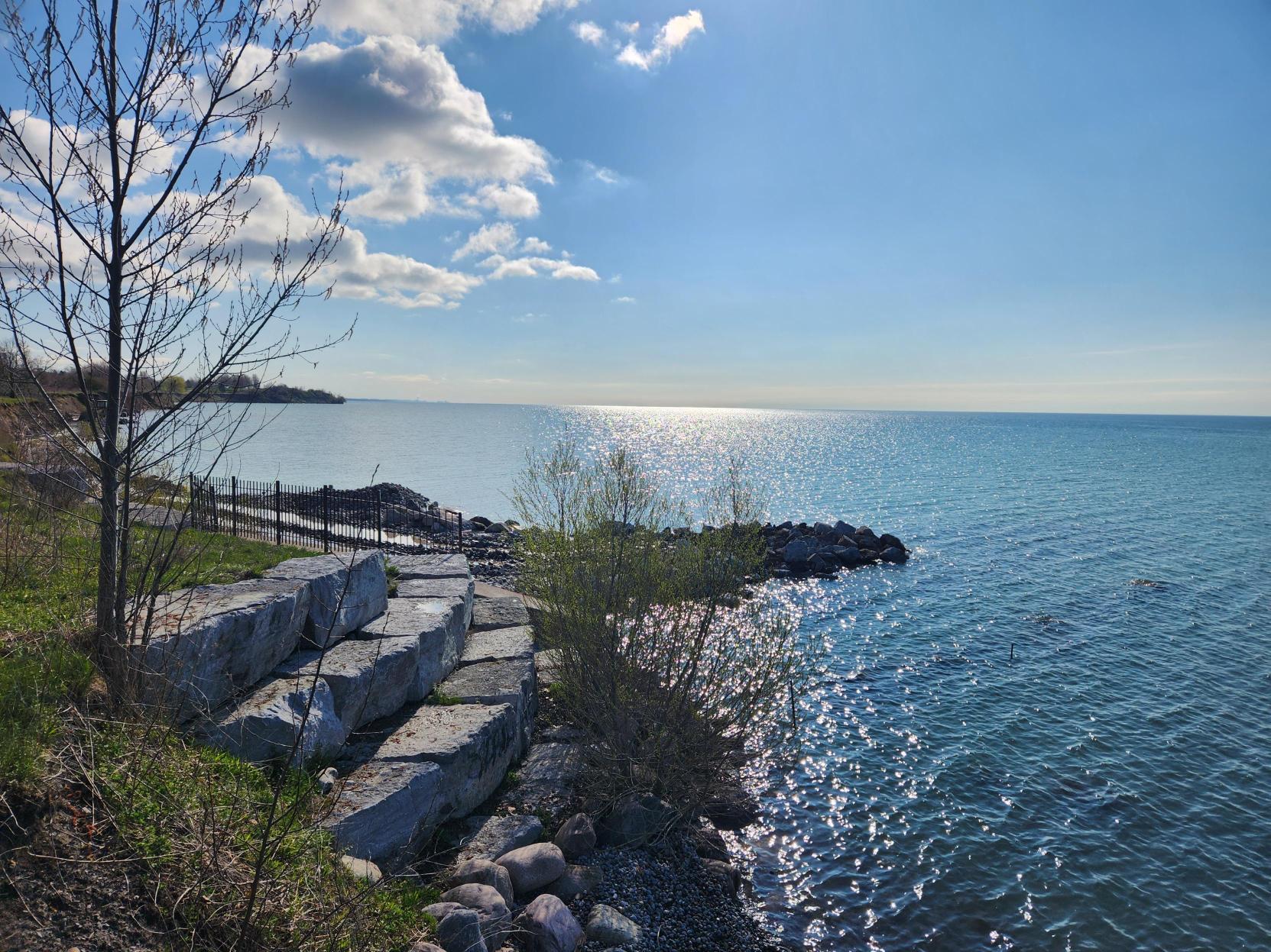
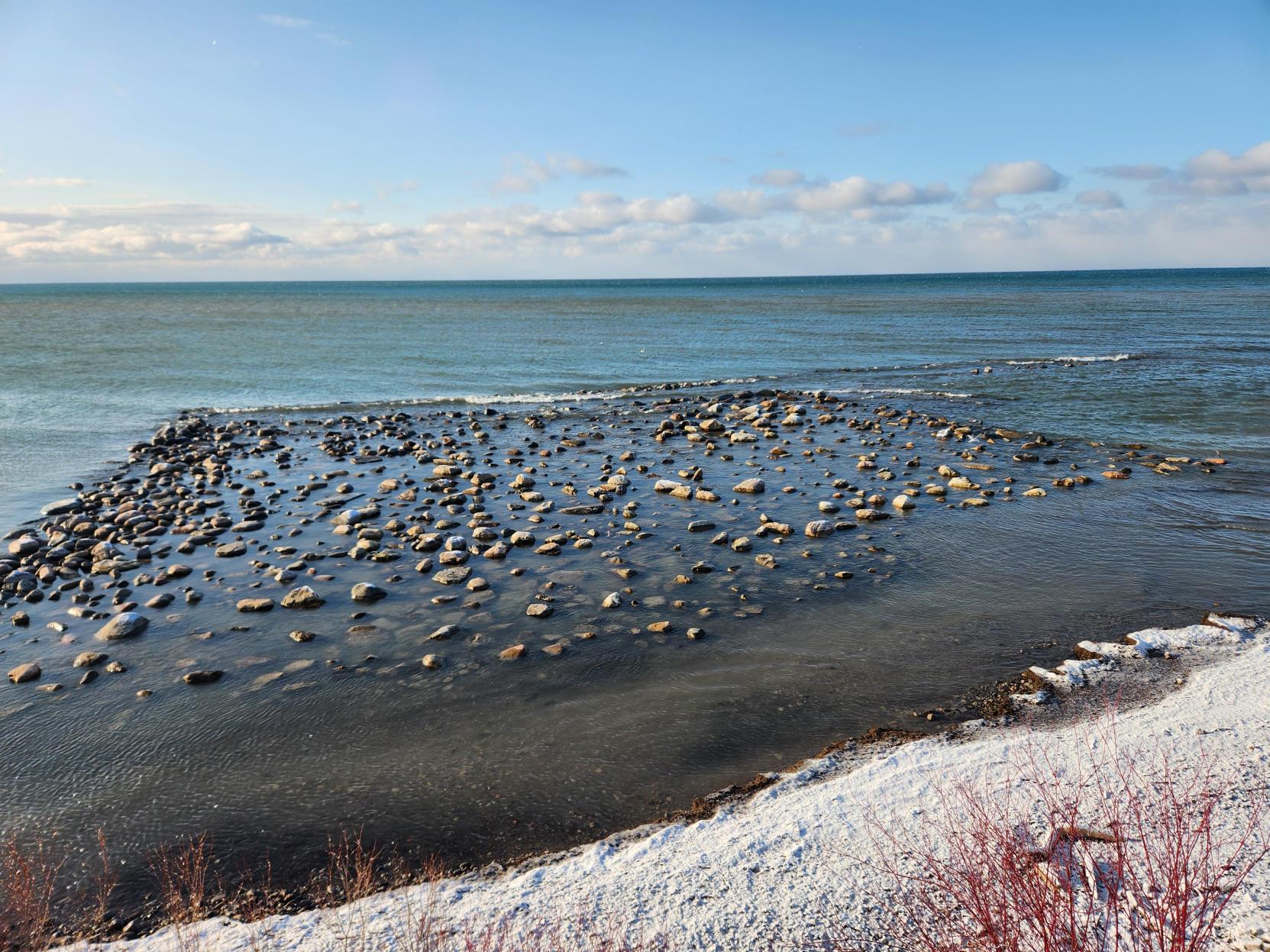
Through the Environmental Assessment process, TRCA identified that erosion in project area would be best addressed through a cobble boulder shoreline.
This shoreline would mimic historic natural conditions before a practice called stonehooking removed stones from lake Ontario shorelines.

Coupled with more intense and frequent storm events fueled by climate change, the Ajax Waterfront shoreline is vulnerable to hazardous erosion conditions.
The proposed cobble and boulder shoreline uses natural processes and a mix of large and small stone material to provide:
- Protection from waves to reduce erosion impacts to parkland, trails,
and infrastructure - A range of shoreline conditions supporting habitat and plant growth
- A more natural shoreline and beach condition
- Ongoing recreational use of the beach
What is a “Cobble and Boulder Shoreline”?

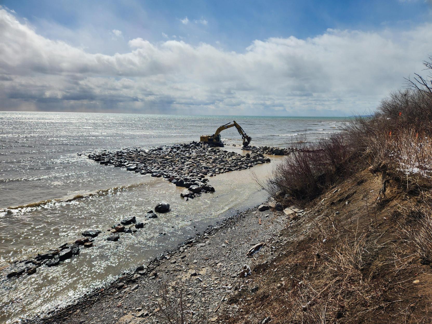
A “cobble and boulder shoreline” is a design that provides erosion protection through adding more stone material to the shore. However, the Ajax Shoreline Project is unique because the approach being used will allow waves to move and naturally direct where the stones go.
Instead of placing cobbles and boulders directly onto the shoreline, they will be placed underwater and along the beach where it meets the water for erosion protection.
The boulders will stay mostly underwater and provide a barrier, while wave action will push the cobbles onto the shoreline over time. This will create a more resilient and natural beach, similar to what existed many years ago.
This is a unique installation of a cobble boulder shoreline because of the random natural movement of cobbles by waves.
What Could a Cobble and Boulder Shoreline Look Like?
View renderings:
Previous Projects and Studies
Ajax Waterfront Class Environmental Assessment (2024)
- Study of erosion across Ajax Waterfront Shoreline
- Identified high priority areas including the Ajax Shoreline Project site
- Incorporated public feedback into final shoreline protection proposals

Duffin’s Creek Boardwalk (2020)
- Built a boardwalk to replace trail prone to flooding
- Highlighted flooding and erosion concerns in the park
- Allowed public access along Duffin’s Creek

Love Crescent Outfall (2019)
- Protected Town of Ajax infrastructure from erosion
- Currently within the project area

Shoreline Erosion Monitoring

Any work planned along the Ajax Waterfront Park shoreline will also fall into TRCA’s ongoing Shoreline Erosion Monitoring program.
About the Shoreline Erosion Monitoring Program:
- Part of recommended solutions developed in the 2024 Environmental Assessment
- Paired with any shoreline restoration or protection work
- Teams monitor erosion rates and site conditions
- Will measure how effective shoreline restoration is and keep information current
- Can help inform future funding for shoreline restoration
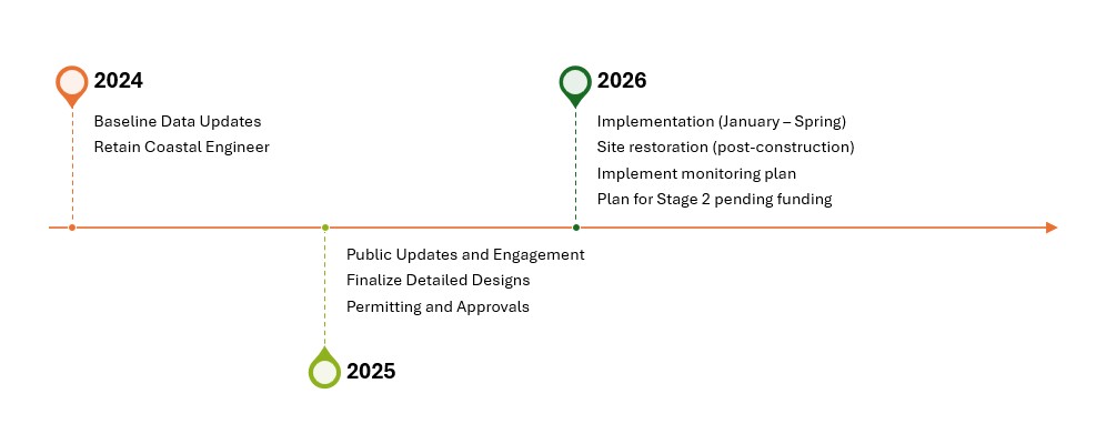
Project Timeline
Public Notices and Events
The Ajax Shoreline Project Team thanks members of the public who attended our Public Update Sessions before work began. We appreciate your feedback and support. If you were unable to attend, please find session materials from both events below:
November 18th, 2025 Session Panel:
11-18-2025 ASP Info Panel
March 19th, 2025 Session Panels:
03-19-2025 ASP Info Panel 1
03-19-2025 ASP Info Panel 2
NOTICE OF CONSTRUCTION
Ajax Shoreline Project Notice of Construction
Project Updates
JULY 2026
Shoreline restoration in-water work for the Ajax Shoreline Project is now complete, and the Construction team is working on site restoration and demobilization activities. Restoration activities include topsoiling and seeding the staging and stockpile area, demobilizing site facilities and construction equipment.
Additional restoration activities that will continue in the summer and fall include: invasive species removal, trail repaving, native plantings, and grass terraseeding. The staging/stockpiling area will remain fenced to ensure successful grass establishment and regrowth, but the Waterfront Trail will be fully open for use.
JUNE 2026
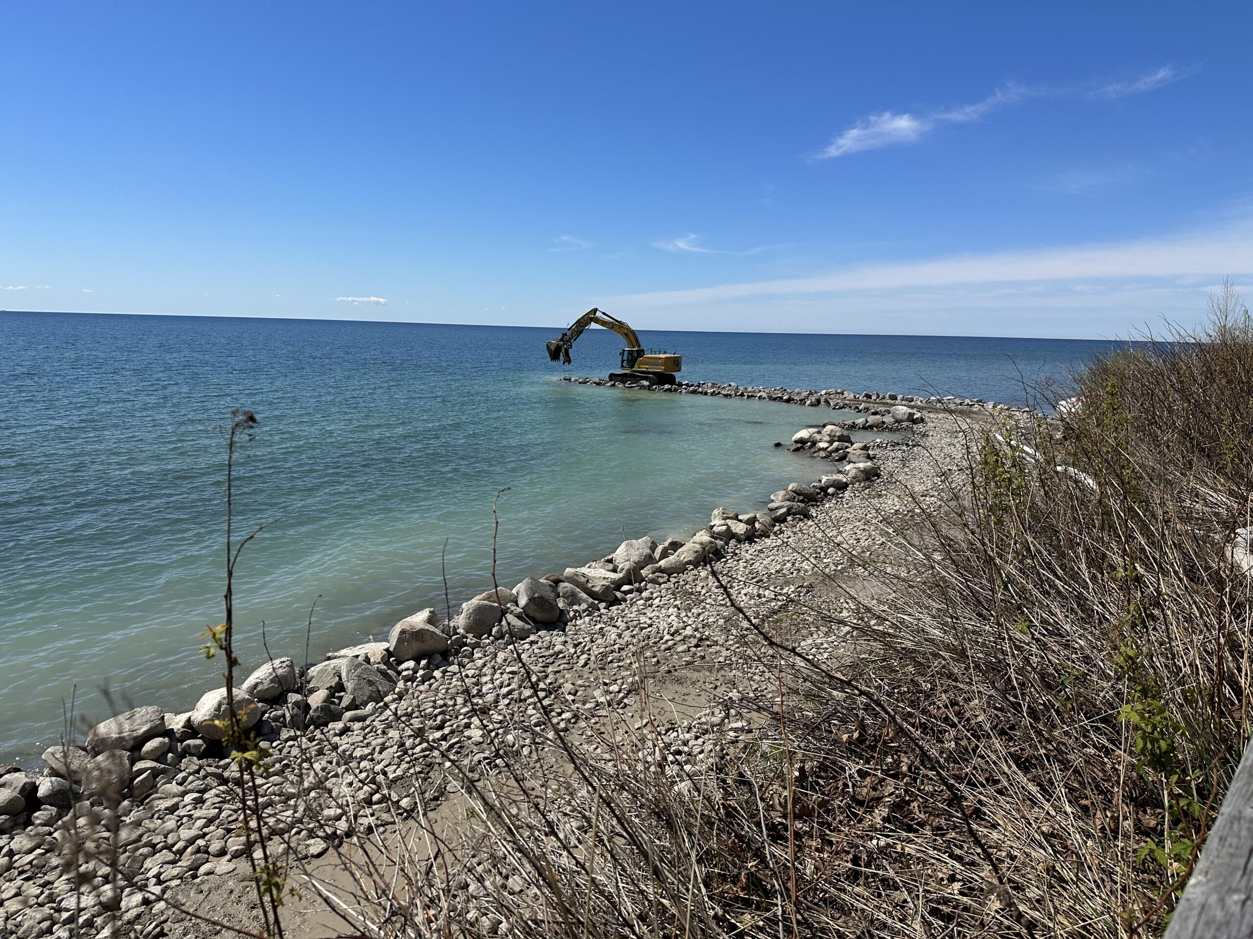
Ajax Shoreline Project construction is around 75% complete; crews are working their way towards the western limit of the Project Area, place cobbles and boulders below the water line. The team estimates that construction will be complete by the end of June, and will pivot to restoration work beginning in July.
MAY 12, 2026
An access road has been established along the shoreline at water level, and has been built into the lake to allow for the placement of stone below the water line.
MAY 2026
TRCA construction crews have remobilized on site following a brief site closure and are continuing work on the western portion of the project area.
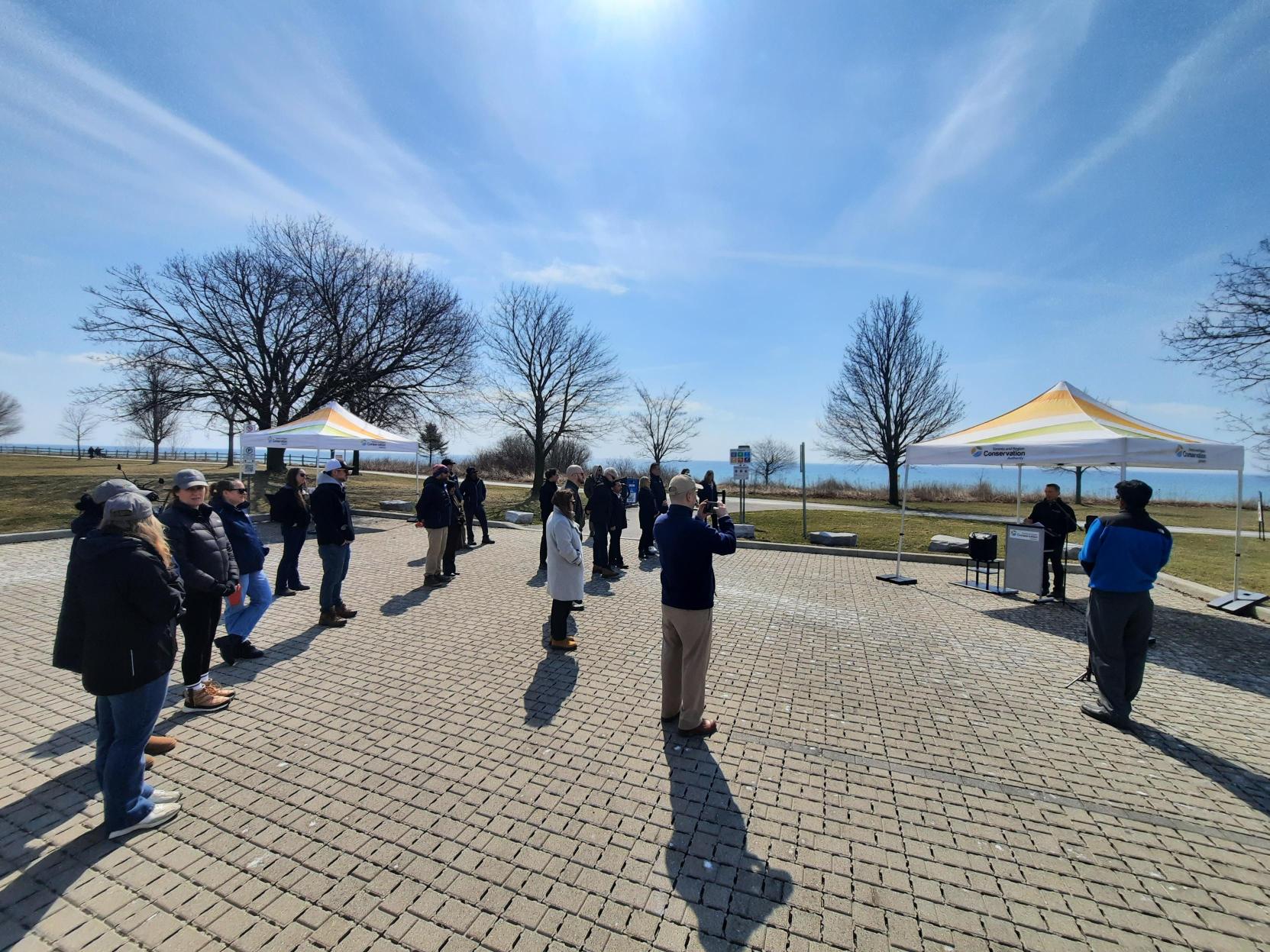
APRIL 09, 2026
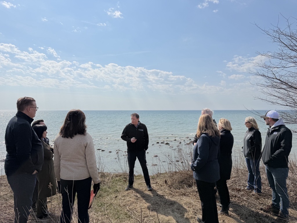
TRCA, in partnership with Canada Water Agency (CWA), met on site to recognize the progress made on the innovative Ajax Shoreline Project. Representatives from Town of Ajax, the Province of Ontario and the Government of Canada were all present along with the Project Team to celebrate shoreline restoration at Ajax Waterfront Park.
Visit TRCA and Canada Water Agency Launch Shoreline Restoration Project in Ajax – Toronto and Region Conservation Authority (TRCA) for more details.
APRIL 2026
TRCA Construction crews have completed work at the eastern end of the project area and are now working on completing the western end of restoration designs. Crews will move back towards the eastern limit to complete shoreline restoration.
MARCH 2026
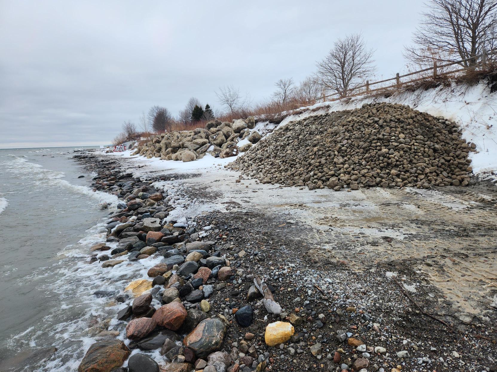
TRCA has begun in-water works placing cobbles and boulders close to the shoreline. Crews are working to complete as much of the shoreline restoration design as possible with the funding and material currently available. Approximately 50 meters of the eastern portion of restoration is complete.
WINTER 2026
The TRCA construction team has completed site set up and has started work moving cobbles and natural stone down to the shoreline to begin restoration work. Stone will be stacked on the shoreline temporarily before being moved out into the lake. Crews are working hard to maintain the site and make sure there is no unnecessary impact to Ajax Waterfront Park.
Contact Us
For more information regarding this project, please contact:
Whitney Brennan, Project Manager
Erosion Risk Management
Restoration & Infrastructure Division
whitney.brennan@trca.ca
647 212 6871