Detailed Design Process
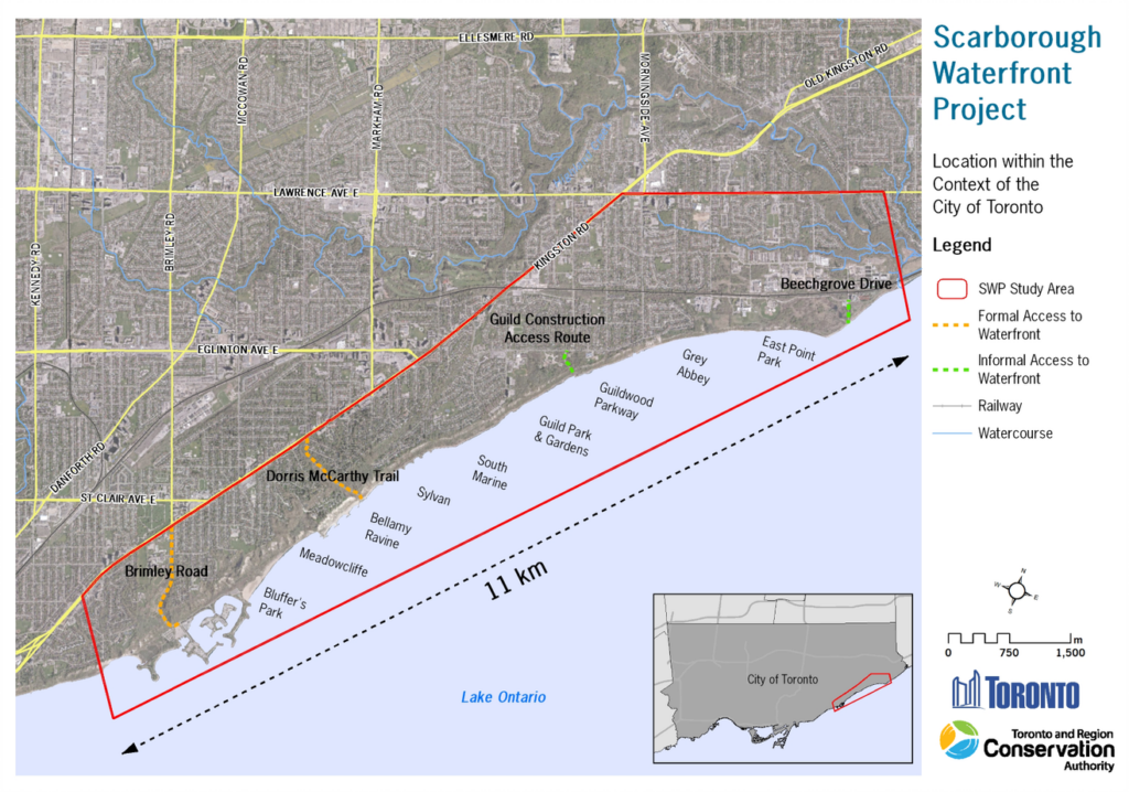
Toronto and Region Conservation Authority (TRCA) has completed the Detailed Design Process for the Brimley Road South Multi-Use Trail and the Scarborough Waterfront Project (SWP) West Segment Shoreline and Multi-Use Trail.
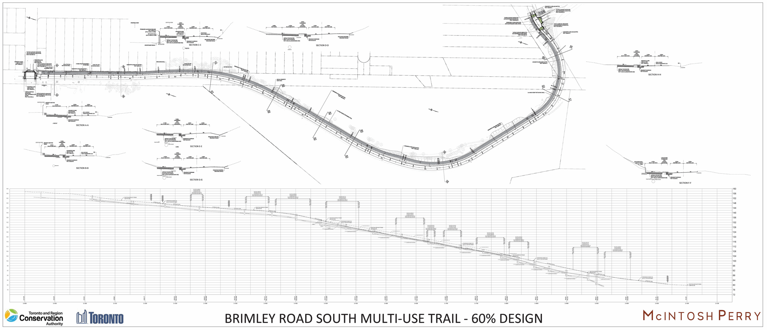
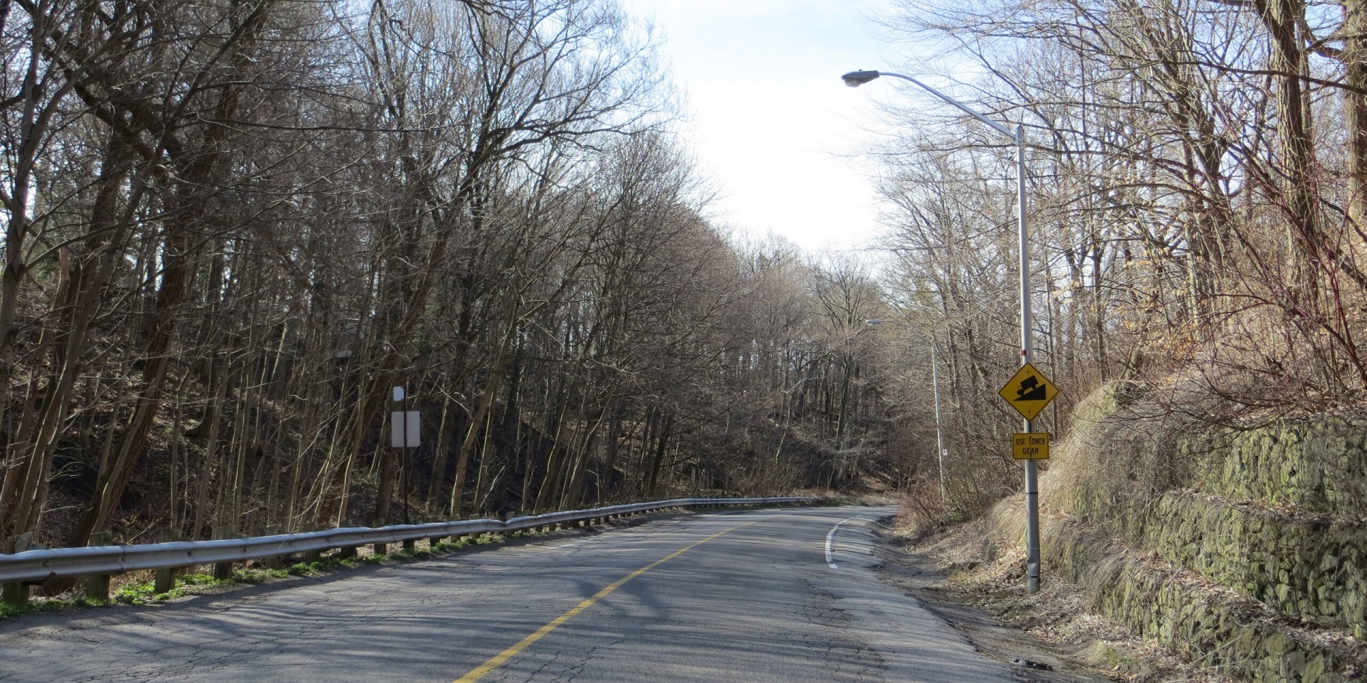
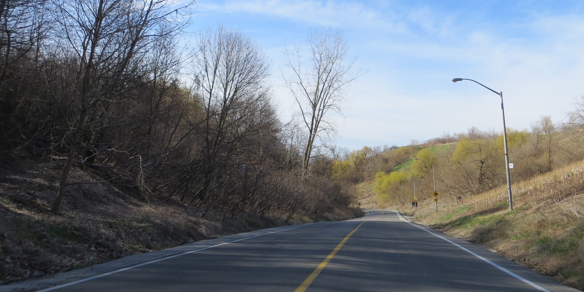
Brimley Road South Multi-Use Trail
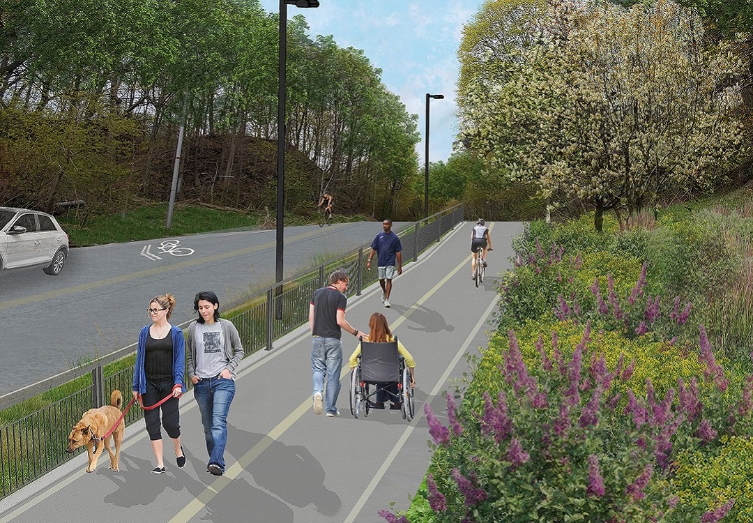
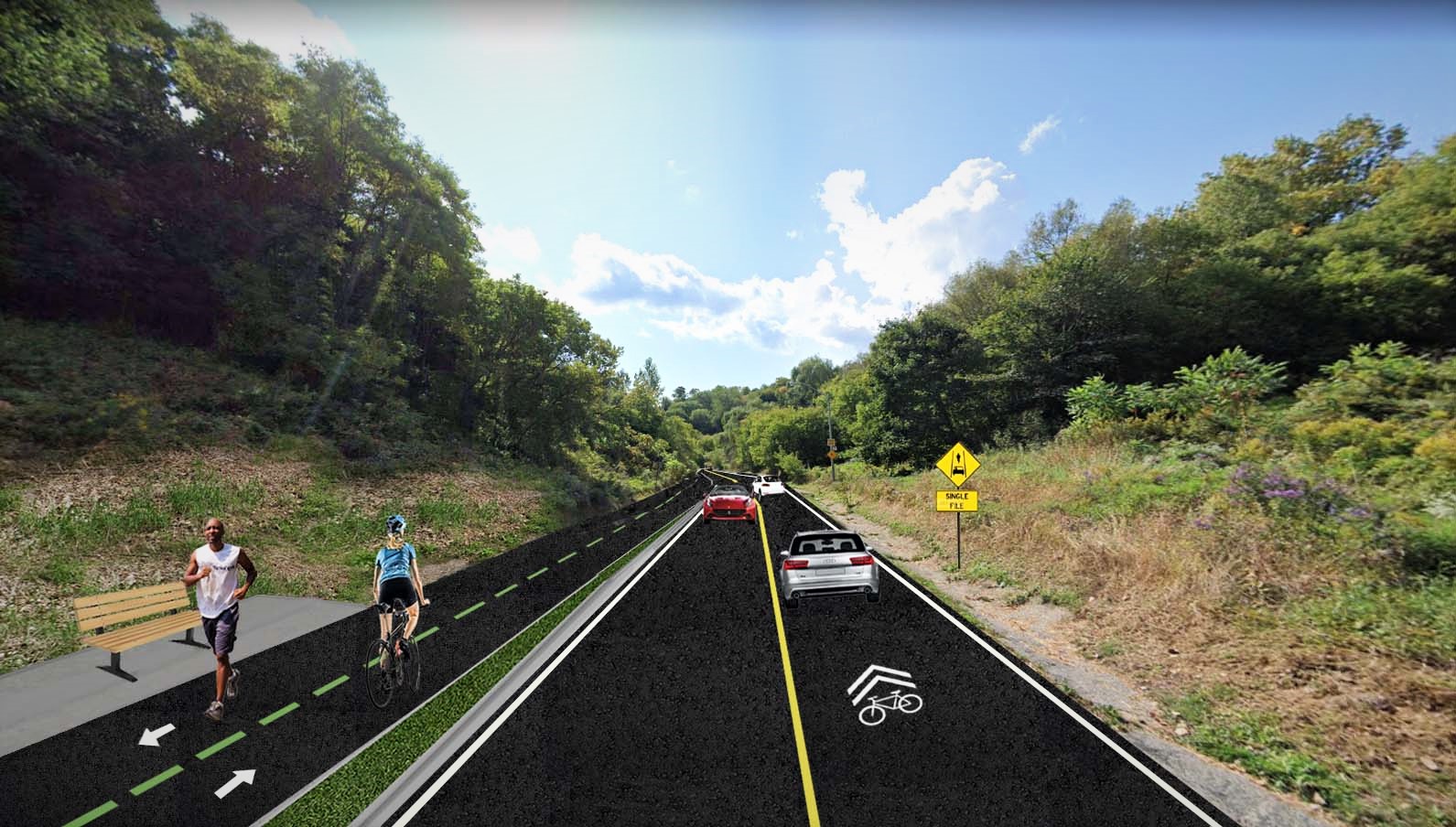
This component of the SWP West Segment includes construction of an at-grade 3.0 to 5.1 metre wide paved and illuminated trail along the east side of Brimley Road South, starting at Barkdene Hills and ending at Bluffer’s Park Road.
Select the images below to view full-sized.


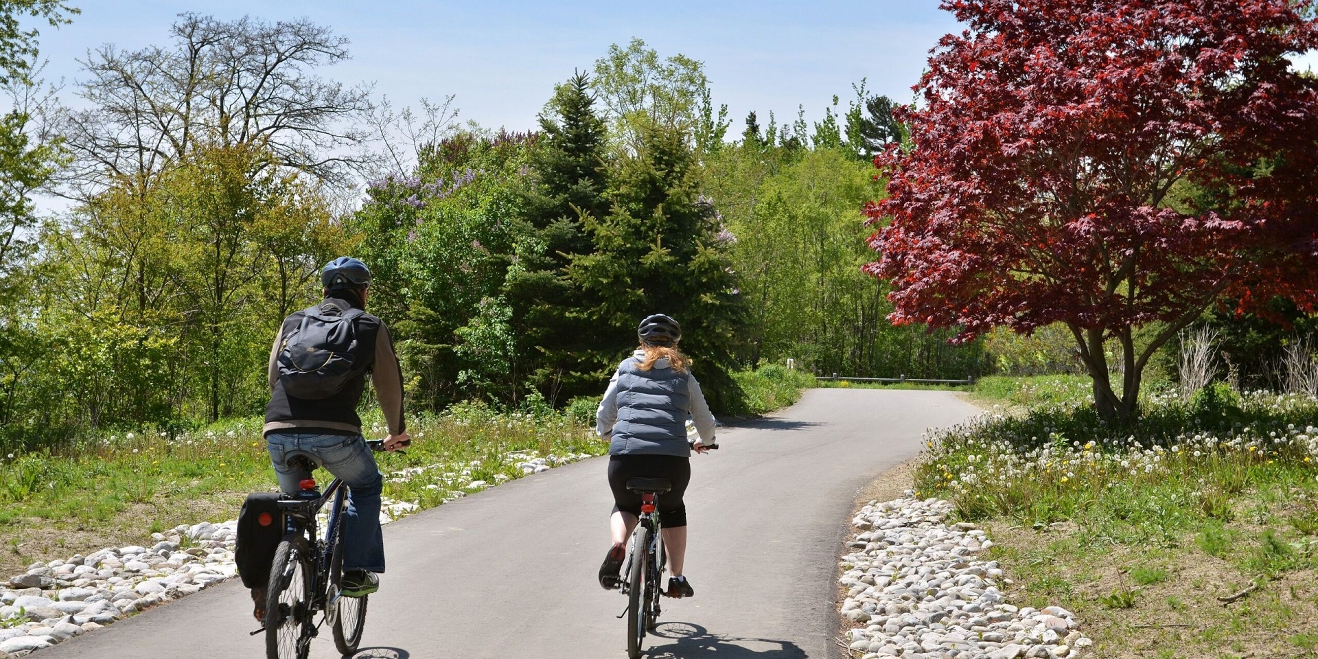
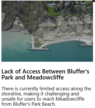
West Segment – Shoreline and Multi-Use Trail
This component of the SWP West Segment includes:
- An expanded headland off both Bluffer’s Park and Meadowcliffe
- A significantly larger sand beach
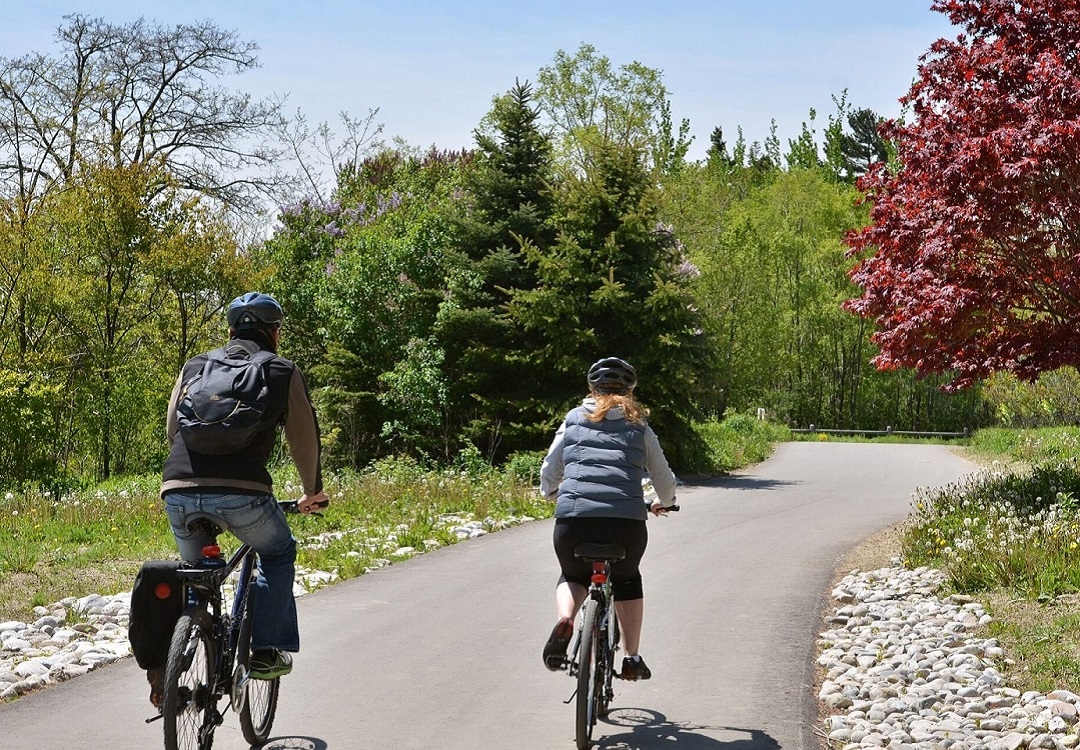
- A paved, separated 5.8m wide recreational multi-use trail to accommodate both pedestrian and cyclist usage along the beach, along with a 4.0m wide pedestrian trail along the new Bluffer’s Park headland
- Enhanced aquatic and terrestrial habitat
Select the images below to view full-sized.


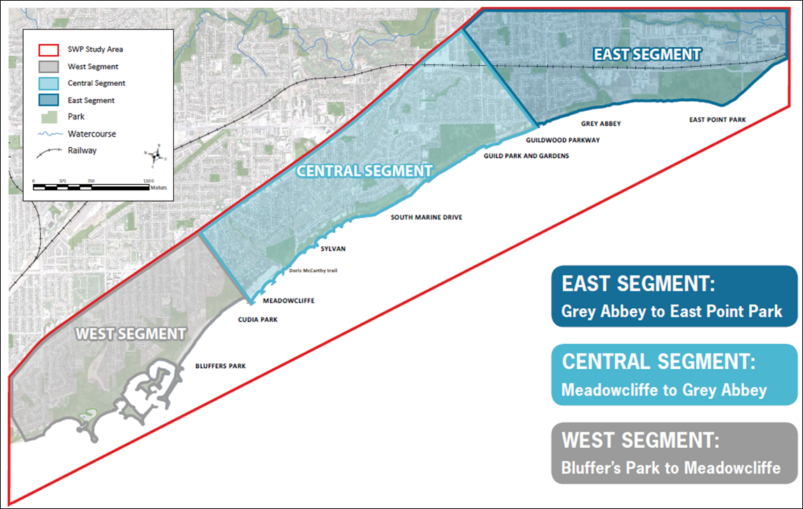
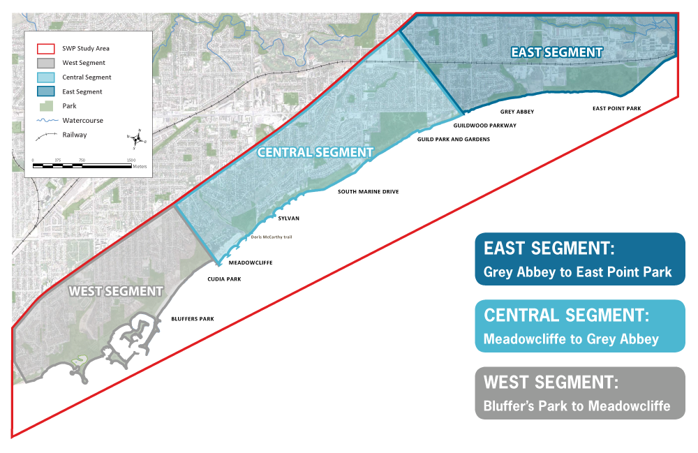
Central & East Segment
It is expected that Central Segment design works will begin after the start of West Segment shoreline and multi-use trail construction, and that East Segment design works will be initiated after the start of Central Segment construction.
Timelines for each phase will be dependent on project funding and are yet to be determined.
Public Engagement Events
Brimley Road South Multi-Use Trail Project
December 6 to 13, 2021
In December 2021, TRCA in partnership with the City of Toronto hosted a Virtual Open House for the Brimley Road South Multi-Use Trail Project.
Through this event, details on the revised 60% design, impacts and mitigation measures associated with construction, and next steps in the process were provided.
The Virtual Open House materials were accessible from December 6 to 13 for a self-guided review of informative panels/tiles, a video presentation, design drawings, and key maps, with a live question-and-answer (Q&A) event hosted on December 8.
Relevant event materials can be found below.
DOWNLOADS

- Renderings
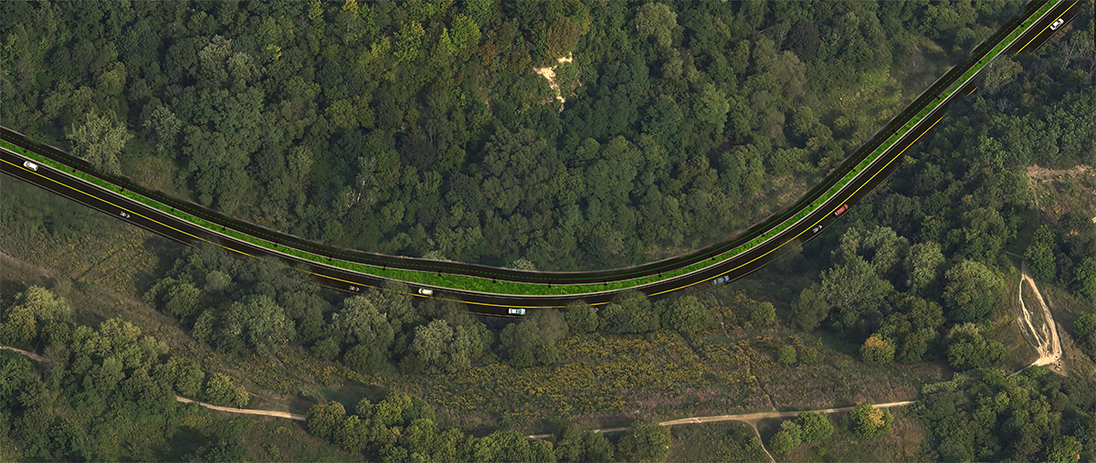
Bird’s Eye View

Bluffer’s Park
Midpoint

North Section
- Key Issues Maps
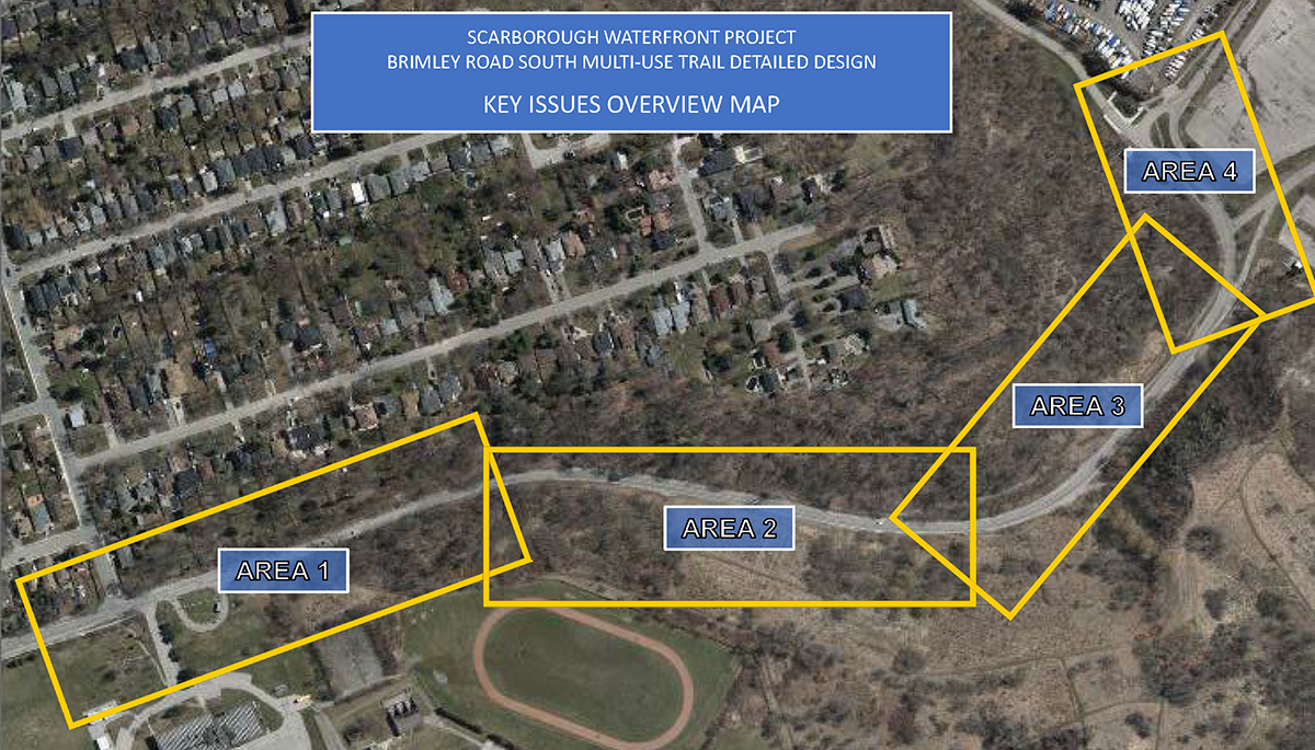
Key Issues Overview
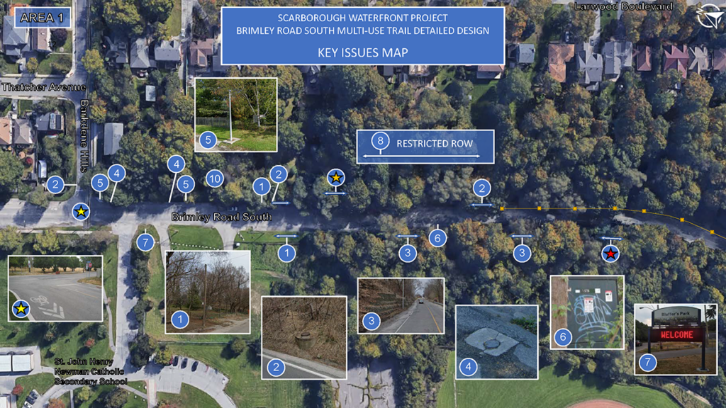
Key Issues Area 1
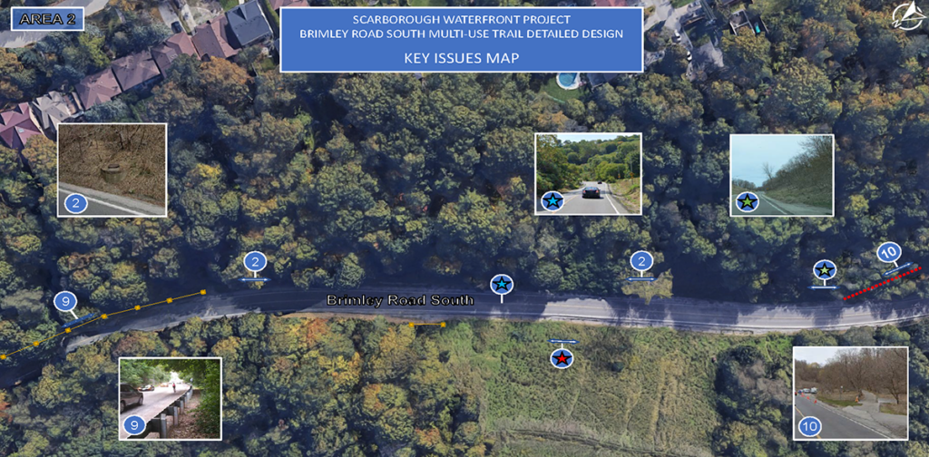
Key Issues Area 2
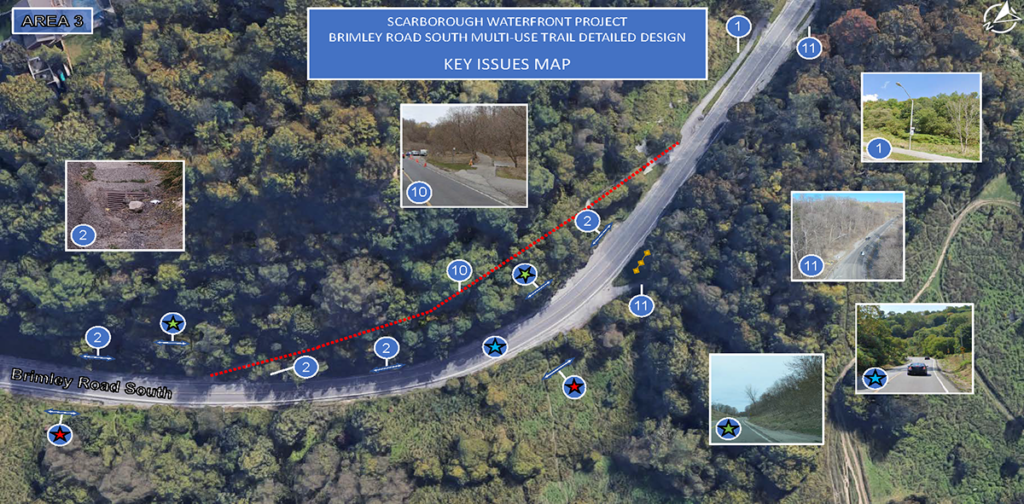
Key Issues Area 3
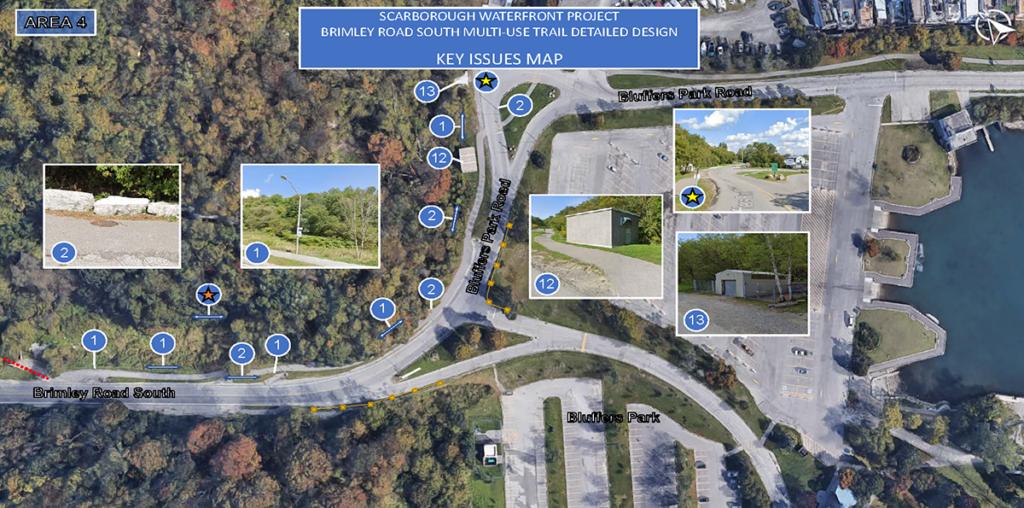
Key Issues Area 4
West Segment Shoreline and Multi-Use Trail
May 15 to June 9, 2023
In May and June 2023, TRCA in partnership with the City of Toronto hosted a Virtual Open House for the Scarborough Waterfront Project – West Segment Shoreline and Multi-Use Trail.
Through this event, details on existing conditions, the 60% designs, and next steps in the process were provided.
The Virtual Open House materials were accessible from May 15 to June 9, 2023 for a self-guided review of informative panels, project renderings, and key maps, with an on-site drop-in public information event hosted by the project team on May 28, 2023.
Relevant event materials can be found below.
DOWNLOADS
- Renderings
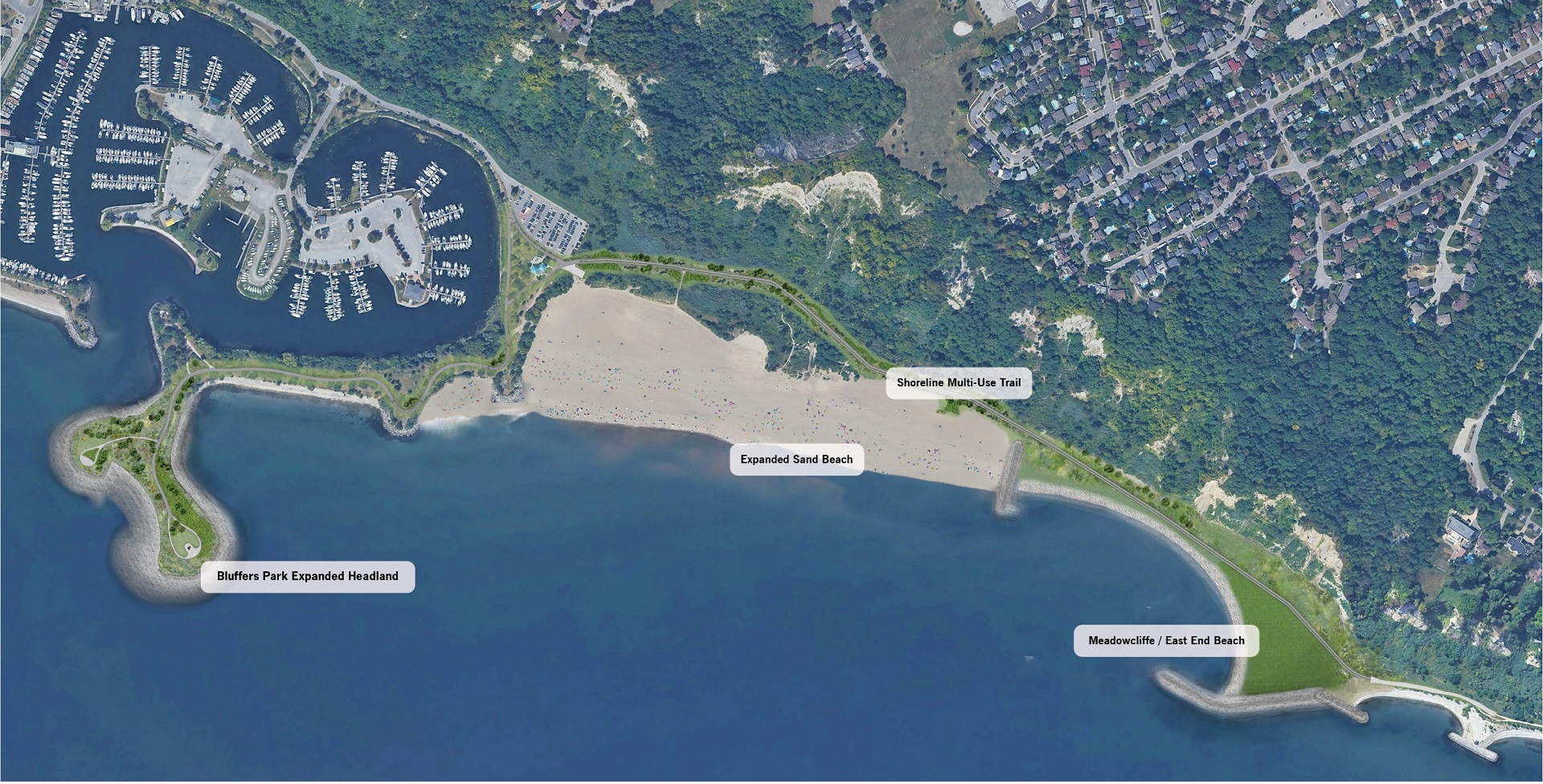
Master Plan
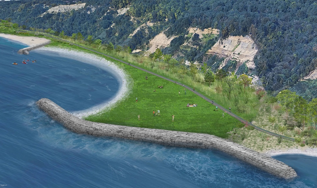
Meadowcliffe
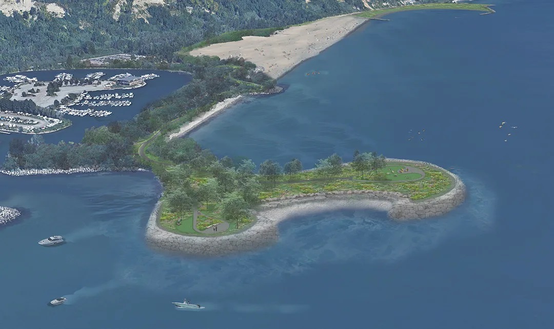
Headlands
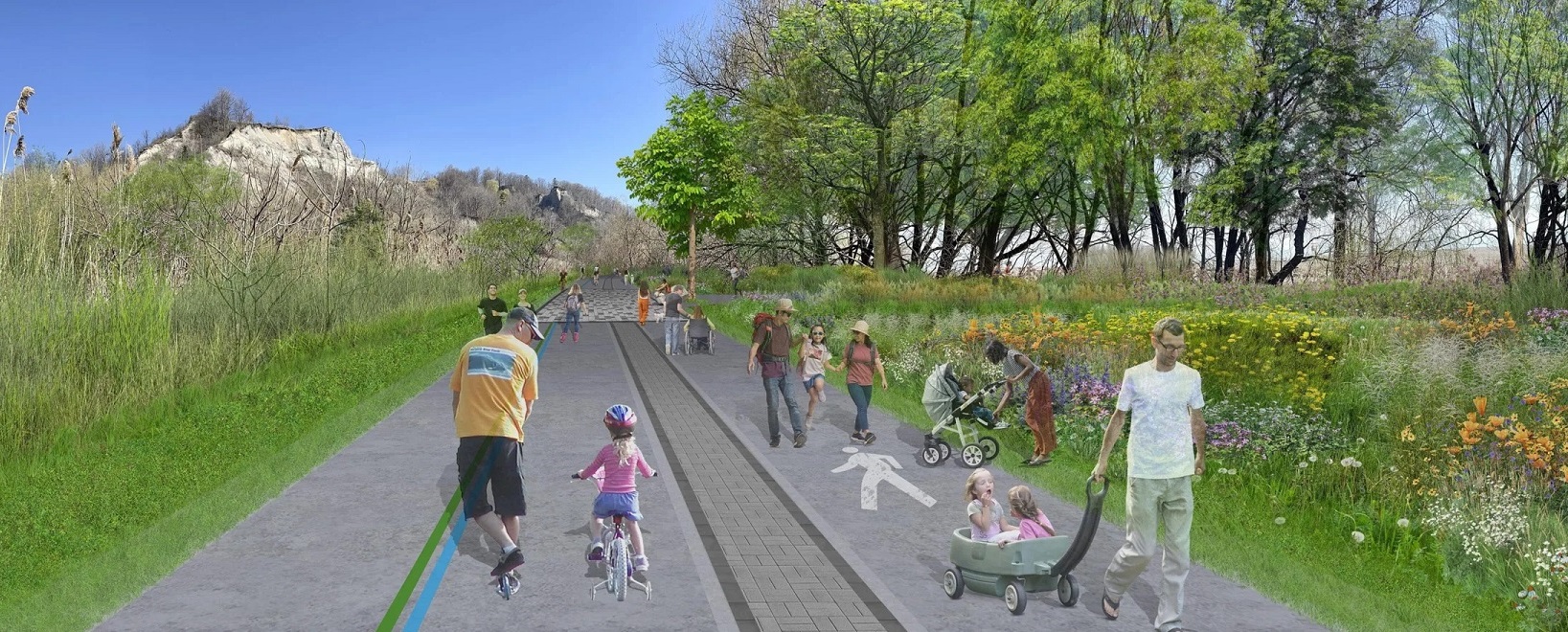
Beachside Trail
- Design
- Key Issues Map
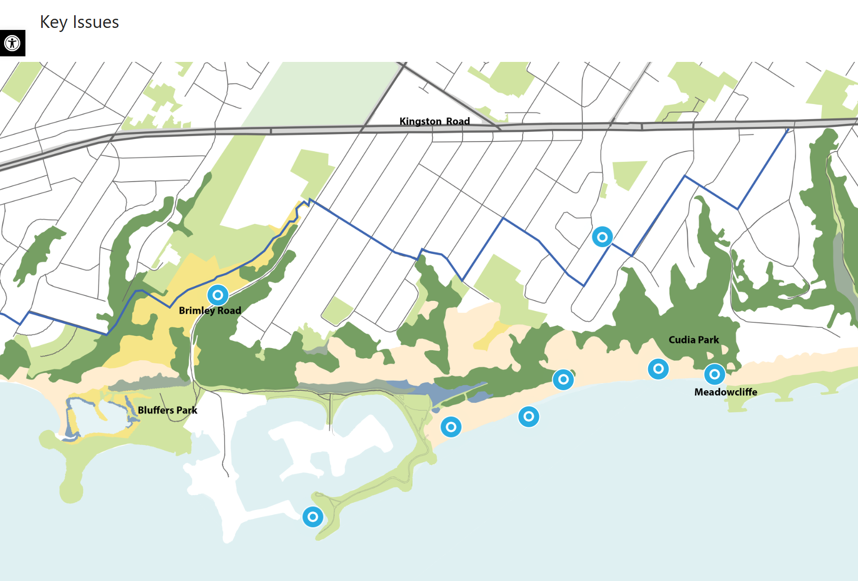
Key Issues Overview

Stop 1

Stop 2
Stop 3

Stop 4
Stop 5
Stop 6
Stop 7