
Toronto and Region Conservation Authority (TRCA) is undertaking maintenance work on existing shoreline erosion control structures in Tommy Thompson Park along the eastern shoreline of the “Spit.” This work will provide long-term protection for the park from erosion and address public safety concerns.
Project Location
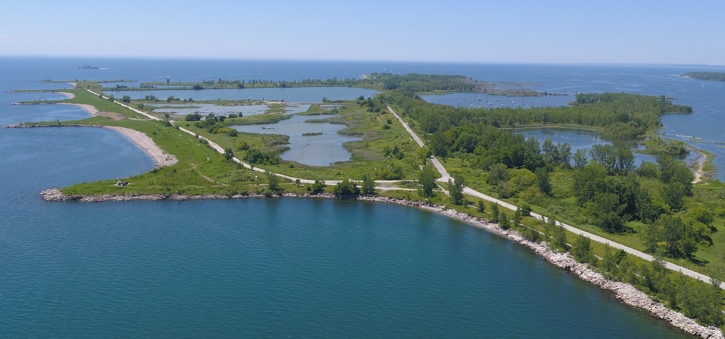
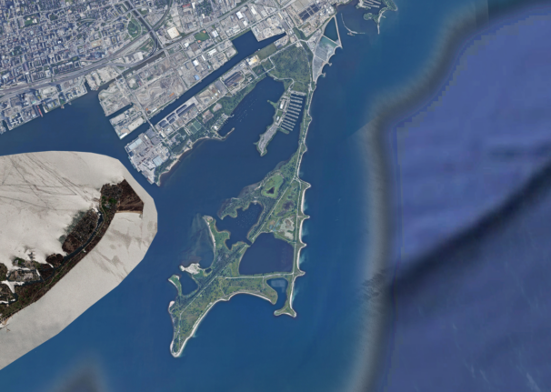
Tommy Thompson Park (TTP) is located at 1 Leslie Street, Toronto. The park makes up the largest portion of the Leslie Street Spit (the “Spit”). This artificial peninsula extends about five kilometres into Lake Ontario and covers over 500 hectares.
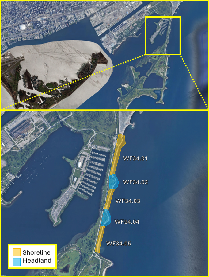
This project is focused on the eastern shoreline of TTP located along the narrow “neck” of the Spit. The areas of concern consist of three stretches of rubble shoreline and two rubble headlands (Figure 2).
Learn More About the Project



Project Background
The Toronto Harbour Commissioners (now Toronto Port Authority) initiated the construction of TTP in the 1960s in anticipation of increased port activity following the opening of the St. Lawrence Seaway.
Millions of tons of concrete, construction rubble, earth fill, and dredged sand have been used to build the current site, which extends five kilometres into Lake Ontario.
Visitors now enjoy TTP as a unique urban wilderness with activities such as fishing, hiking, cycling and birdwatching. Moreover, TTP supports remarkable biodiversity, including rare and significant plant species, migrating and nesting birds, breeding insects, and habitats for both reptiles and amphibians.
TTP’s eastern shoreline has degraded significantly because of its highly erodible material, the structure’s age, and from exposure to strong wave conditions on Lake Ontario due to higher water levels and extreme storms.
Continued erosion threatens public safety for park users and the existing trail/road infrastructure.
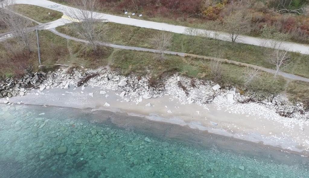
Existing Rubble Shorelines and Rubble Headlands
The erosion control structures within the project area have been monitored annually since 2019 as part of TRCA’s Erosion Risk Management Program (ERMP).
Most structures in the project area are at risk or failing and require major maintenance to protect TTP from long-term erosion and ensure public safety for park users.
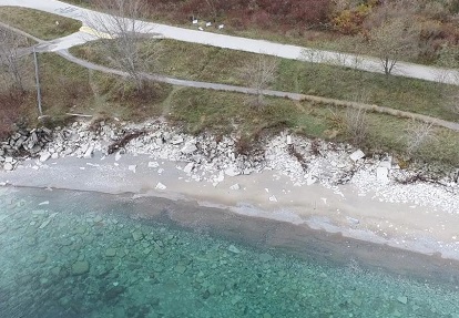
There has been a significant amount of material displacement, bank scouring/erosion, and exposure of rebar tangles. The exposed rebar and damage to the informal park path pose public safety risks.
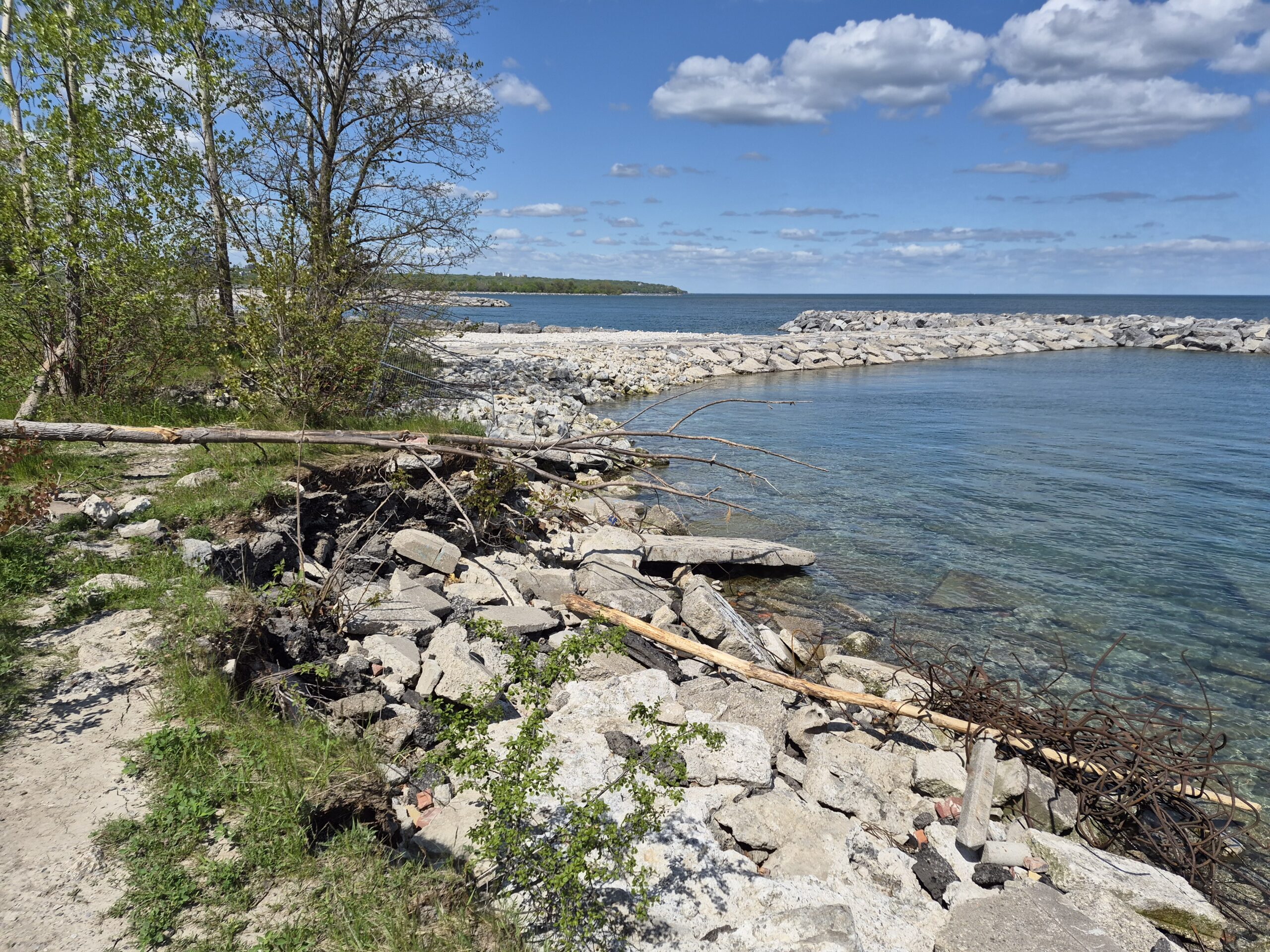
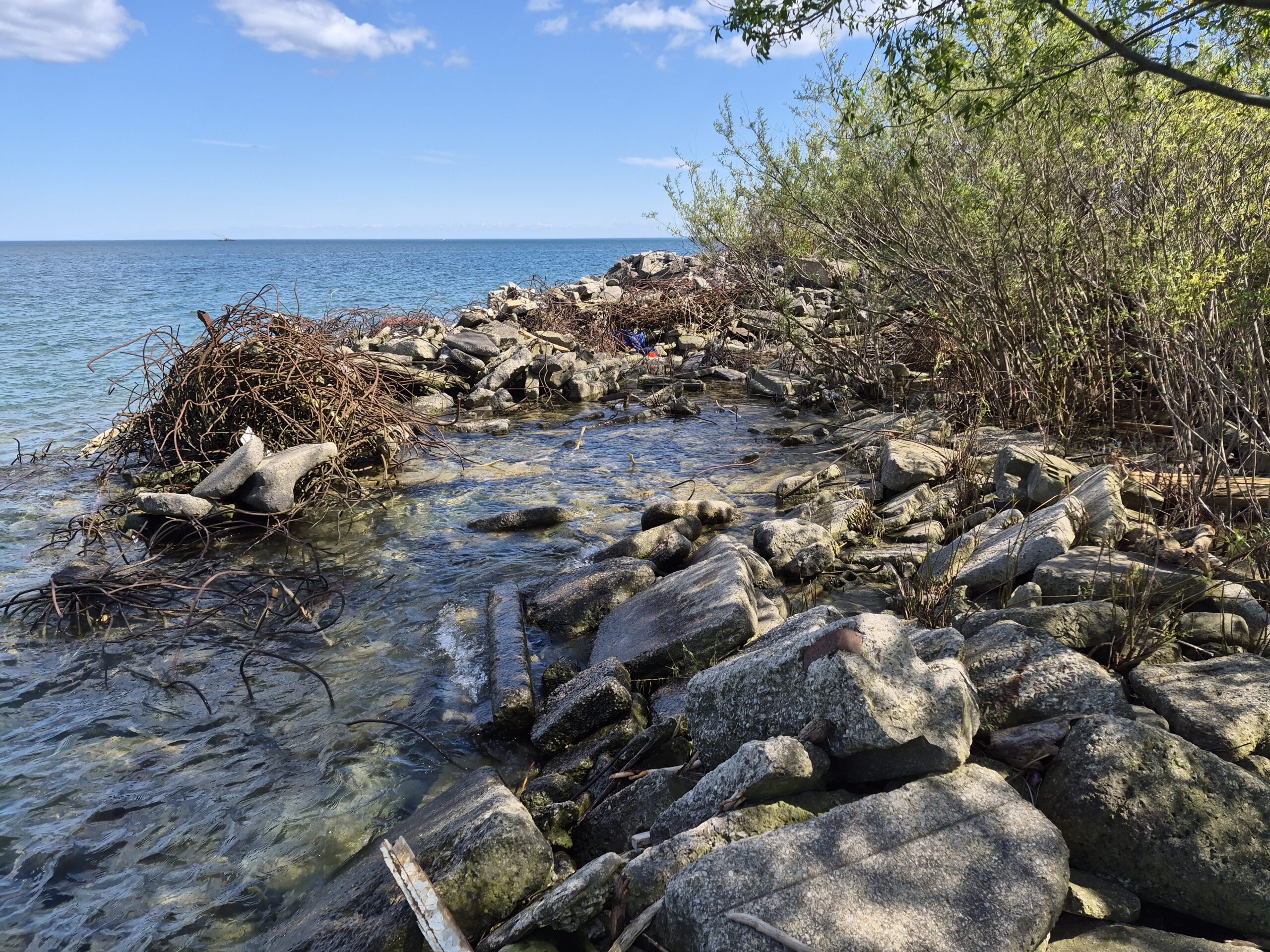
Scope of Work
The objective of the maintenance work is to improve shoreline stability, public safety, critical habitat, and to protect infrastructure.
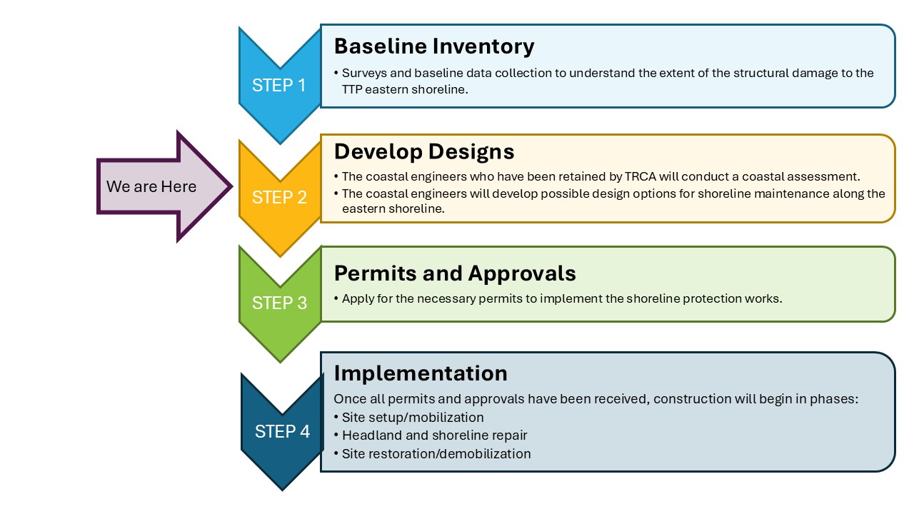
The project team completed a baseline inventory in 2025 to compile all available information on the site. The inventory included species at risk screenings, flora and fauna inventories, fish surveys, historical aerial photos, and mapping.
These studies will help inform the development and selection of the preferred designs for the shoreline protection work.
TRCA has contracted a coastal engineer to:
- Complete a coastal assessment of the area
- Develop detailed designs for appropriate erosion control treatments, with soft or nature-based solutions prioritized where possible
TRCA will continue to work with teams within the organization as well as interest-holders during the design development and implementation planning process to provide updates and gather insights.
Public Notices and Events
Upcoming information sessions are being planned, and more details will be posted here.
Frequently Asked Questions
How is this work being funded?
This work is funded by the City of Toronto and by a federal grant from Infrastructure Canada’s Disaster Mitigation and Adaptation Fund.
How will the shoreline protection designs be chosen?
Coastal engineers will conduct a coastal assessment of the relevant project areas, considering wave action, water levels, and visitor use of the park. The assessment findings will help determine the right shoreline design and appropriate materials.
Given TTP’s highly naturalized state, we will prioritize solutions that balance robust erosion protection with nature-based solutions that fit the park landscape where possible, while providing shoreline protection.
What will TRCA do to protect wildlife during construction?
Wildlife protection is a priority, and TRCA will take the following measures to limit construction impacts:
- Regularly inspecting the construction area and access route for signs of wildlife, such as nesting
- Avoiding tree and vegetation removals during nesting periods
- Minimizing tree and vegetation removals to only what is necessary to facilitate the construction
- Avoiding areas disturbing nesting birds and fish during sensitive periods
Contact Us
For more information regarding this project, please get in touch with the Project Team at:
ttp.east.shoreline@trca.ca